


I’m watching late week changes that are going to bring an impact to Colorado in a couple of ways. Over the next several days I just have to figure out to what extent. There are three things at play. The first is an upper-level wave that will move east off the coast of California. The second is an upper-level system that will be over the northern Rockies. The third is arctic air that will plunge south over the central United States.
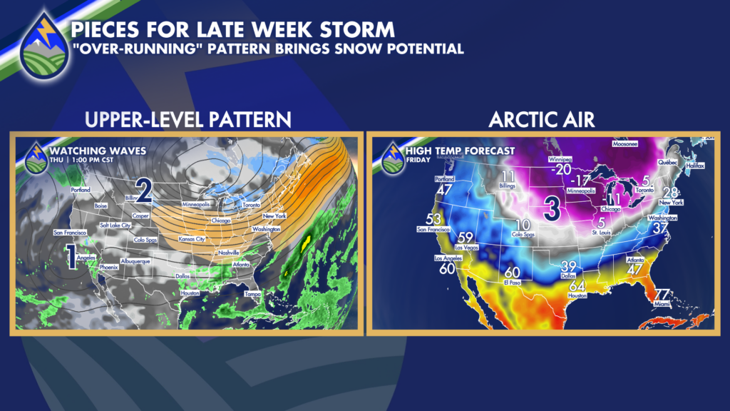
What I’ll be working on over the next several days is how these three things will interact and to what extent over our area. The general pattern suggests large-scale over-running lift across the area. The technical name for this is isentropic upglide as the air off the surface ahead of the upper systems would glide up and over the arctic air at the surface. There are other things at play too of course, but this is the best simplification of the pattern.
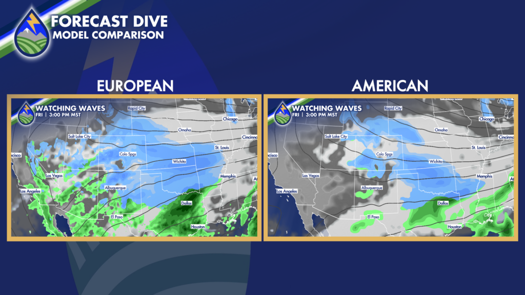
In this situation snow is usually really fluffy with lots of air in it and the far eastern plains and Arkansas River Valley east of the mountains tend to be colder than the foothills and the mountains, but I’ll keep working on the details over the next several days. Friday looks like the most likely day to get snow and Friday and Saturday look cold east of the mountains. More to come!
Be ready for the change – download the Peaks2Plains Weather App today!


