


![]() Matt Meister and Merry Matthews, longtime southern Colorado broadcast meteorologists, welcome you to Peaks2Plains Weather, the new home of the most detailed, specific, and reliable Colorado-focused forecasts powered by deep local expertise and decades of trusted on-air experience.
Matt Meister and Merry Matthews, longtime southern Colorado broadcast meteorologists, welcome you to Peaks2Plains Weather, the new home of the most detailed, specific, and reliable Colorado-focused forecasts powered by deep local expertise and decades of trusted on-air experience.
No more waiting for the news, Peaks2Plains Weather is built for our community – locally focused accurate and detailed forecasts rooted in integrity and community delivered in Matt and Merry’s fun and engaging way you’ve come to love – whenever you want it, wherever you are. At Peaks2Plains, we are committed to being there when weather is active – live on your tv or computer at home, and our app or social media when you’re on your phone on the go.


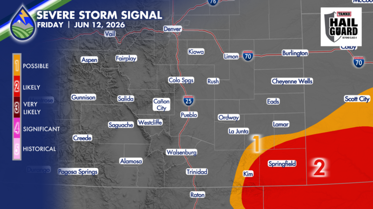
Severe Storms in SE Corner of Colorado Friday
SEVERE STORMS FRIDAY Severe thunderstorms over eastern Las Animas County, southern Bent and Prowers Counties, and Baca County are likely to develop today between 2:30-4pm,
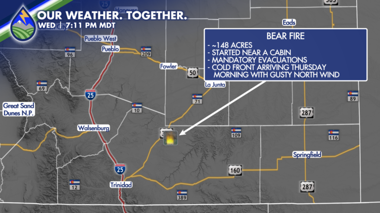
BEAR FIRE: Interview with evacuees
BEAR FIRE: Merry and I were honored to have Linda Rush and Chaz Wakeman, who are evacuated from their homes in the path of the
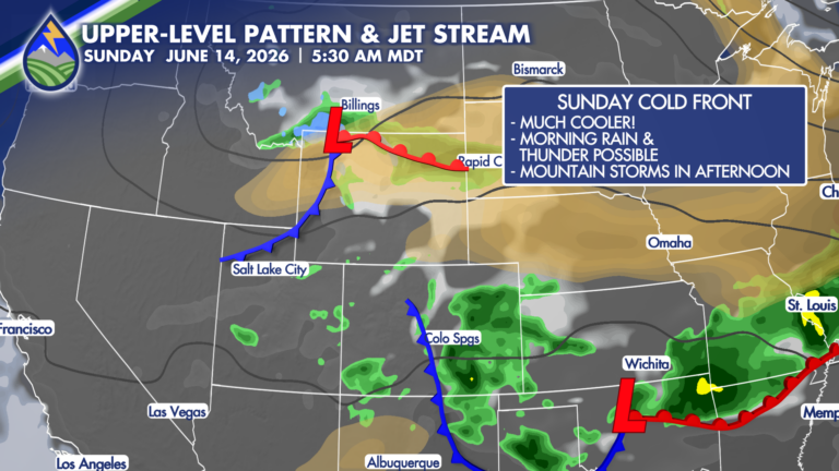
Sights on a Soggy Sunday?
A cold front moving south over the area Saturday night may bring some early morning showers, and perhaps some thunder to start Sunday. That’s rare