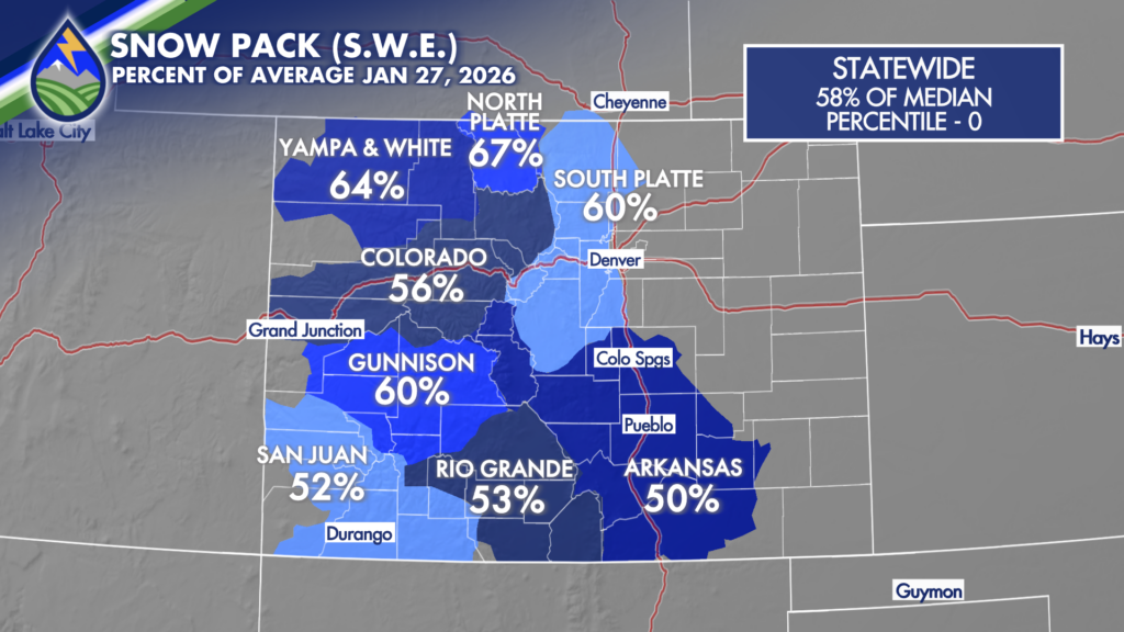
Last weekends storm bumped the snow pack up across Colorado a little bit, even 5-8% over the southern river basins, but we remain well below average and at historically low levels as January wraps up. We remain at zero percentile on the SNOTEL data set from that began in the late 70s.
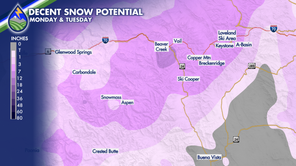
February does look to start with a storm coming in from the northwest early next week. Early signs are that it’ll have some decent lift and dynamics with it. Storms of this strength and on this general trajectory typically end up as pretty good snow makers over the central and northern mountains.
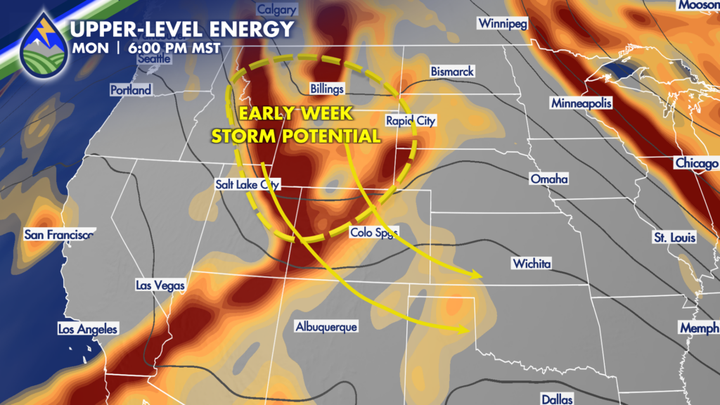
As I’m writing this on Tuesday, January 27, obviously it’s a week out. You might be saying, “well how can you talk details this far out.” Great question! I’m just forecasting the pattern. Storms resembling this strength and on this path usually (probably 8 times out of 10), but down an average of 7-14″ for the central and northern ski resorts. An early look at numerical guidance is right in that envelope. It makes sense a week out! We certainly need snow in the high country so here’s to this storm doing what it should! I’ll update here at Peaks2Plains Weather over the days ahead.