LATE WEEK PATTERN CHANGE: After the mountains get some snow Wed-Thurs we watch the main part of the late week pattern change I’ve been talking about for three weeks now move across the Rockies.
It’s going to send us into a cooler and more unsettled late week region-wide, but there is an interesting development to note Monday morning (2/9) as I write.
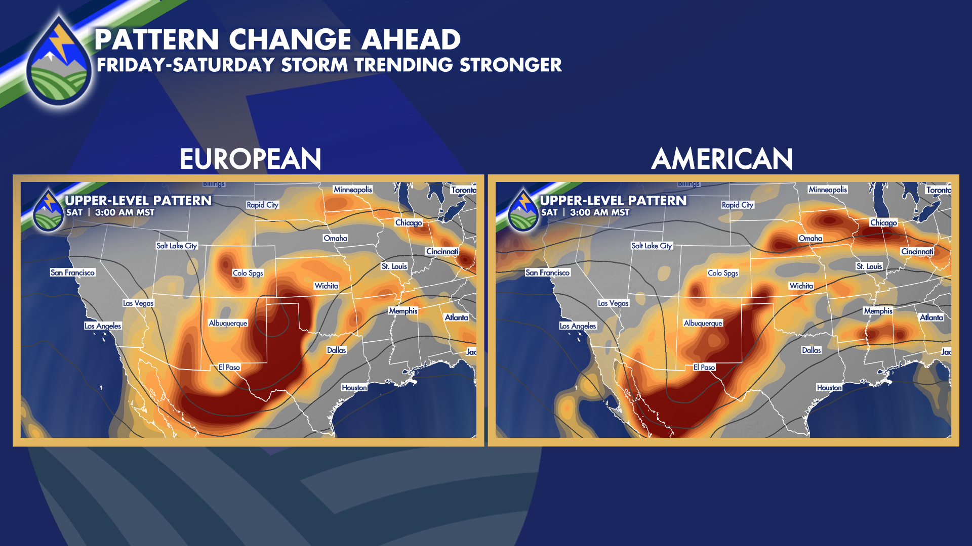
What’s emerging now in the model trends is a strengthening storm from Friday into Saturday moving across New Mexico into the southern plains. It looks stronger than it did a few days ago and the European model is latching on to a developing circulation in the mid-levels of the atmosphere. The European model is stronger and a little farther north with the storm early Saturday compared to the American (GFS) model, and would bring some heavy, wet snow to northern slopes of the Raton Mesa. I’ll watch this close the next couple of days!