


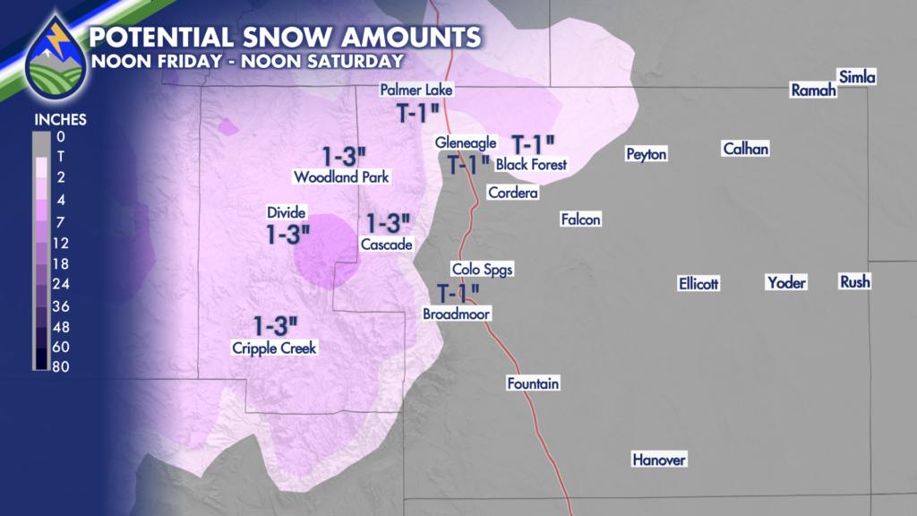
Late Friday and Saturday will bring some snow to the local higher terrain areas of southern Colorado.
Between 8,000′-6,500′ I’d only expect it to be light, and only on the grass, trees, cars, etc. Think wet, slushy stuff. In fact, it probably melts after a few hours of sitting on the ground, especially the closer to 6,500′ you are. The farther north you are the less likely you are to get this. That’s why I labeled my Pikes Peak Region map as “Potential” and the other two maps as “most likely”. Please note the important distinction!
Between 8,000′-9,500′ an inch or two of wet, spring-like snow is possible and the farther south you are the better chance you’ll have of catching 3″.
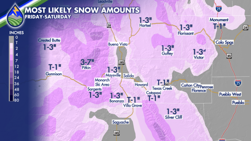
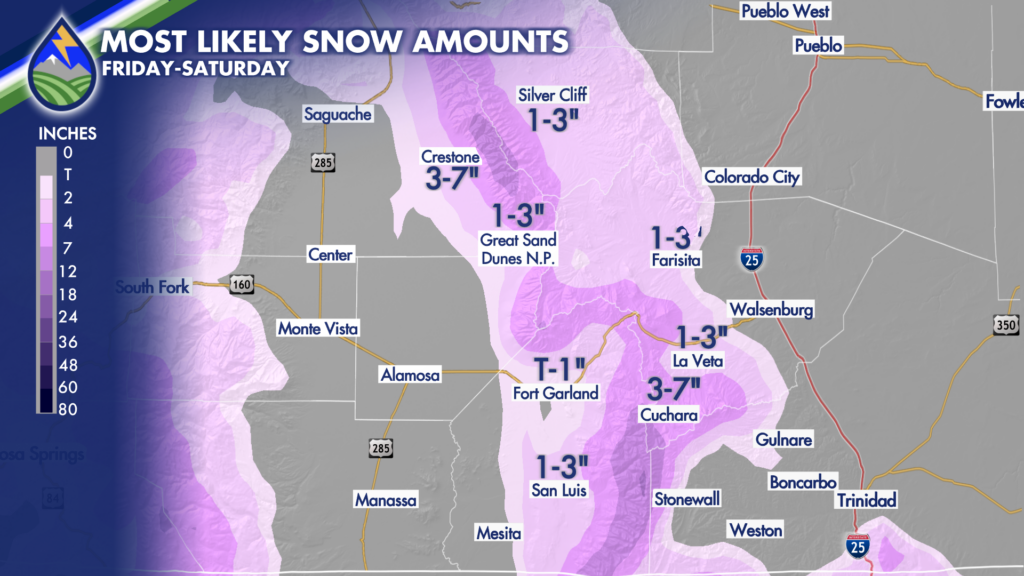
Higher than 9,500′ will be the heaviest snow, particularly the Sangre de Cristo Range south of US 160 around Cuchara and the Spanish Peaks, some areas could get up to 7″ of snow.


