


Ahead of the Front: Monday’s Warmth and Fire Danger
Monday is all about what’s happening ahead of the cold front—and it still looks and feels more like late spring than early spring. We’re back near record territory with 70s and 80s along the I-25 corridor and even pushing toward 90° across the far eastern plains. But the bigger story today is the wind and fire danger.
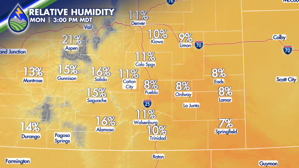
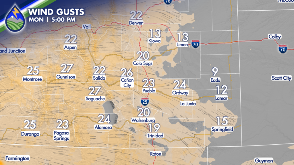
Winds turn westerly this afternoon, gusting 25–40 mph in the mountains and 20–35 mph across the plains. Combine that with humidity dropping into the single digits, and we’ve got elevated fire weather concerns across southern Colorado. We may see some afternoon cloud buildups and even a little virga, but no meaningful moisture—just the potential for brief, localized gusty winds.
Behind the Front: Tuesday’s Reset
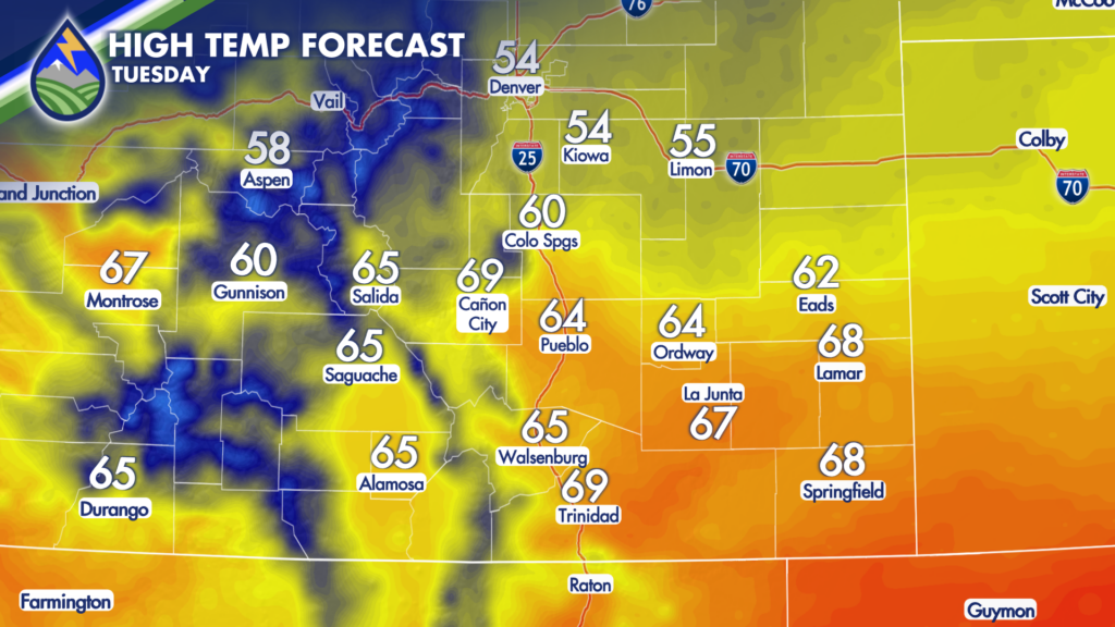
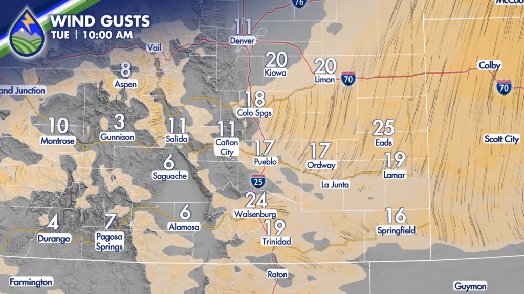
That cold front arrives early Tuesday—and it’s a noticeable shift. Temperatures fall back into the 40s and 50s across the plains, with some 50s near the Front Range. It’ll be breezy, especially east of the mountains, as cooler upslope air pushes in. We’ll have a clear divide between lingering warmth in the higher terrain and cooler air across the plains. The upside? Fire danger drops significantly thanks to the cooler temperatures.
There will be some scattered showers over the mountains Tuesday, and maybe something late in the day along the Interstate but better chances are set to move in.
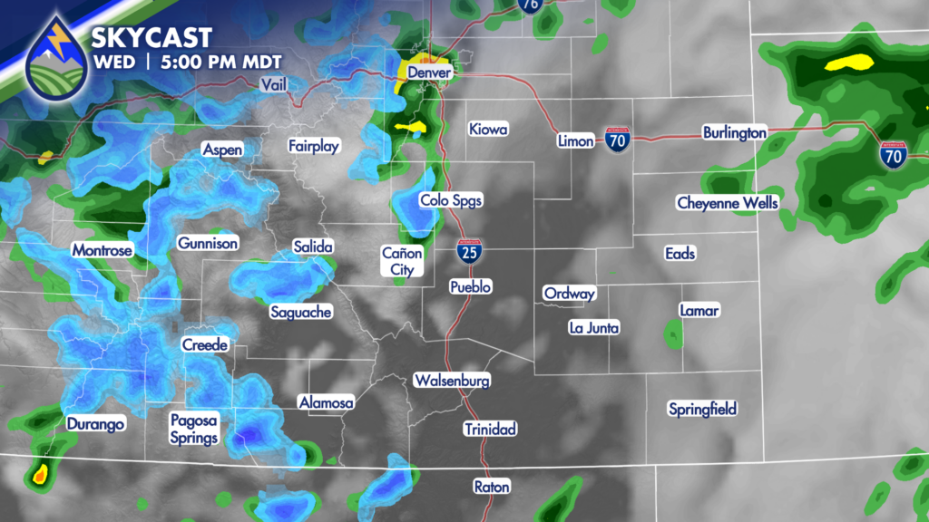
Wednesday: Cooler with Increasing Moisture

By Wednesday, we’re firmly behind the front and into a more active pattern. A system moving in from the west brings our best chance for precipitation. Snow levels drop to around 8,500 feet, with light snow possible over the mountain passes. Lower elevations may see scattered rain showers—and even a rumble of thunder—as the system moves through.
It’s a true spring transition, something you’ll definitely feel day to day.
Our Weather. Together.


