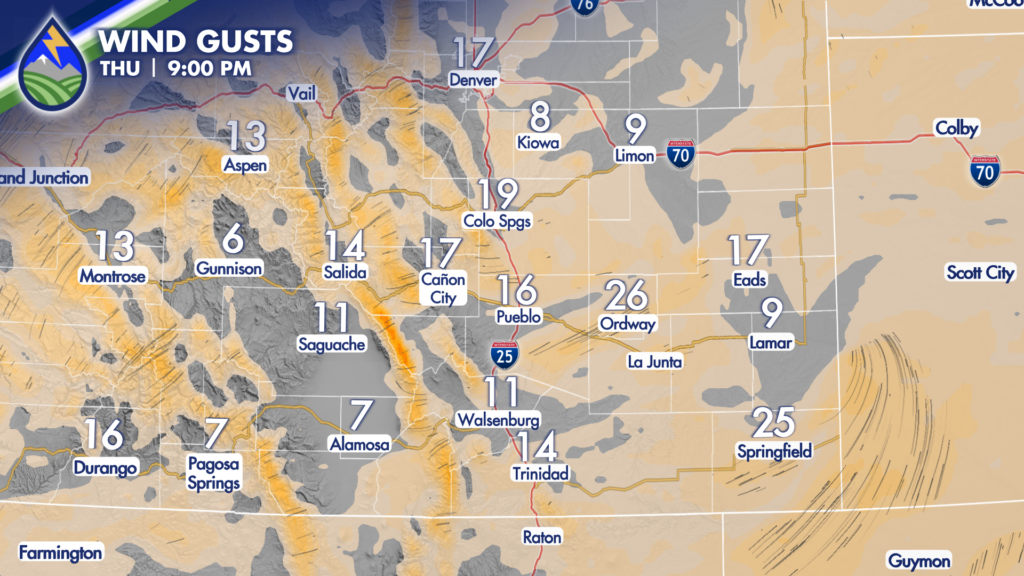
Fire danger to hard freeze – and snow for some.

INCREASING WIND

It’s not going to be windy all day in every spot, there is a progression that will happen through Thursday.

Windiest areas in the morning are what we call the “gap” flow areas where wind can more easily come through the Rockies in relative lower spots. In southern Colorado this is La Veta Pass to through Walsenburg and coming out of Bighorn Canyon in Fremont County through Cañon City. In the early afternoon breezes are picking up over the plains and our gusts get strongest in the middle to late part of the afternoon. This is all in response to a lee trough that develops today as the wind aloft picks up ahead of tomorrow’s storm.

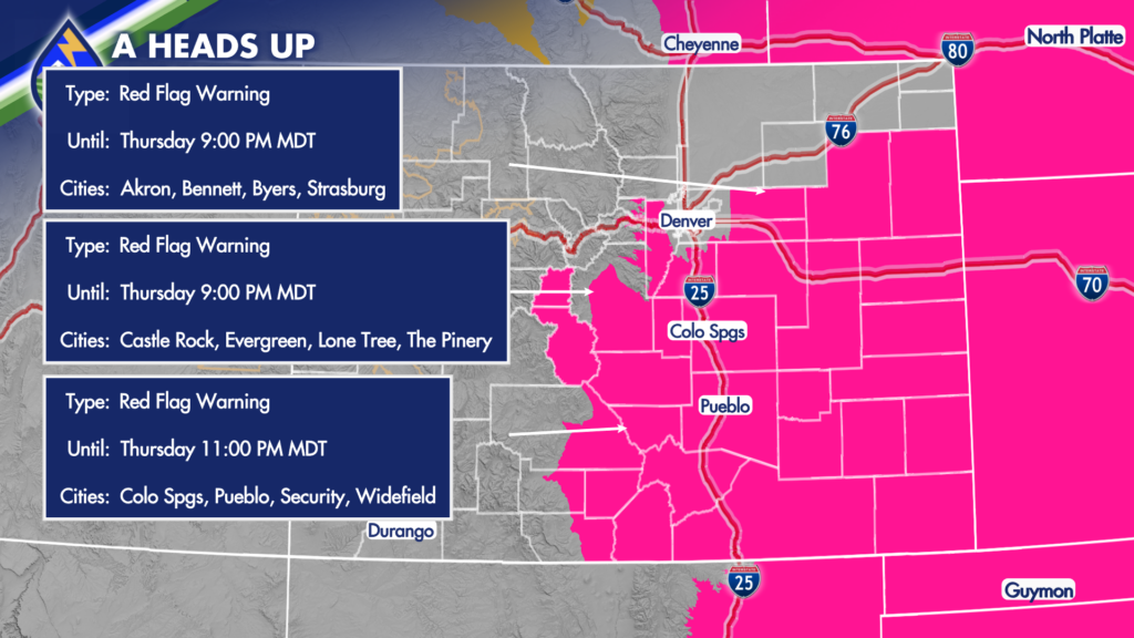
The combination of gusts in the afternoon and low relative humidity increase the fire danger today and Red Flag Warnings are up through the evening. Be smart!

Wind stays up Thursday evening ahead of the cold front.

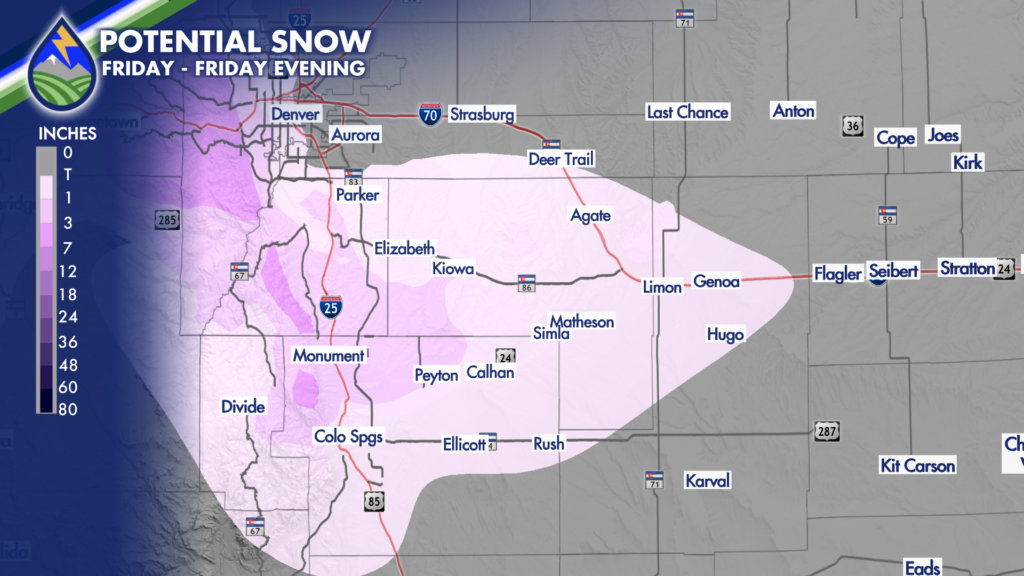
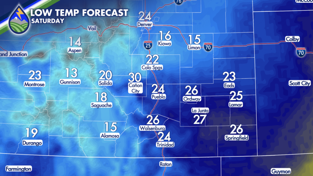
SNOW POTENTIAL & HARD FREEZE

Snow will fall Friday around the Pikes Peak Region and Palmer Divide…starting during the mid to late morning and lasting through the afternoon.
 
A couple things to be aware of. There is potential for some banded bursts that could reduce visibility…bursts should have big, fat flakes. Not everyone will see these, but this is where quick accumulations on the grass and trees of an inch or two are possible. Roads probably stay wet during the day.
 
Even though snow will end really quick Friday evening, temps will continue to fall and it’ll stay windy for a bit. This might freeze some of the wet roads. The wind could help to dry them out though…so we’ll have to see how everything plays out…for now, just be aware that’s a possibility.
 
I want to remind you to unhook hoses and drain your backflow if you got your irrigation system up and running.