FRIDAY
We start watching the western edge of low-level moisture the next few days as there are some non-zero chances of severe storms over parts of Colorado. Here’s what I see…
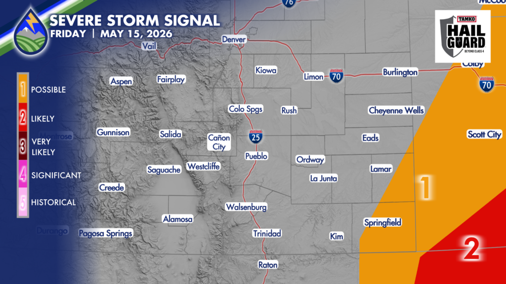
Low-level moisture will try to move into the southeastern corner of the state late in the day and this evening. Dewpoints probably stay below 40 over Baca County and eastern Prowers County, so our storms are more likely to produce some wind gusts near 60mph that prompt a severe thunderstorm warning. Anything producing hail near an inch would be in Kansas or Oklahoma. Heads up in the southeast corner after about 4pm though!
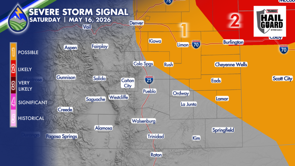
SATURDAY
Low-level moisture that increases over the plains Friday night gets blown off to the northeast during the late morning and early afternoon. Use the arrows below to see how the dewpoint temperatures will change from the early morning to the early afternoon.
Dewpoint temps that start in the 30s to around 40° east of the mountains end up in the teens and 20s by the time storms start to form over the Palmer Divide. They’ll move off to the northeast at a good clip, too, so the best chance of a severe storm is over northeast Colorado north of I-70. That said, I can’t rule out one of the isolated storms that develops over the Palmer Divide getting gusty enough to prompt the issuance of a severe thunderstorm warning if the updraft gets strong enough fast enough. Heads up in the early afternoon on Saturday over Douglas and Elbert counties in particular. Wind gusts are more likely than even rain with these storms.