


HAIL POSSIBLE WITH SUNDAY’S STORMS

Behind the morning cold front, surface moisture is higher than what it was on Saturday – that’s more fuel for thunderstorms. We’ve got better ingredients in place farther west for storms to produce hail today compared to yesterday when the biggest threat over the Pikes Peak Region and the western Palmer Divide was wind gusts.
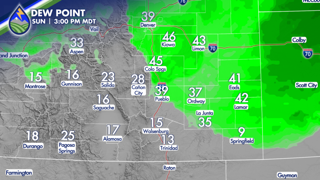
I’ve got the wind field and forecast dewpoints for you – as together they both show where the front is likely to be sitting this afternoon. Areas south of it with the southwest wind and dewpoints in the teens get elevated fire weather concerns.
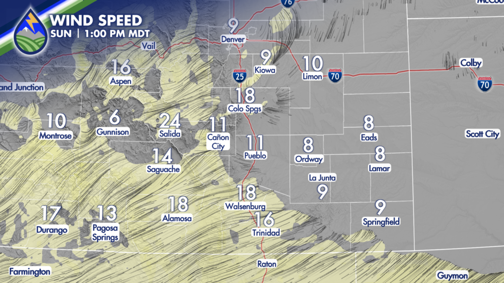
Areas north of the cold front have the fuel in place that if storms form or move overhead, they’ll be stronger than the storms on Saturday – particularly with regards to hail production. The warm desert air overrunning the surface of the front over the eastern plains along and south of the Arkansas River will effectively put a lid on thunderstorm development today. We call that a “cap”.
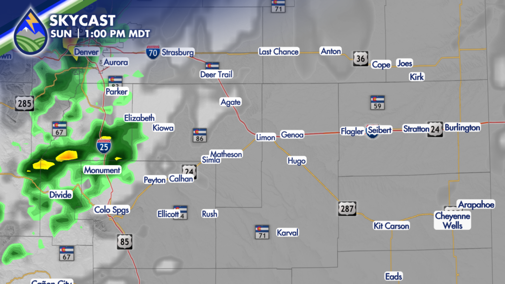
In the Pikes Peak Region where the storms will form in the middle of the day, and for areas over the Palmer Divide and northeast Colorado where the storms will move in through the afternoon…hail and wind gusts could cause severe thunderstorm warnings to be issued. Most cells will be moving northeast, but any that get a more easterly component to the motion will tend to have the potential for hail between 1-2″ in diameter, especially the farther east they go.
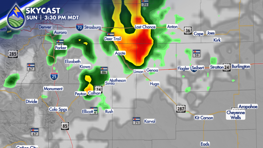
I’m eyeing 12-4pm as the greatest window for storms over Teller, El Paso, Douglas, Elbert, and Lincoln counties today.


