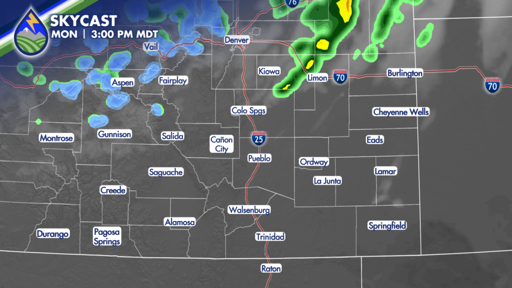
SHOWERS/STORMS MOVING NORTHEAST
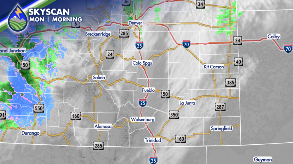
Showers and thunderstorms on the western slope Monday morning will move to the northeast today. Here’s what to know:
SAN LUIS VALLEY: The showers will hold together over the San Juan and La Garita Mountains. As they move into the western edge of the valley they’ll ingest very dry air and collapse. This will come with a sharp increase in wind and likely kick up dust that rolls east across the valley. Will keep an eye out for reduced visibility – and maybe a dust storm warning. Timing will be between 9-11am.
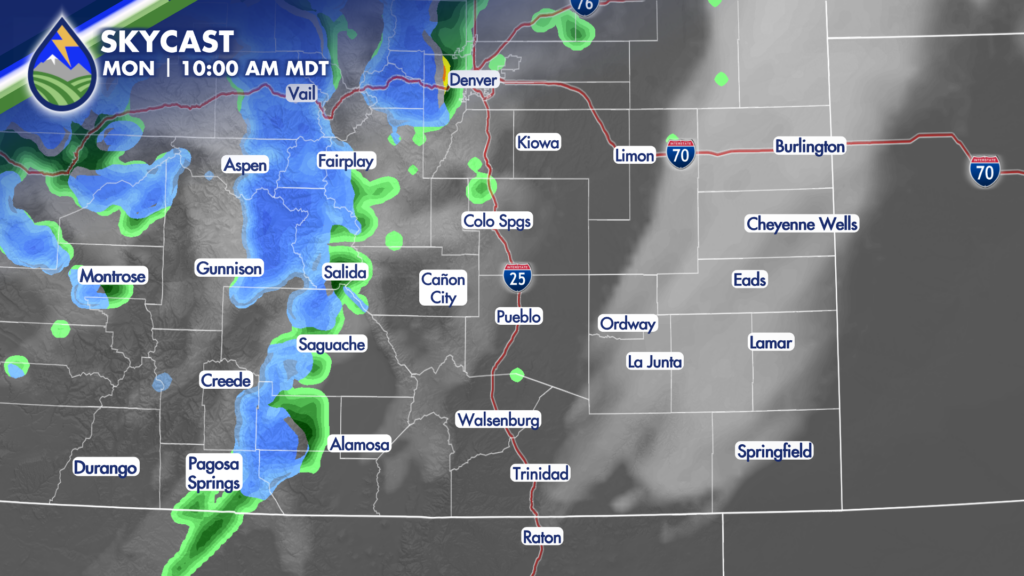
UPPER ARKANSAS RIVER VALLEY: Showers will move off Monarch Pass, Tabeguache, Shavano and the Collegiate Peaks between 9 and 11am. Snow above 9,000′ with a mix below.
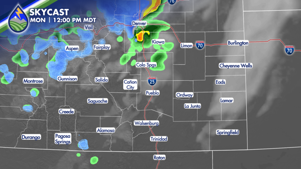
PIKES PEAK REGION: Showers will hold together and move across the area between 10:30 am – 1 pm. Could even have a thunderstorm embedded in here. A quick burst of snow possible above 8,500′ with big wet flakes and a quick drop in visibility. 8,500-7,000′ could see a mix, and below that rain.
WET/SANGRE DE CRISTO MOUNTAINS & PLAINS: Mainly dry.