


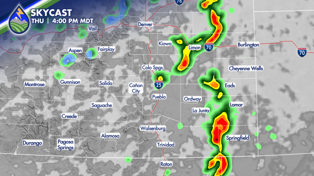
SEVERE STORMS POSSIBLE THURSDAY
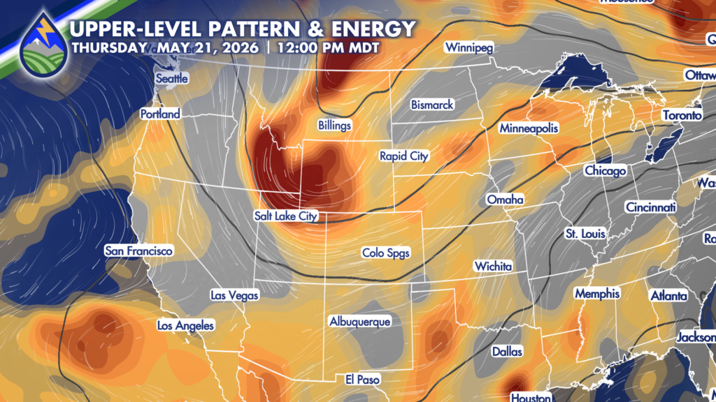
Warmer afternoon temps, an approaching wave from the northwest, and abundant low-level moisture will combine to support strong to severe thunderstorms across the eastern plains Thursday.
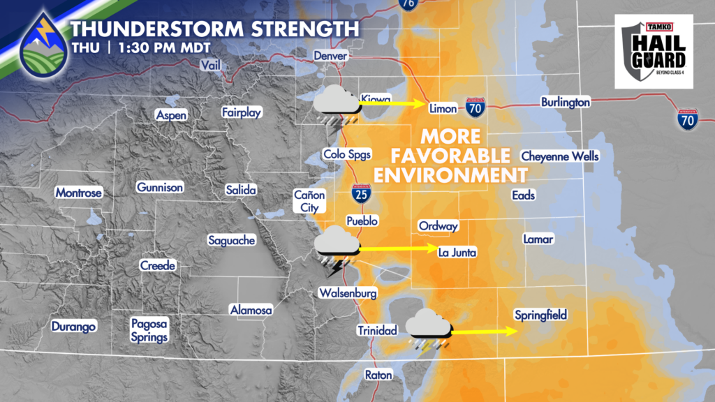
Storms will form in the early afternoon over the eastern slopes and adjacent plains of the Rocky Mountains where moist air is pushed up the slopes and built-in instability over the higher terrain combine.
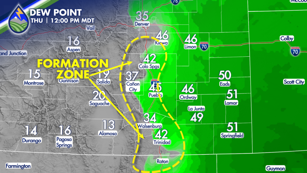
With the increased dewpoints east of the formation zone, the storms will move east into an environment favorable for strengthening. As they intensify, the strongest cells will become capable of producing hail between 1″-1.25″ in diameter. As the storms move east a straight-line wind threat will develop as the storms begin to “go upscale” – increasing in coverage in some bowed or linear segments.
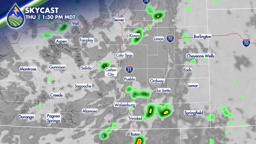
Storms will develop between 11:30 and 1:30 in the formation zone, and move east through the afternoon and early evening. It currently appears that most of the storms will be in western Kansas by 8pm.
DOWNLOAD THE APP
Be ready for the storms with the Peaks2Plains Weather app! We will give you a digital shoulder tap if a strong or severe storm is coming your way and we will have live coverage as storms become severe.


