June begins with a return of low-level moisture into eastern Colorado that begins early Monday morning. How far west, and how “deep” this moisture is is still in question by the time storms form Monday afternoon.
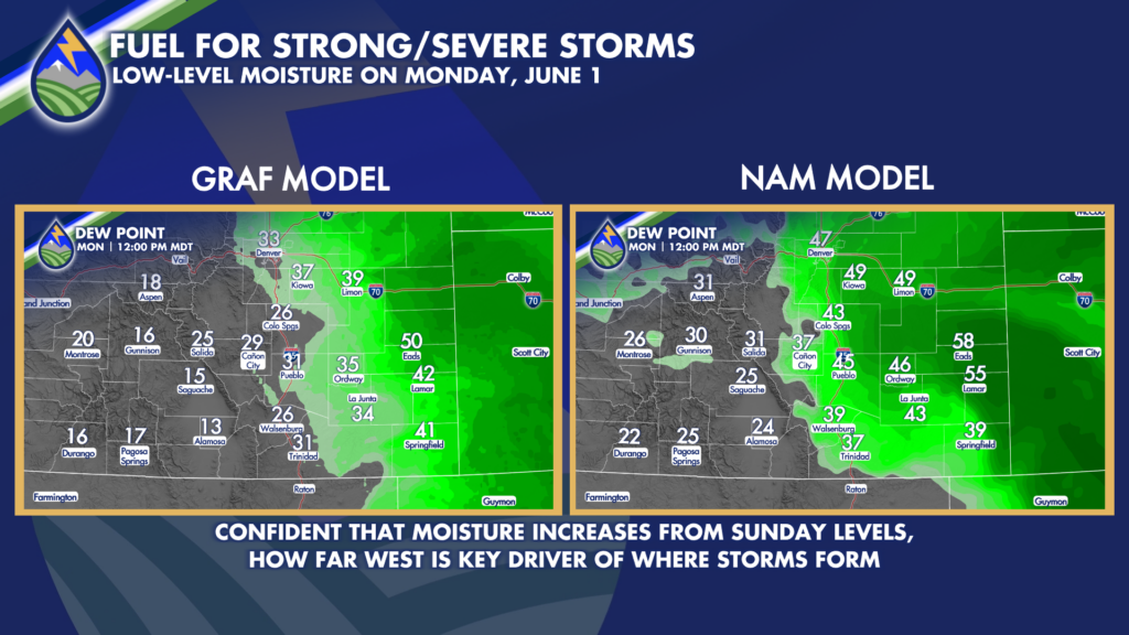
The number that I find I typically watch for on the dewpoint is 50°. When we get above that, and other parameters are in place we tend to have a chance of severe storms in eastern Colorado. You can see in the two different model forecasts I present above for noon on Monday there is some variance in numerical guidance. There are similar magnitude and positional variations in other short-term models, too. Typically, I’ve noticed over the years that on the first day of moisture return, models tend to be too far west, too fast with their forecasts – and I tend to err on the side of a slower movement because of that. Western Kansas has had a lot of rain lately and perhaps that ends up playing a role…it’s something to watch. I had that conversation with Peaks2Plains storm chaser Matt Minnillo, Sunday morning. We’ll see what happens!
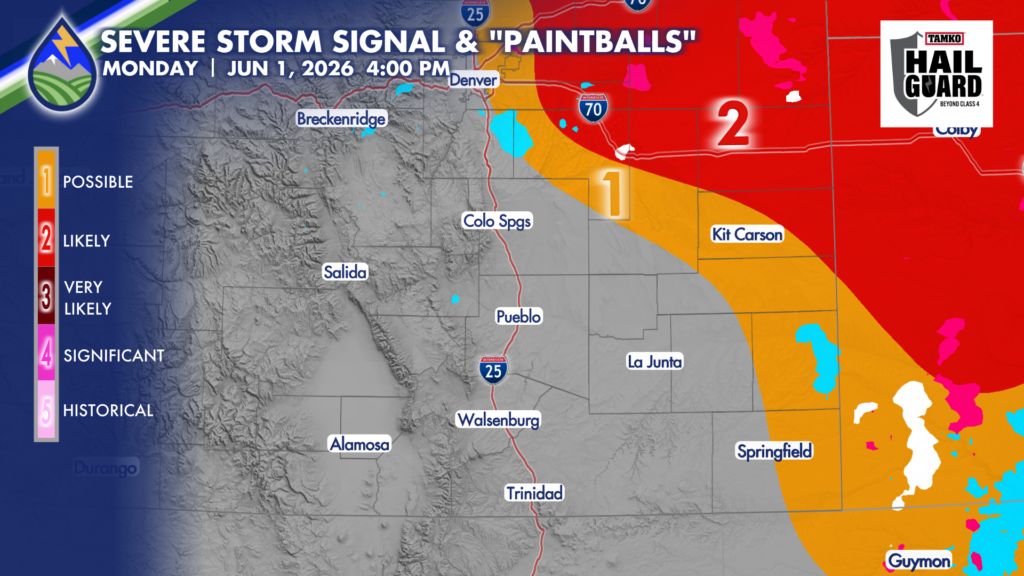
One analytical tool I also like to use is to take a few different convective allowing models and compare where and when they think stronger thunderstorm cores will be. I call them “paintballs” because I take one color to represent where the models are seeing 40dbz or higher radar returns in their forecasts. More timing and location agreement is one way to see where models are lining up different thunderstorm formation and strength factors and where they are actually forecasting stronger storms to be.
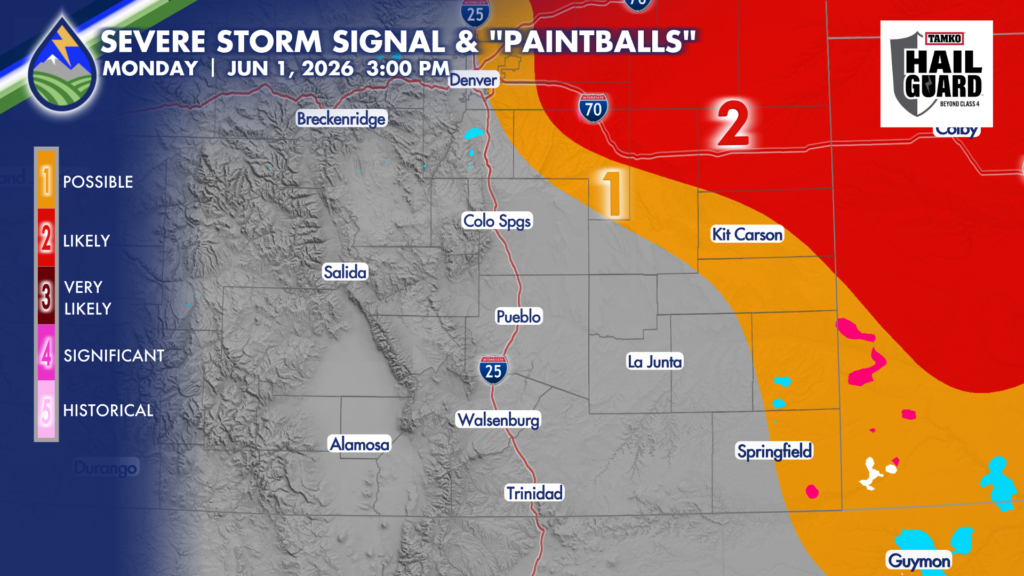
By 3pm Monday you can see that the model having the moisture farther west is developing storms farther west. Makes sense given what we talked about above. Notice in the middle afternoon though that there is more general agreement amongst the three models that far eastern Colorado is more likely to have storms going in the vicinity at the point than the Palmer Divide. So we’ll watch these areas first. However, by 4pm we’re seeing the other models join in the storm forecasts over the Palmer Divide too, but the spatial agreement isn’t as “tight” as the storm forecasts near the Kansas line in southeast Colorado. Again, where the deeper moisture is will be the determining factor. We’ll watch it!