


STORM CHALLENGES TUESDAY
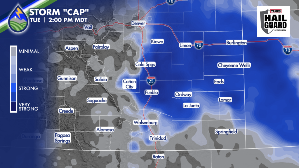
While we lack the wave that was moving across northern Colorado yesterday, we still have wind shear with east wind at the surface east of the mountains and southwest flow aloft. There’s plenty of water around for storms today. Fuel isn’t the problem. If a storm goes, it’s got energy to work with. The challenge for storms today will be a mid-level “CAP” over the plains in the cooler air behind the thunderstorm outflow reinforced cold front that is backed up against the Rockies. This acts like a lid on storm development where it is strong.
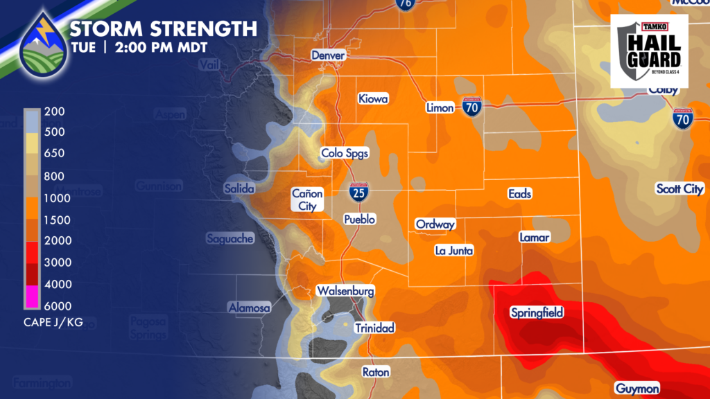
What these maps show when you put the CAP and storm strength together is that storms are most likely to develop on the edge of the CAP where there is fuel. I’m eyeing the Raton Mesa as we hit the early afternoon and the northern slopes of the Palmer Divide into the southwestern corner of the Denver metro. These are the areas MOST LIKELY to see storms go initially.
While I can’t rule it out on the slopes of Pikes Peak, the southeast wind will tend to keep the cool air right up against the terrain and the CAP may hold firm. Or if a storm can develop right on the western edge of the cooler air it may die out as it tries to move east over the Colorado Springs metro. We’ll watch for that possibility.
The wild card for areas where the cap holds firm is outflow from any storms that can go. As an example, it’s possible that the storms that go this afternoon between Trinidad and Springfield send an outflow north that provides enough small-scale lift on its leading edge to break the CAP closer to the Arkansas River. We’ll watch for that possibility.
Keep the Peaks2Plains Weather App close today as we’ve got fuel…and a couple different scenarios to watch for. Share this post so we can get your friends and neighbors in the know with the important details that are sometimes missed elsewhere.


