


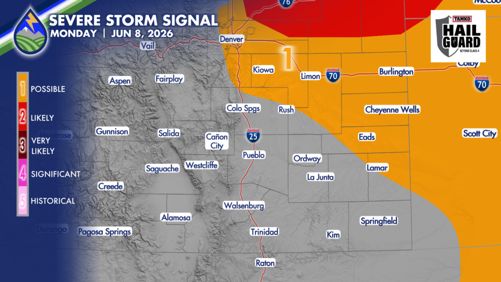
I’ve got some questions as to exactly where the cool front and the low-level moisture behind it end up. It’s important…it’s going to drive where the storm chances are. As of now, I think the best chances are JUST to the northeast of northern El Paso County, but I can’t rule it out yet, so I’ve added you as having potential for some strong storms. Storms Monday, mainly after 2pm in the areas with low-level moisture may produce hail near 1.5″ in diameter, gusts to 60mph, and perhaps an isolated tornado, particularly from Limon eastward.
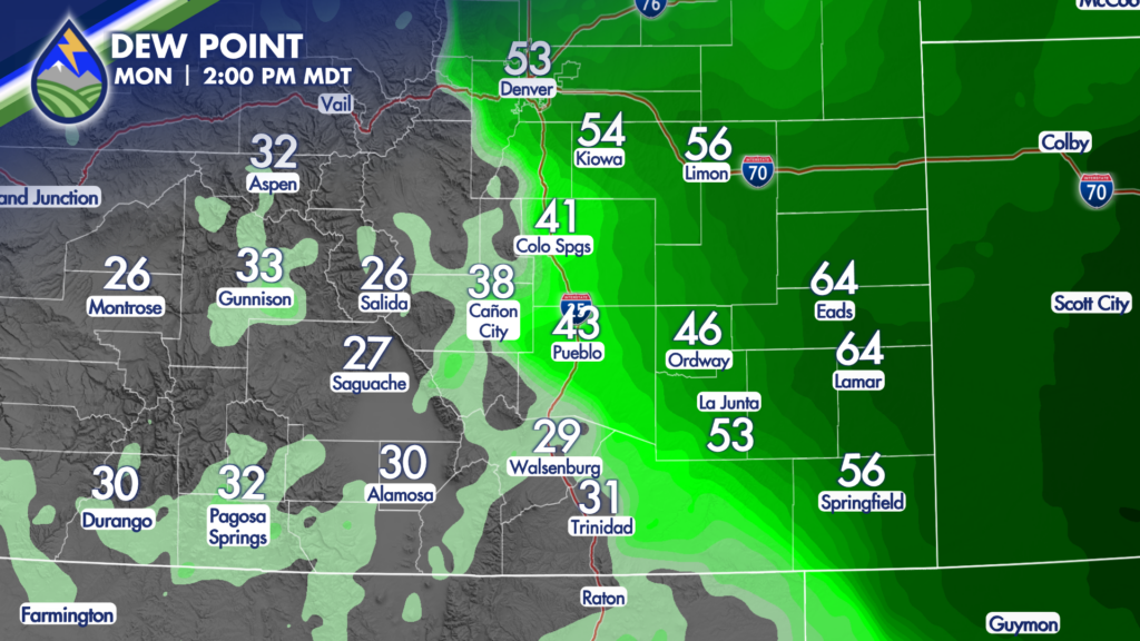
Areas west of the cold front will have a slightly better chance of a high-based, gusty-type storm Monday.
There are uncertainties…we’ll know more in the morning! I’ll have update on Mornings with Meister at 6:30 am.


