COLD FRONT ARRIVING
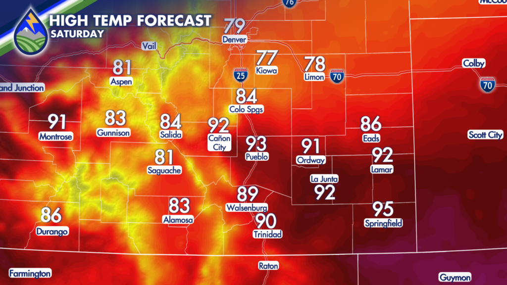
We take the edge off today from Friday’s heat! It’ll be breezy as the front arrives from the north.
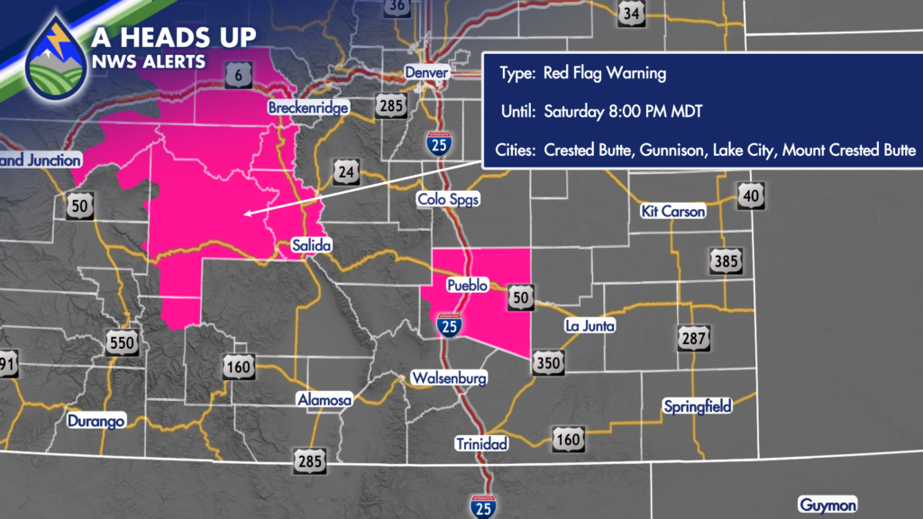
Where the front arrives last, particularly in the upper-Arkansas River Valley we’ll hit high fire danger weather criteria this afternoon and a Red Flag Warning is up. There is about a four hour stretch in the late morning and early afternoon where we may hit 25mph or greater gusts and low enough humidity that the NWS has issued one for Pueblo County, too.
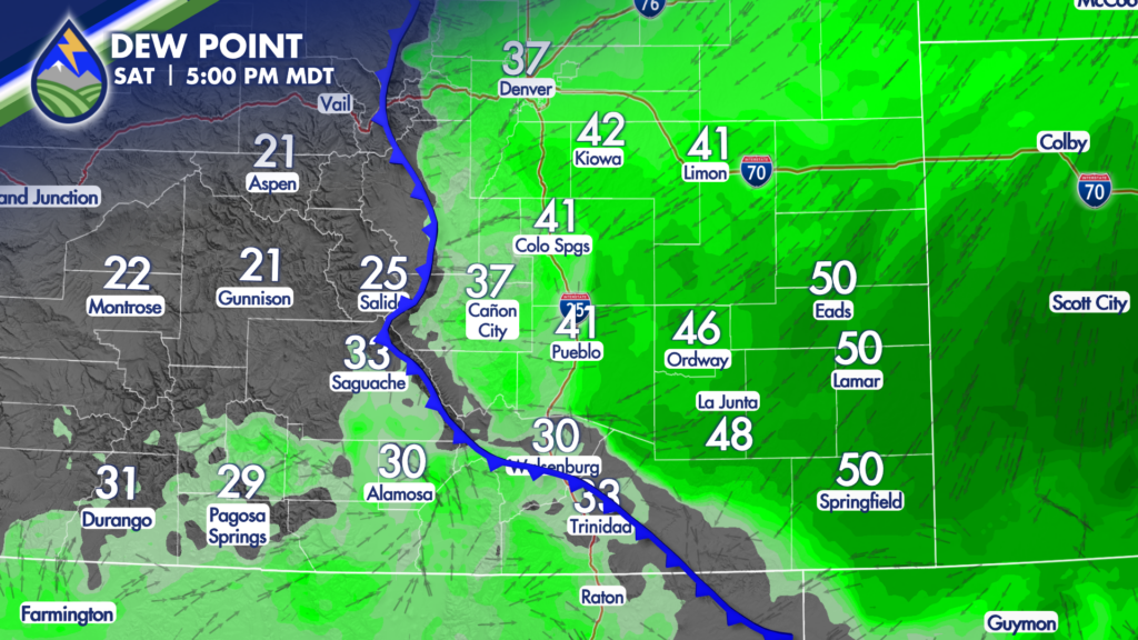
As the front and increasing low-level moisture behind it pushes westward into the hills late in the day, a few thunderstorms may develop. These will continue until about 7pm this evening. Tough to pinpoint where they’d be today, but should only be a few around. I don’t think I’d cancel any plans because of that chance.
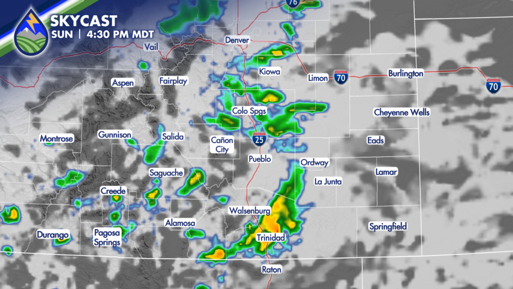
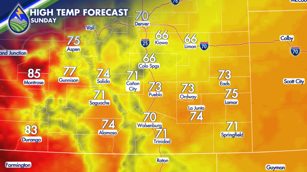
MUCH COOLER SUNDAY
We’ll see a big-time drop in temperatures for Sunday with parts of the Pikes Peak Region and Palmer Divide not hitting 70°. This front is deep enough that even the big mountain valleys cool back into the middle 70s.
We’ll keep pushing the low-level moisture up against the hills and this should bring a gray start to the day for some, especially east of the mountains and south of the Palmer Divide. Enough mid-day clearing and wave dropping in from the northwest will get scattered showers and thunderstorms going in the afternoon over the mountains. These will move southeast over the Interstate in the late afternoon and head over the plains in the evening. Late in the day, the storms over the Palmer Divide and those along the hills southwest of Pueblo may become capable of some large hail near 1″ in diameter. We’ll watch for that chance and let you know!