







Severe Storms or High Fire Danger Saturday
Welcome to your weekend! A system passing over Colorado and Wyoming on Saturday is going to make for a “fun” weather day.
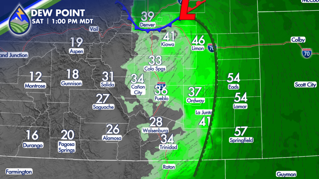
Low-level moisture starts up against the hills as the sun comes up and there may even be some spots of overcast or patchy fog over parts of the far eastern plains as a result.
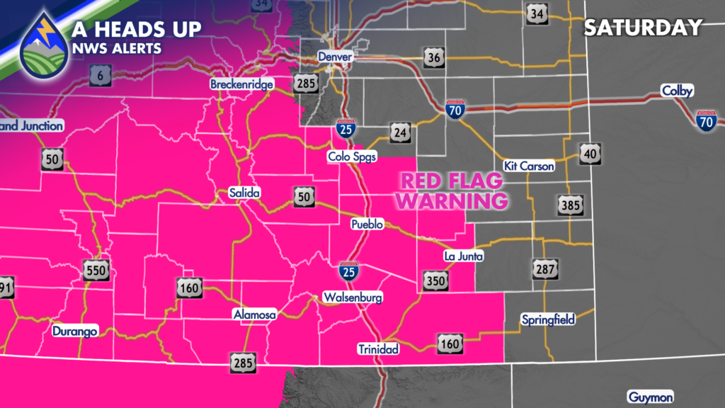
As the system moves into Wyoming during the day, a developing area of low pressure over the northern slopes of the Palmer Divide starts to draw dry air off of the mountains and spreads it east. Wind will pick up and the humidity will be very low so Red Flag Warnings have been posted as some areas will get gusts to around 45mph. The Red Flag Warning lasts until 10pm Saturday night.
East of the developing dryline, strong thunderstorms will be possible…especially over the Raton Mesa and over the Palmer Divide. Storms in eastern Colorado may be large hail producers during the back half of the afternoon as the head east. The threat for tornadoes is higher across northeastern Colorado and northwest Kansas/southwest Nebraska, but I can’t rule one out on the eastern edges of the Palmer Divide. Strong downbursts will be possible too.
We’ll have more details on the severe storm timing and storm impacts Saturday morning.
Be ready, download the Peaks2Plains Weather App today. Keep your location turned on….we’ll send you alerts for where you are and notifications about live coverage.






