FRIDAY 9AM
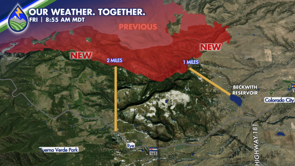
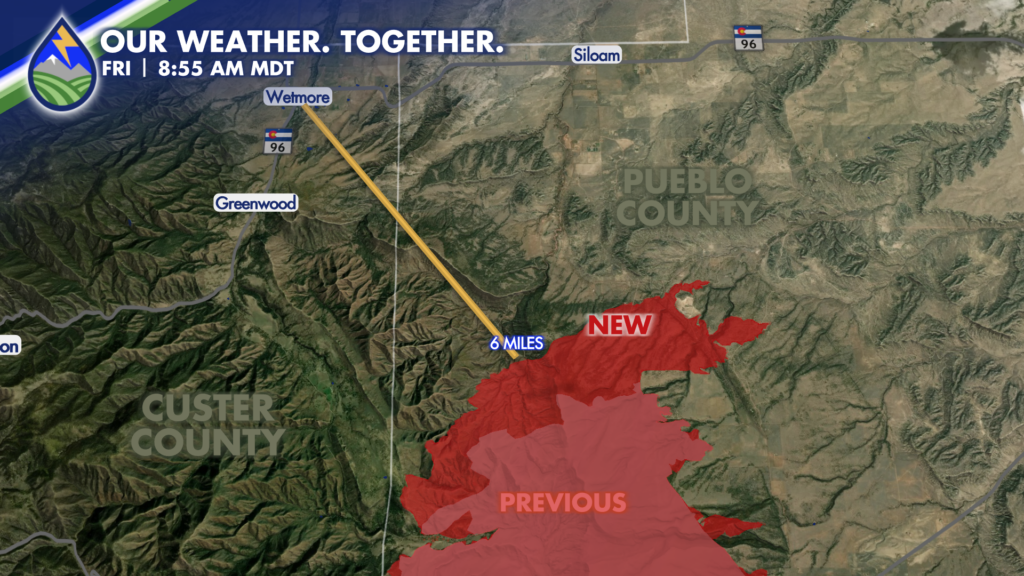
I was able to get the new growth from last night onto the map here showing the additional growth overnight on the north and south ends of the fire.
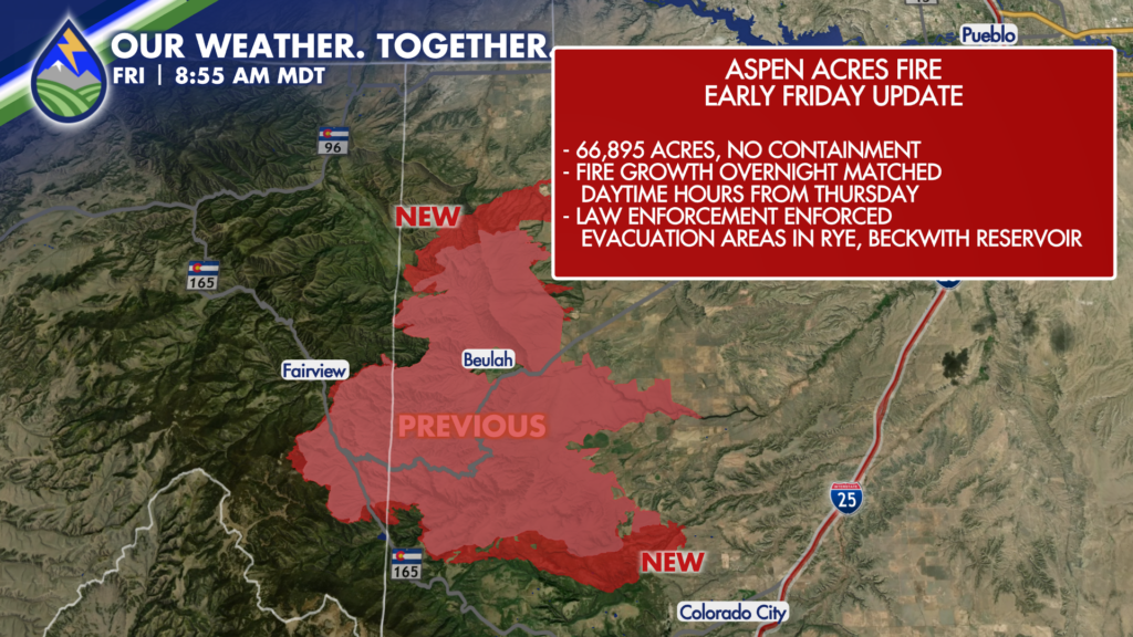
Keep in mind that there is often a lag on the official perimeters when the fire advances like it has done at times this week.
I’ve also zoomed in on these areas to show the distance from the fire line to the northwest side of Rye, Beckwith Reservoir, and Wetmore. I’m hopeful this helps explain why authorities were going door-to-door to enfore the mandatory evacuation overnight on the south end of the fire. It is closer to Rye and western sections of Colorado City and the reservoir than it is to Wetmore and the small community of Greenwood.
Regarding weather…I think the very late part of the day and evening/overnight are going to be active again. As a cold front approaches, a pre-frontal trough/dryline will accelerate away from the hills and will pick the wind up…it may end up a bigger issue between 6pm-12am than it is between 12pm and 6pm today.