


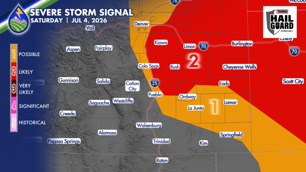
SEVERE STORMS SATURDAY
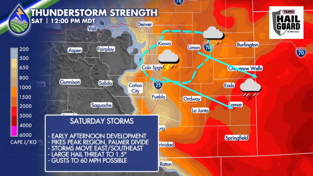
Behind an overnight cold front to welcome the holiday weekend, storm initiation is looking more likely to be in the Pikes Peak Region and Palmer Divide in the early afternoon on Independence Day. Storms may specifically fire over the east slopes of Pikes Peak or Colorado Springs during the lunch hour and then spread to the east/southeast through the remainder of the afternoon.
That’s good news for evening plans (check local sheriff/municipality for fireworks bans!) but beware if you’re doing something in El Paso, Douglas, and Elbert Counties in the middle of the day. A storm could develop right on top of you.
The biggest risk Saturday is hail between 1-2″ in diameter – closer to 1″ west and 1.5-2″ out east later in the afternoon. Wind gusts to 60mph are also possible west and near 70mph over eastern areas.


