







SEVERE STORM OR TWO POSSIBLE
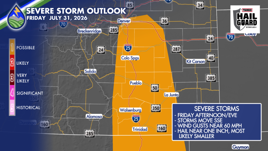
Behind this morning’s cold front, we’ll have enough wind shear along with low-level moisture being pushed up against the eastern slopes that a severe storm or two are possible Friday afternoon or evening.
Bursts of moderate-heavy rain are likely with stronger storms and a couple may bring some downdraft wind near 60mph. The strongest storm might even drop a couple of hail stones around an inch in diameter. The strongest couple of storms will move south-southeast, with weaker storm moving southeast.
ASPEN ACRES FIRE

It’s another day to be alert! Storms are more likely along the eastern slopes and adjacent plains today than other areas and a storm or two may hit the fire. The storms will likely have some moderate-heavy rain, and, like what we saw earlier this week, bring some debris and mud flows.
Be alert in low-lying areas and be ready to seek higher ground if waters rise where you are. Keep the Peaks2Plains Weather app handy and your location turned on so we can give you a digital shoulder tap!






