WEEKEND HEAT AND SMOKE
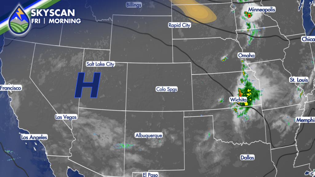
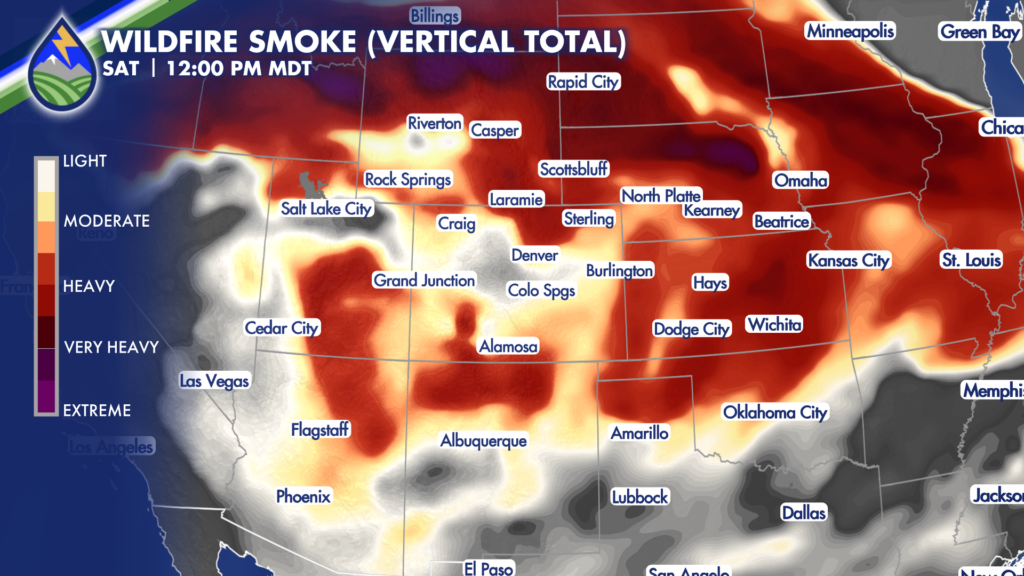
Near or record heat will be with us through the weekend with a high off to our east. The other thing we will see is the continuation of haze and smoky stretches from the wildfires off to our north and west…the fires over the Pacific northwest in particular continue to be most active with the largest smoke plumes.
CHANGES START TO DEVELOP
Over the weekend the high pressure begins the process of making a move to the southeast. This takes a few days of course, and as that happens we start to see southerly flow over the western U.S. redevelop. This is the monsoon. It’ll take a few days once it is established to really moisten up, but that’s important for us and our long-term forecast. Once it gets going, it’s going to stick around for a while in the best possible location for Colorado. The high ends up over Oklahoma and Texas, and even western Louisiana for a little bit.
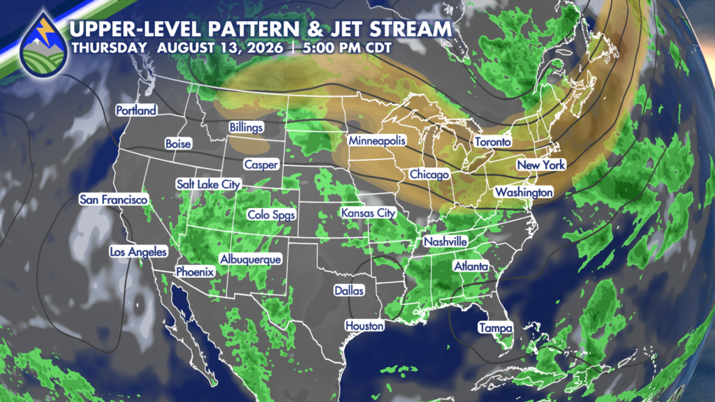
This curls the mid-level flow across Colorado from southwest to northeast and helps the monsoon push storms off the mountains. When the flow is moisture laden, that’s good news if you want rain. The other thing we have going for us next week is that we’ll see a cold front or two possibly back in from the northeast thanks to the jet up across the U.S. and Canada border.
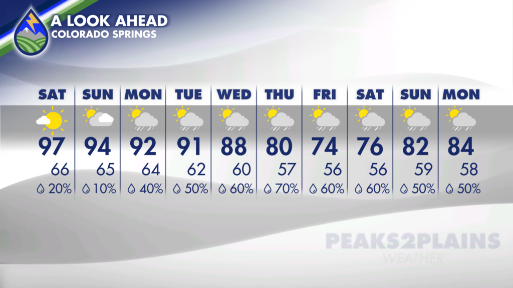
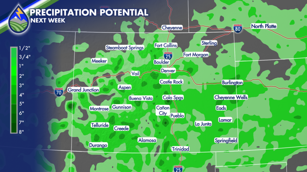
A WET STRETCH AHEAD
Not only does this help cool us down, but these back door fronts help with low-level moisture, and upslope – making the coverage of storms better and the likelihood of heavy rain higher. We’ll see this change start in the mountains this weekend, and spread eastward early next week over the plains…it’ll take a few days. but the middle to late part of next week, and even next weekend still looks like we’ll be talking likely storms and heavy rain.