







CHANGES ARE HERE
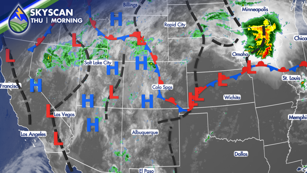
Clouds this morning signal changes to our hot weather of the last week and a half. An overnight cold front and the monsoon pull the temperatures back through the weekend region-wide.
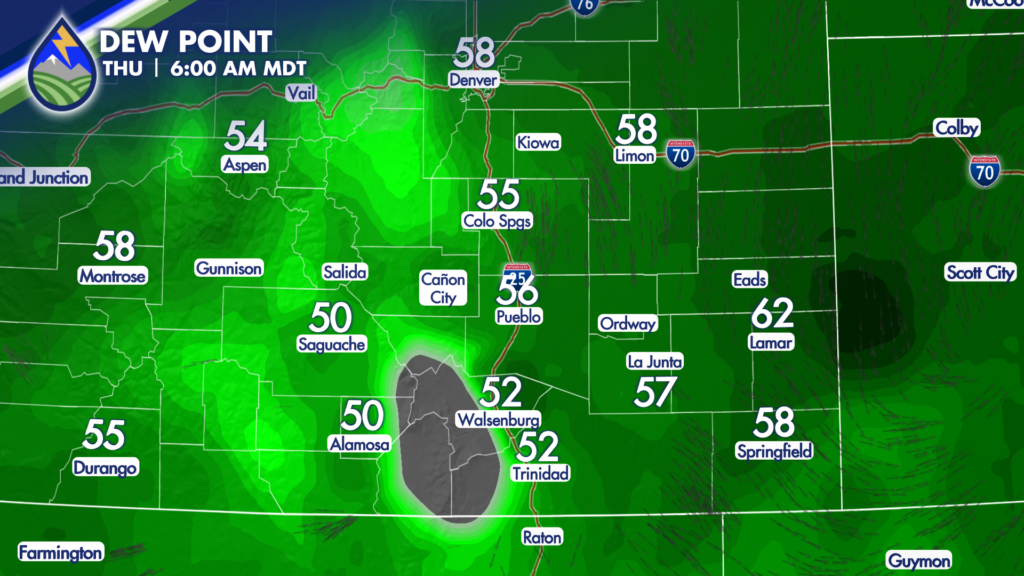
Thursday brings heavy rain with thunderstorms across the area this afternoon and evening. A Flash Flood Watch is up for the Aspen Acres Fire burn area as the combination of low-level moisture behind last night’s cold front and the monsoon now overhead means some wide spread storms today.
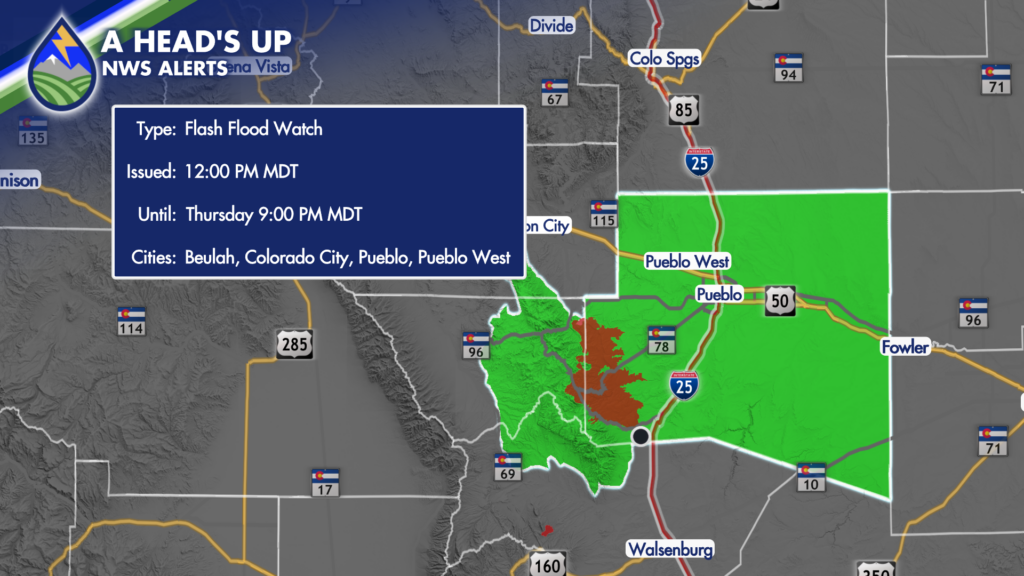
Storms will have heavy rain capable of starting debris and mud flows in and near the burned area. If you’re in the area please be alert this afternoon and stay aware of the situation. There may be multiple rounds of storms today, too. I’m eyeing one between 1pm-3pm and s second possible between 5-7pm.
Other storms will be efficient rain-makers today, capable of bringing between 1-1.5″ of rain under the strongest storms.
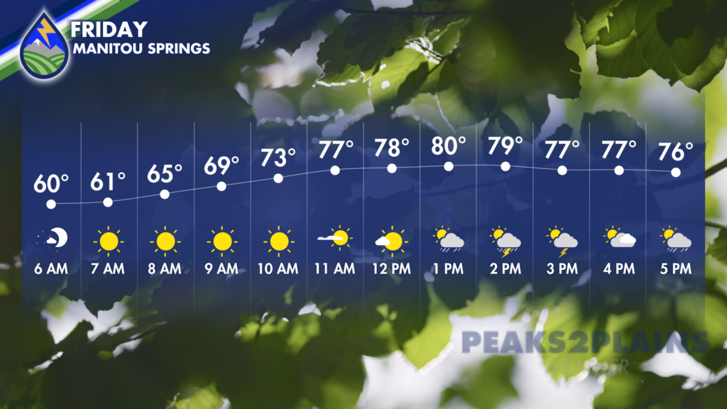
More storms expected on Friday, forming first over the mountains, the Palmer Divide, and Raton Mesa….individual cells moving northeast, but a general eastward movement of storm coverage through the afternoon into the evening.
MORNINGS ARE BEST
Need to avoid storms with some level of certainty? It’s the morning…get your to-dos, your workouts, your walks, practices, etc. done prior to the storms. Take advantage too, because the mornings will be very comfortable with some clouds around under the monsoon plume. That will make it feel great to be outside! You’ll be dodging storms through the afternoons and evenings though, a trend that continues through the weekend.
WEEKEND AND NEXT WEEK
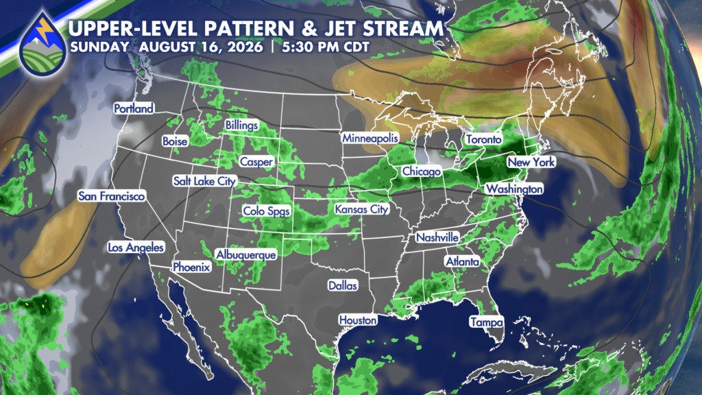
Moisture remains abundant over Colorado for the weekend with daily thunderstorms being driven by an active monsoon plume and some low-level moisture east of the mountains that moved in behind a cold front. Temperatures remain cooler than most of the last week and a half, particularly east of the mountains – a welcome break for many. Storms will develop over the mountains in the late morning and early afternoons…the Palmer Divide and Raton Mesa may also be trigger areas for storms. Individual cells will move northeast….while a general eastward shift into and through the evening occurs with the general area of stormy weather.
Daily waves in the atmosphere will help drive where the biggest clusters of storms are each day…and we’ll have to take that specificity as each day arrives. Storms will remain capable of heavy rain through the weekend. Early next week, the high shifts back into the western U.S. and breaks up the monsoon tap some…storms will become less widespread, and not as heavy when that happens. Parts of the plains may get some dry days returning next week, too.






