







As high pressure builds overhead, temperatures are expected to climb on Tuesday!
Along and east of I-25, highs in the 90s and 100s are expected. Even our local mountains and mountain valleys will be hot, with highs in the 70s and 80s!
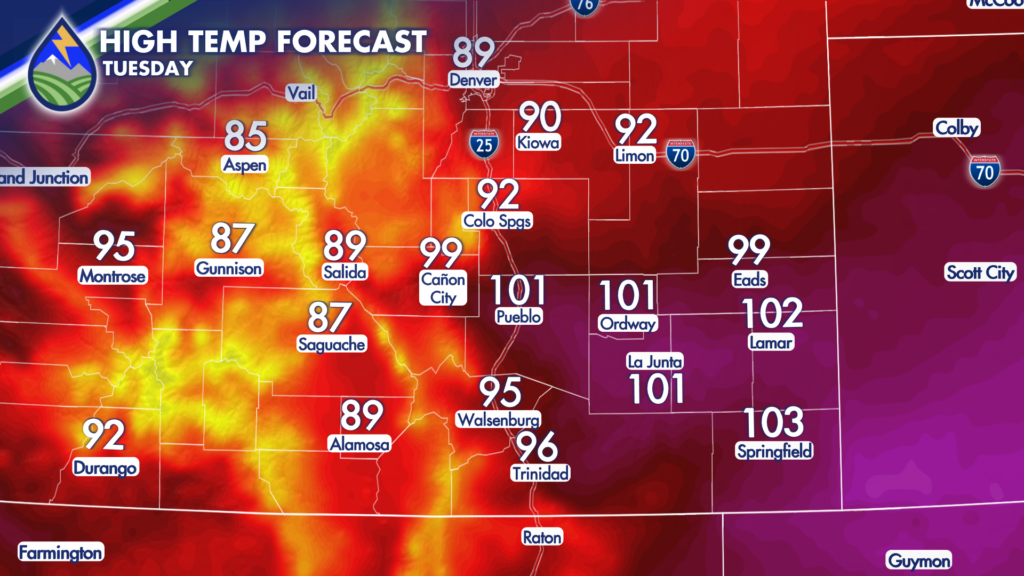
There is a slight chance afternoon and evening storms north of I-70, as a cold front will begin moving through the area – it won’t cool temperatures down noticeably on Tuesday, but it could help to spark a storm or two. While an isolated cell over/near our local mountains will be possible, most of southern Colorado can expect a hot and mostly dry day.
As the aforementioned cold front passes through the entire state by early Wednesday morning, low level moisture will be on the increase. Combine that with increased instability, and the stage will be set for storms to develop around the mountains that are expected to slide eastward and intensify once they hit the plains.
Storms on Wednesday will be capable of producing heavy rains, which will raise the threat for flash flooding over saturated areas, recent burn scars and active fires. The strongest storms could also bring large hail and damaging winds.
Storms will likely begin firing in the mountains shortly after noon, impacting the I-25 corridor around 3PM and then redeveloping/sliding eastward across the plains through 5-7PM. While a few storms could linger near the Colorado/Kansas state line, most of the region will quiet down and clear out by about 10PM.
Thursday won’t be as active, however daily afternoon storms are expected through the end of the work week.
This weekend, our ridge of high pressure begins to slowly shift eastward which will help to draw more monsoonal moisture into the state. This will help to bring an increased chance for daily, heavy rain-producing storms by Sunday that will last into next week.






