







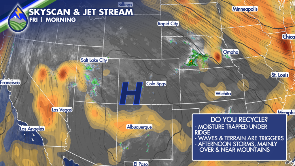
Friday is bringing another hot one to Southern Colorado, with temperatures running close to record levels in Colorado Springs, Pueblo, and parts of the eastern plains. Colorado Springs could reach the mid 90s, Pueblo is headed toward 100, and additional 100-degree readings are possible farther east, including around La Junta. Even the mountains and valleys will be warm, generally in the 80s to near 90.
That heat is arriving ahead of a cold front scheduled to move in late Friday night into early Saturday morning. It is not a major cooldown, but it will take the edge off the heat for the weekend while also leaving more low-level moisture in place for thunderstorms. Friday remains the hottest day in this stretch, so take the heat seriously if you are working outside, traveling, attending an event, or spending time on the trails.
Thursday brought a round of late-day storms mainly along the higher terrain, from southern areas and the Wet Mountains to the southern Sangre de Cristos and the west side of Colorado Springs. A storm west of Colorado Springs prompted a severe thunderstorm warning, and warnings were also issued near the Aspen Acres Fire, north of Pueblo, and on the west side of Pikes Peak. There were no reports of severe weather, but it was an active afternoon near the hills, where much of the rain fell. For Friday, thunderstorms should once again develop first over the mountains and foothills. The overall coverage east of the mountains looks lower than Thursday, and storms moving onto the adjacent plains may struggle to hold together.
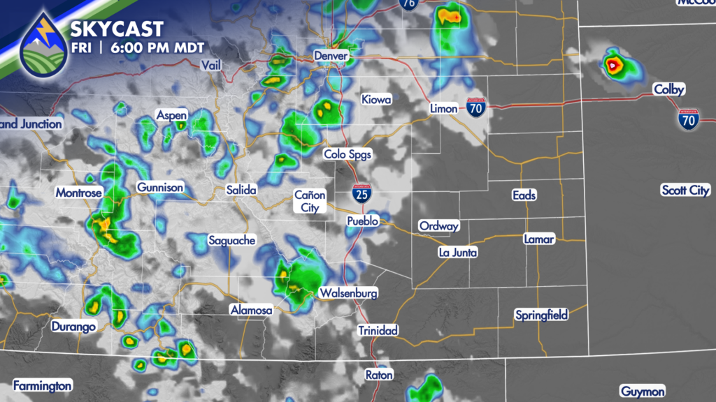
The best opportunity for a more meaningful rainfall, including pockets of more than a half inch, is over the mountains. The heavy-rain concern there looks a little lower than it was Thursday, but any slow-moving storm near vulnerable terrain or burn-scar areas still deserves attention. Storms that make it down the eastern slopes or toward the nearby plains Friday could bring a quick burst of rain. Farther east of Interstate 25, storms that survive into the evening are more likely to produce gusty wind than widespread rainfall. Keep an eye on the sky late in the day if you have plans outside, especially near the foothills, but Friday does not look like an all-day washout for most locations. As the front arrives overnight, a few thunderstorms may develop east of I-25 into early Saturday morning.
Those storms could have a little more low-level moisture available behind the front, so there may be some rain with them. It is a part of the forecast worth watching if you live or travel across the eastern plains overnight, though the larger storm focus shifts into Saturday afternoon and evening. Saturday starts the weekend with cooler temperatures than Friday, though it will still be warm. Most importantly, the atmosphere should have more moisture to work with. Storms are expected to begin over the high country during the afternoon, then gradually move east of the mountains later in the day. That means the better window for Colorado Springs, Pueblo, the I-25 corridor, and the eastern plains is generally very late afternoon into the evening.
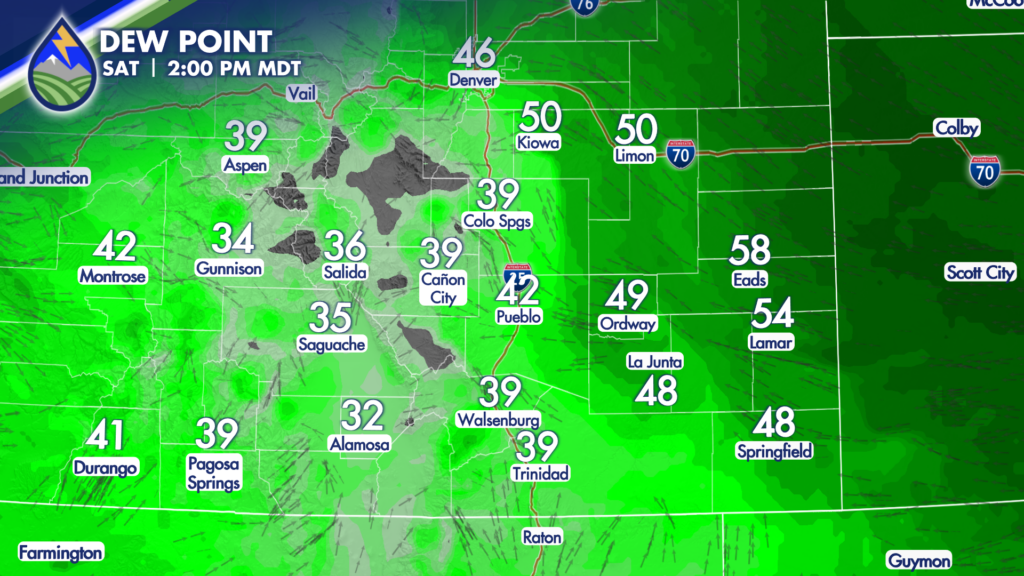
There could be a severe storm or two Saturday from the eastern foothills across the plains, including the cities. The main concerns with the stronger storms are heavy rain and gusty winds, with wind gusts near 60 mph possible. One or two storms could also come close to producing hail around one inch in diameter. Not everyone will see those conditions, but it is enough of a possibility to have a plan for outdoor activities and a way to receive weather updates. The timing should help with weekend planning. Through roughly midafternoon Saturday, the better storm chances are still over the mountains.
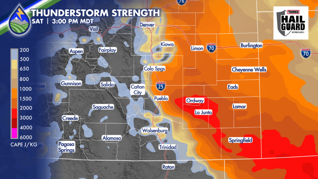
Storm chances expand farther east later in the afternoon and evening as storms find the added moisture over the foothills and plains. If you have an early mountain trip, a ballgame, a backyard gathering, or travel planned later Saturday, build in some flexibility for changing weather. Sunday looks a touch cooler again, with temperatures dropping another degree or two from Saturday in many areas.
The more important change is that storm coverage may become more widespread. Sunday and Monday currently look like the better chances for storms capable of producing heavier rain across the region. That does not mean nonstop rain, but it does mean more locations may have a chance to pick up a shower or thunderstorm compared with Friday. The increased moisture pattern continues to favor afternoon and evening development, beginning over the mountains and moving toward the adjacent plains.
Heavy rain will be a concern in stronger cells, especially where storms move slowly or track over the same location. Area burn scars need extra attention through the weekend and into early next week, since repeated rounds of storms can quickly create runoff concerns even when rain is brief.
Our Weather. Together.






