After another active afternoon and evening across Southern Colorado, Monday looks like a rinse-and-repeat kind of day. We will start the work week dry, warm, and fairly pleasant, but another round of afternoon and evening thunderstorms is expected to develop. The storms may be fewer and more scattered than what we saw over the weekend, but the storms that do form can still bring locally heavy rain, small hail, gusty winds, and a flooding concern.
Monday morning starts quietly. Storms from Sunday evening should wind down by sunrise, leaving a few clouds around but plenty of sunshine to begin the day. Morning temperatures will generally be in the 60s across the lower elevations, with cooler readings in the mountain valleys and high country. It should be a nice start for commuters, outdoor workers, and anyone getting an early jump on the week.
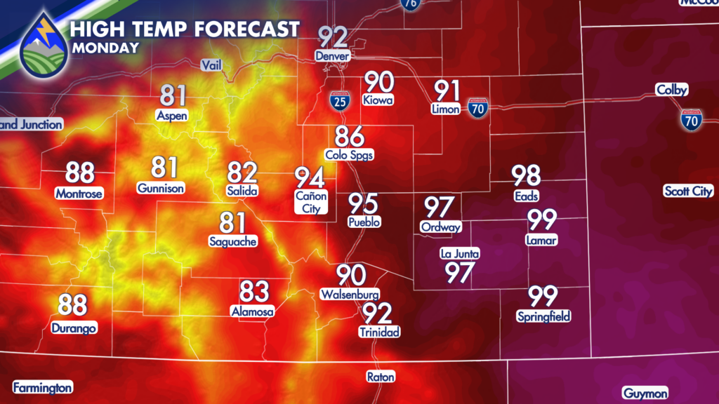
By afternoon, temperatures will climb quickly. Colorado Springs is expected to reach around 87 degrees, while Pueblo and much of the lower Arkansas Valley warm into the 90s. Lamar and Springfield could come just shy of 100 degrees. It will be another hot afternoon across the plains, so make sure you have water handy if you will be outside before storms begin to develop.
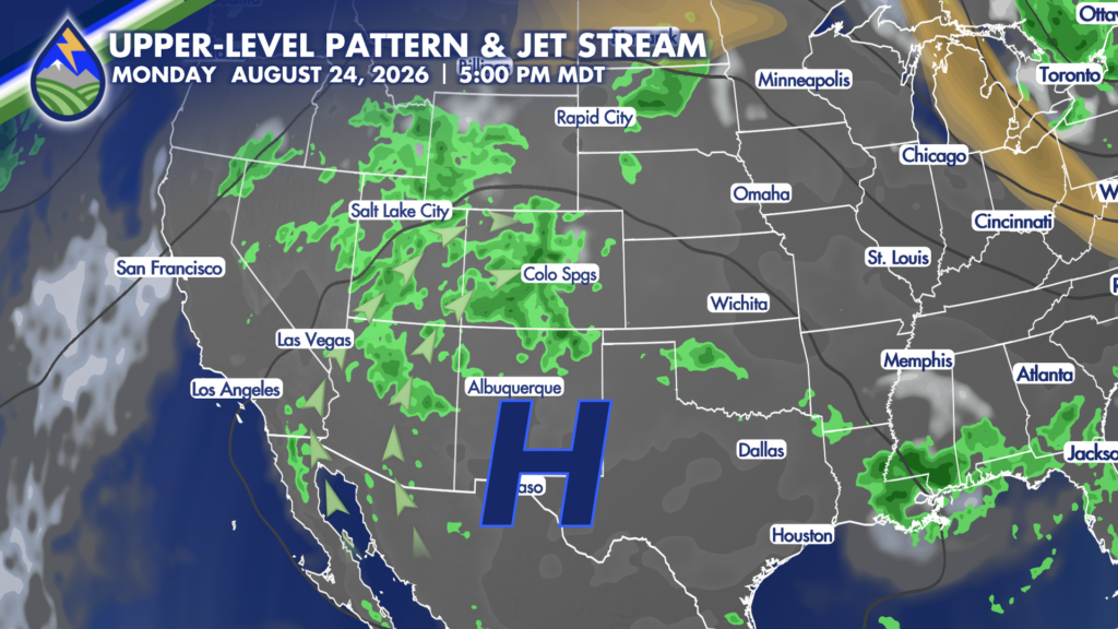
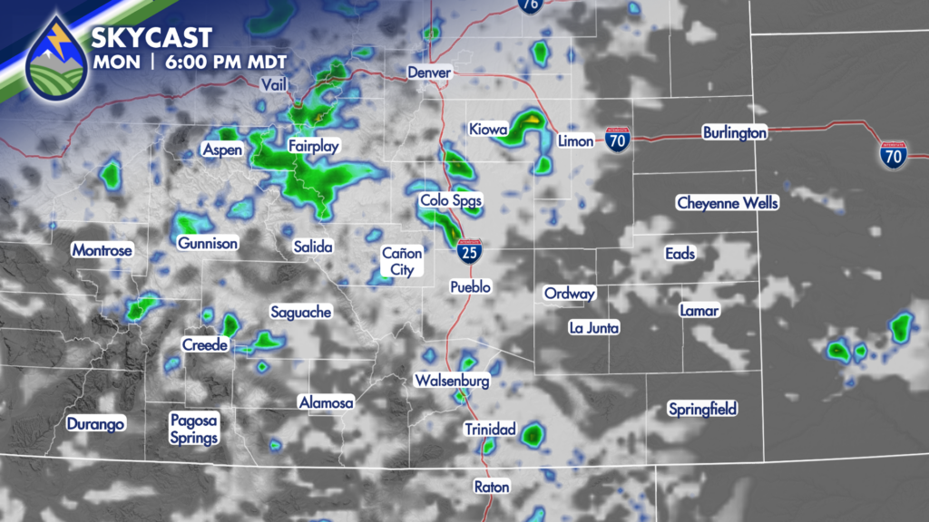
Monsoon moisture remains in place Monday, helping thunderstorms fire first over the higher terrain during the early to middle part of the afternoon. Storms may begin bubbling up near the mountains around 2 p.m., then gradually expand toward the Interstate 25 corridor, nearby valleys, and eventually the eastern plains. Not every location will see rain, but any storm that moves overhead could put down a quick, heavy burst of rain.
The Pikes Peak region may see storms around the evening commute, with a wetter setup possible near Colorado Springs by roughly 5 p.m. If you are heading home from work, allow some extra time and be prepared for changing road conditions. Heavy rain can reduce visibility quickly, while water can collect in low spots and on roads where drainage is poor. Do not drive through water covering the roadway.
The biggest concern with Monday’s storms is locally moderate to heavy rainfall. Storms are expected to be fairly slow-moving, which can allow rain to pile up over the same area. That raises the risk of flash flooding, especially where soils were already saturated by weekend rain. Areas that received repeated storms recently will be more sensitive to another round of downpours.
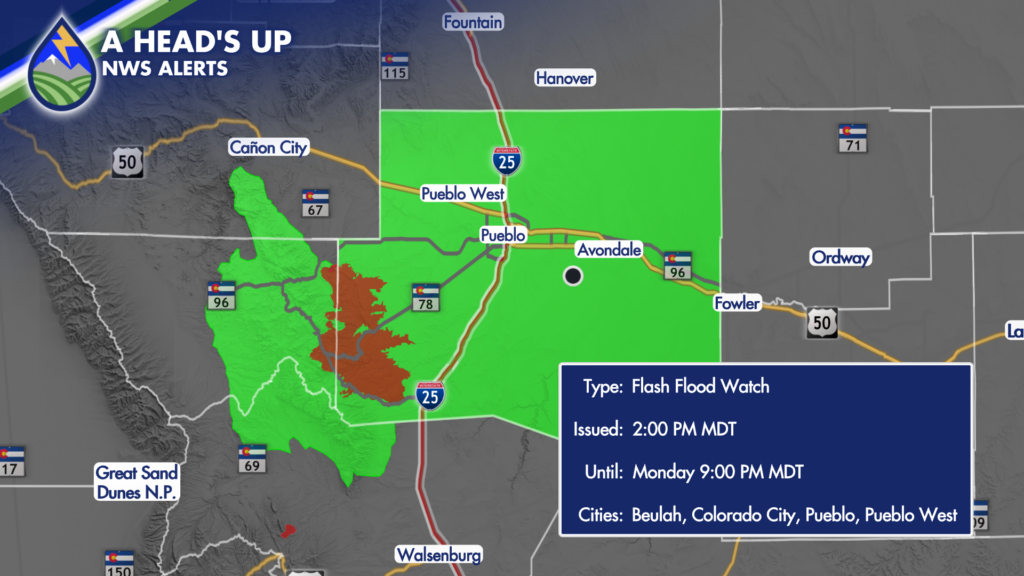
The Aspen Acres Fire area remains a particular focus when heavy rain is in the forecast. A Flash Flood Watch is in effect from 2 p.m. until 9 p.m. Monday for the Aspen Acres Fire burn scar. Rain falling over a burn area can run off quickly, creating flash flooding and debris-flow concerns in and downstream from the scar. If you live, work, travel, or recreate near the burn scar, keep a close eye on conditions through the afternoon and evening.
Storms may still be around Pueblo County, Fremont County, and near the Aspen Acres Fire area into the evening. Farther east, storms could linger the latest near the Colorado-Kansas state line. While storm coverage should gradually decrease Monday night, a few showers and storms may hang on across the plains into the first part of the overnight period before weakening substantially toward Tuesday morning.
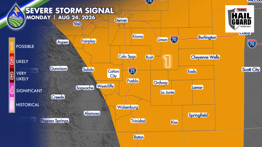
In addition to heavy rain, stronger storms could produce small hail and gusty winds. There is also a chance for a few storms to become strong to severe from the central and eastern mountains, through the I-25 corridor, and across the plains. The main hazards to watch will be intense rainfall, lightning, brief gusty outflow winds, and hail. Remember that lightning can strike well away from the heaviest rain, so head indoors when thunder is nearby.
This is a good day to have multiple ways to receive weather alerts. Keep the Peaks2Plains app nearby, turn on location services, and make sure alerts are enabled before you head out. That is especially important if you will be driving, working outdoors, attending an evening event, or spending time near creeks, arroyos, burn scars, or other places that can flood quickly.
Tuesday stays warm, though temperatures will come down a handful of degrees from Monday. Expect 80s and 90s across Southern Colorado, along with another chance for afternoon and evening showers and thunderstorms. Storm coverage will remain part of the forecast, and the flooding concern does not completely go away where heavier rain falls or where the ground remains wet from earlier rounds of storms.
Wednesday currently looks like the coolest and one of the more active days in the extended forecast. A small disturbance moving through the region should help trim temperatures a little further while low-level moisture increases. That combination may support another active round of showers and thunderstorms, so Wednesday is another day to stay weather-aware and flexible with outdoor plans.
Our Weather. Together.