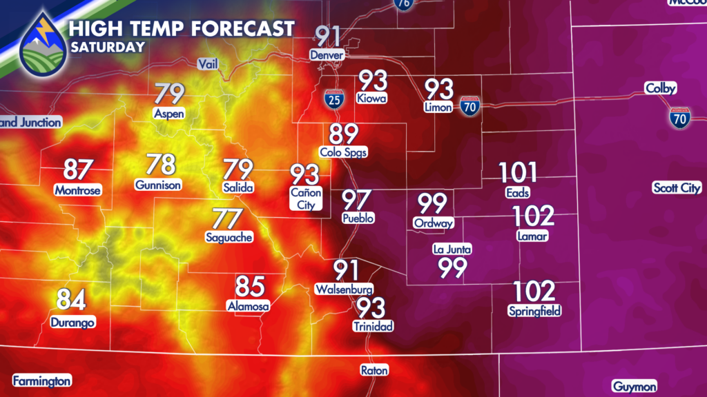
While it won’t be record-breaking, it is going to get HOT on Saturday!
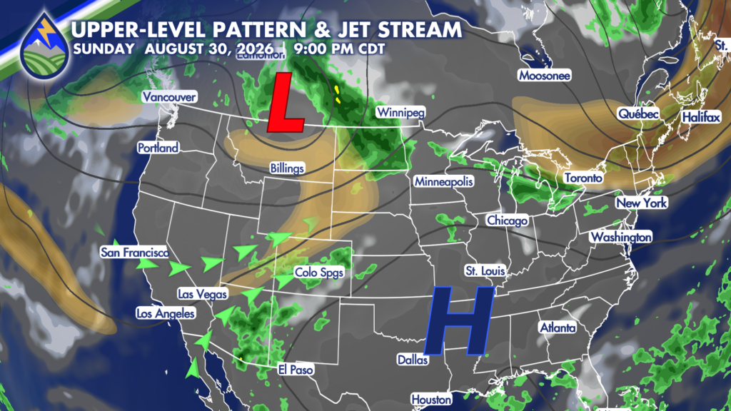
A combination of an upper-level low passing across the northern Rockies and high pressure to our southeast will help to usher in moisture Saturday, Sunday and Monday.
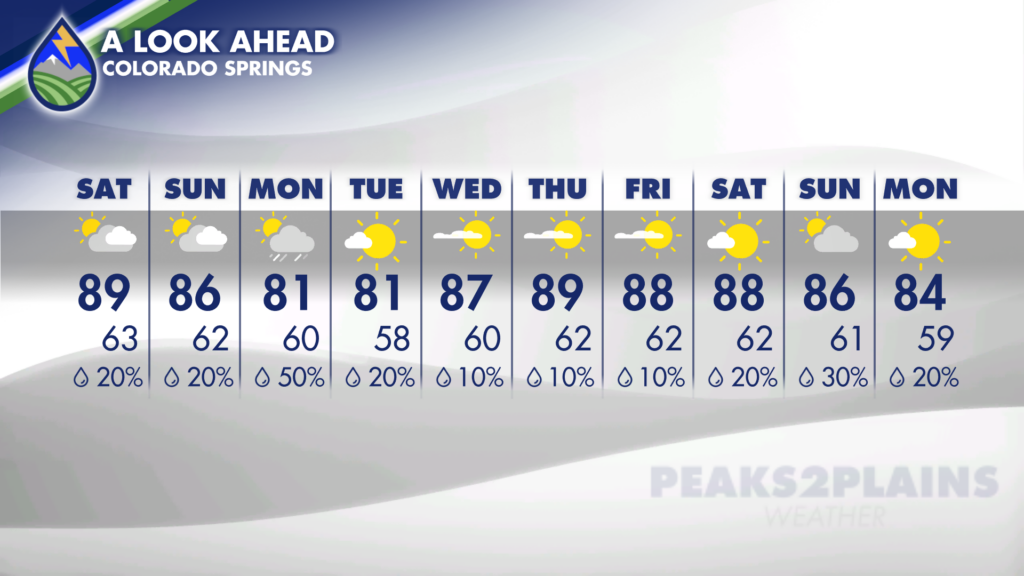
This will increase the chance for storms in the high country throughout this timeframe. Meanwhile, along and east of I-25 the chance for storms will begin increasing through the weekend, with the greatest chance arriving on Sunday and Monday thanks to a cold front expected to move through.
With any storm that develops, moderate to heavy rain will be possible. This means that flooding in the high country will be a concern, and flash flooding over and near recent burn scars will also continue to be a major concern.
The aforementioned cold front will help to bring some relief from the weekend’s heat! Highs this weekend will be in the 80s to 100s, but by Monday highs should end up be about 10-15 degrees cooler!
Enjoy the cool-down while it lasts. As high pressure begins to meander westward, our moisture stream will be shut off. Drier and warmer conditions will return by Wednesday, lasting through the end of the work-week.