







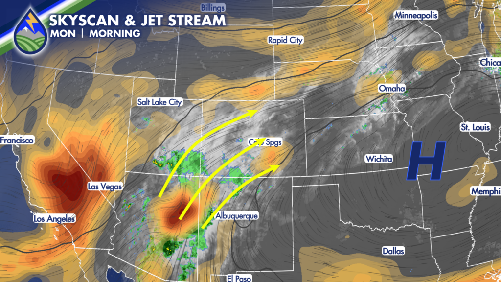
There’s moisture in the mid-levels still coming from the southwest in the monsoon plume. There’s moisture is a well defined wave near Payson, Arizona (the orange coloring) that will rotate through later today and this evening.
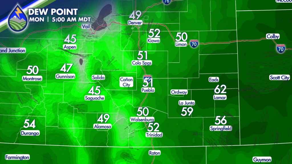
Combined with higher dewpoints at the surface today, we get our best chance of storms today that most of us are going to have through Friday.
The atmosphere remains connected to monsoon moisture from the Southwest, and a defined disturbance moving up from Arizona will rotate across Colorado Monday afternoon. At the same time, energy farther north is helping send the front into southern Colorado. That setup should bring storms developing over the mountains and higher terrain, then moving generally southwest to northeast through the afternoon and evening.
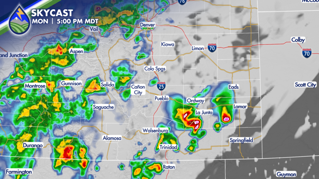
For most locations, the best window for storms looks to be roughly 4 PM to 8 PM Monday. That does not mean every neighborhood sees rain, but storm coverage should be better than what we saw over the weekend. Showers and thunderstorms may also linger into the evening, and an isolated shower or rumble of thunder cannot be ruled out into the early hours of Tuesday.
The main story with Monday’s storms is rain potential. With deeper moisture in place, some storms may be more efficient rain producers, especially over the mountains and nearby foothills. If you have outdoor plans, keep an eye on the sky through the afternoon and evening, and be ready to head indoors when thunder is nearby. Lightning is a risk with every thunderstorm, even the ones that do not produce much rain at your location. Across the plains, storms rolling off the higher terrain could still bring locally heavy rain, gusty winds, and lightning. A stronger storm or two is possible in the far southeast, generally east of a Rocky Ford-to-Trinidad line, where storms may have a little more instability to work with. The practical takeaway is simple: Monday offers the best rain chance of the work week for a lot of southern Colorado, but storms will still be unevenly distributed.






