







Southern Colorado gets a quieter stretch to start the extended forecast, with drier desert air settling in behind a passing wave Wednesday and Thursday. If you have outdoor plans, those look like the better days to make them. Most areas will stay dry, and any shower or storm that manages to develop should be isolated and more likely to produce a burst of gusty wind than meaningful rainfall.
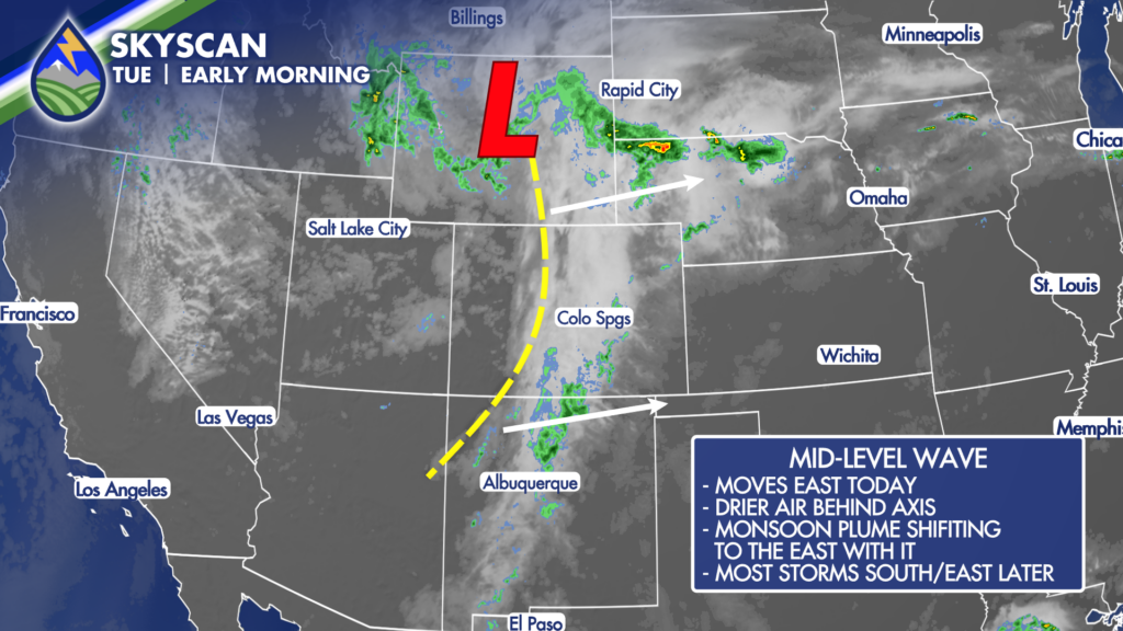
Temperatures will head upward as the drier air arrives. Plains communities, including Pueblo, Colorado Springs, Canon City, Trinidad, La Junta and Lamar, will warm well into the 80s and 90s. Some of the far eastern plains may run close to 100 degrees. Mountain valleys should generally reach the 70s and 80s, while higher elevations stay cooler. It will still be a good idea to watch for locally breezy afternoon conditions, especially in the usual wind-prone spots.
Wednesday looks mainly dry across the mountains, valleys and plains. Thursday follows the same general pattern: warmer temperatures, lower humidity and only a very low chance of an isolated high-based storm. That means plenty of dry time for work outside, late-summer projects, hiking, travel or simply enjoying a couple of calmer September days.
MONSOON MAKES A MOVE
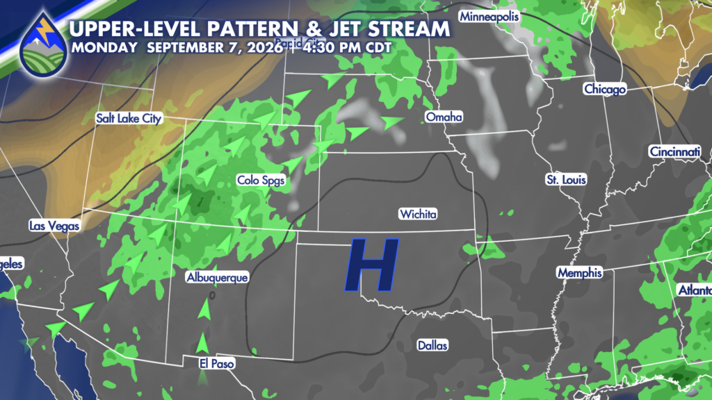
The pattern begins to change as we head into the Labor Day holiday weekend. High pressure centered over the central Plains and lower pressure near the Pacific Northwest will help pull monsoon moisture back north into Colorado. That moisture return will not happen all at once, and storm coverage will vary from day to day, but the overall trend is toward more afternoon and evening thunderstorms from Friday into next week.
For the mountains and higher terrain, storm chances become more noticeable over the holiday weekend and should remain part of the daily forecast into next week. The Sangre de Cristo Mountains, Wet Mountains, Rampart Range, Pikes Peak region, Sawatch and San Juan country, plus the mountain valleys, are the areas most likely to see the more regular monsoon activity. That does not mean every location gets rain every day. It does mean that if you are headed into the backcountry, planning a high-elevation hike or traveling over a pass, you will want to build in some weather awareness each afternoon.
Thunderstorms during a returning monsoon pattern can bring brief heavy rain, frequent lightning, small hail, gusty outflow wind and rapidly changing conditions. Recent burn scars, slot canyons, narrow drainages and low-water crossings deserve extra attention whenever storms are nearby. A storm does not have to sit directly overhead to send runoff downstream, so keep an eye on the sky and have a way to get weather information while you are out.
Colorado Springs and the Pikes Peak foothills could catch a thunderstorm at times over the weekend. At this point, Sunday looks like one of the better opportunities for deeper moisture around the area, with another possible uptick around the middle of next week. Saturday may feature only isolated activity in many locations, and Labor Day Monday and Tuesday could also bring a stray storm while still leaving plenty of dry hours for outdoor plans.
WHAT WE’RE WORKING ON
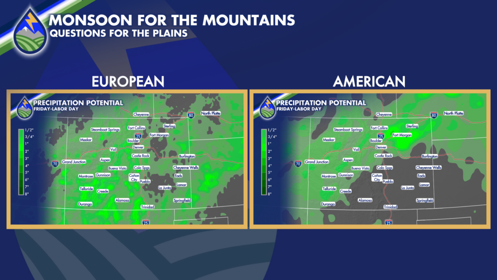
The plains forecast has a little more uncertainty than the mountain forecast. A weak front may or may not make it into eastern Colorado during the weekend. If it arrives, it could help boost thunderstorm coverage east of the mountains. For now, it is too early to get overly specific about where that boundary sets up or who sees the best chance of rain. Storms on the plains may be more spotty than in the mountains, but that is one of the details to watch closely over the next couple of days.
The encouraging part of this setup is that the monsoon does not appear to disappear after one day. Small waves moving around the western side of the high pressure system should keep moisture feeding into the Southwest and Colorado through much of next week. That supports a stormier stretch for the high country, with occasional opportunities for storms farther east whenever the moisture gets thick enough.
September can sometimes turn very dry across Southern Colorado, so it is welcome to see monsoon moisture hanging around in the broader pattern. Temperatures should remain above normal overall, especially across the plains, but increased clouds and afternoon storms can trim daytime heat locally from time to time. Mornings will still offer the most dependable window for outdoor recreation once the daily storm pattern returns.
Looking farther ahead, stronger Pacific systems will be worth watching as we move deeper into September and inch toward October. There is no local snow forecast in this outlook, but this is the time of year when stronger systems can eventually begin producing snow in the high country. For now, the main story is simple: dry and warmer Wednesday and Thursday, then a gradual return to daily monsoon storm chances through the Labor Day weekend and into next week.
Our Weather. Together.






