







Labor Day is bringing a change across Southern Colorado. It will still be warm to hot this afternoon, but moisture increasing from the southwest will give more of us a chance to see showers and thunderstorms than we have had over the last couple of days.
Not every neighborhood will get rain, but storms that move overhead could bring a quick burst of rain, frequent lightning, and wind gusts in the 40 to 50 mph range. A couple rounds of storms are possible, with some activity lingering into the late evening.
The severe-weather risk is low across the region today. Still, the strongest storms could produce locally gusty winds, so keep an eye on the sky if you have outdoor Labor Day plans. Lightning is a concern with any thunderstorm, even one that does not bring much rain. If thunder is close enough to hear, it is time to head indoors.
Temperatures remain summerlike despite the added humidity. Colorado Springs is expected to reach the low 90s, while Denver heads toward 90. Woodland Park will be near 80, with 70s common on the higher terrain around Pikes Peak and mountain temperatures generally running in the 70s and 80s, depending on elevation. The eastern plains will again see 90s.
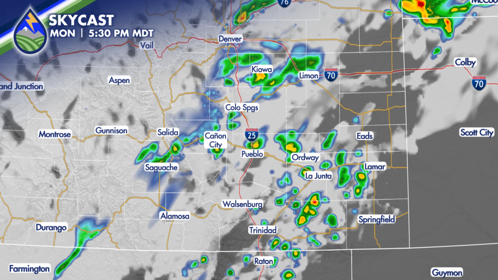
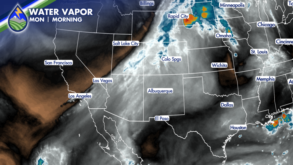
Today’s storms will be fueled by thicker moisture moving into Colorado as a disturbance lifts across the Great Basin and the Intermountain West. That added moisture is the main difference from Sunday and, for many locations, Saturday as well. Storm coverage should increase over the mountains first, then expand toward the I-25 Corridor and out onto the plains through the afternoon and evening.
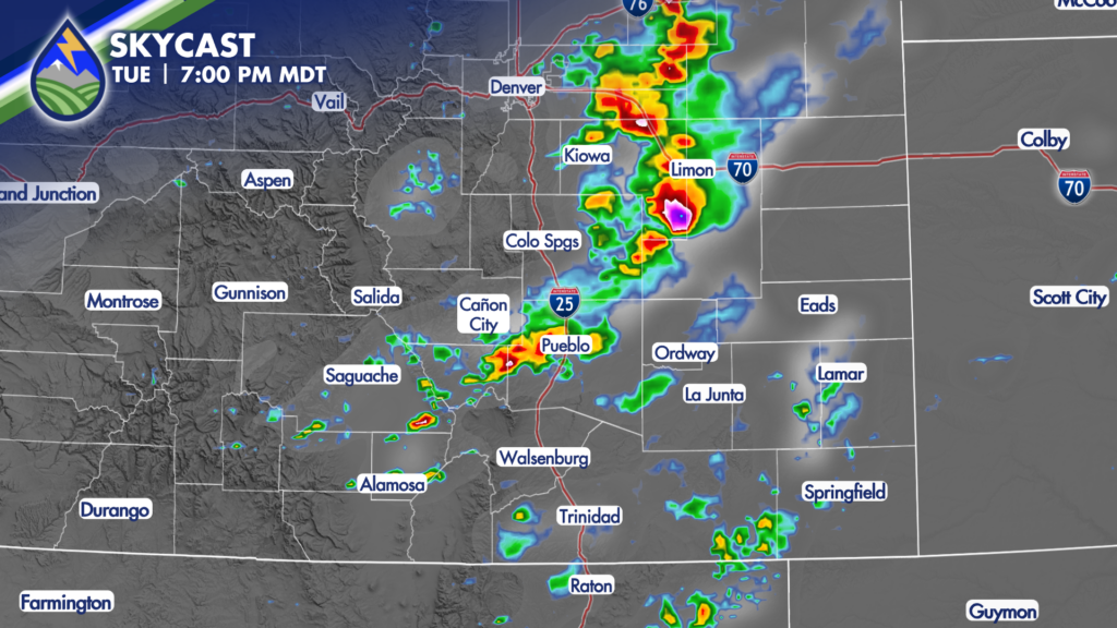
Tuesday brings another shift. A cold front moves in overnight, tied to a stronger weather system tracking from the Pacific Northwest across the Rockies and into the Plains. Temperatures east of the mountains should ease back by roughly 3 to 5 degrees Tuesday, although the far southeastern corner of Colorado may not cool as much. Mountain temperatures will not change a great deal.
The bigger Tuesday concern is the combination of increased low-level moisture and slower-moving thunderstorms. Some storms Monday could produce around a half-inch of rain, but Tuesday may offer a better chance for heavier rain in spots. That makes burn scars west of Interstate 25 especially important to watch, including the 24 Fire and Aspen Acres Fire areas. Heavy rain over or near a burn scar can create runoff issues quickly, even when the rest of the area sees only a brief storm.
Wednesday brings another cold front and another step down in temperatures, especially east of the mountains. The best thunderstorm chances look to be from the eastern slopes of the Rockies across the plains. Storms may take a little longer to develop Wednesday, and cooler air could limit some activity as it moves farther away from the higher terrain. Even so, it is another day to stay aware of changing conditions if you are traveling, working outside, or spending time near drainage areas and burn scars.
For the Labor Day afternoon and evening, have a way to get weather updates if you will be at a park, on the water, at a cookout, or traveling across the region. Storms can produce sudden wind shifts and lightning well ahead of their heaviest rain. Secure lightweight outdoor items, take breaks from the heat, and do not wait until the rain begins to find safe shelter.
The late-week pattern trends drier. Thursday and Friday look quieter overall after the midweek fronts, with fewer storm chances and a gradual return toward warmer temperatures. That does not mean every spot will be completely storm-free, especially near the mountains, but the broader pattern favors a drier end to the workweek.






