Temperatures on Saturday were 10 to 20 degrees cooler for many areas, in comparison to Friday’s high temperatures.
This is thanks to a cold front that moved through early Saturday morning.
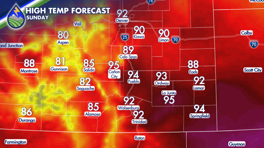
Heat returns on Sunday, however, with high temperatures expected to return to the 80s and 90s for most of the area.
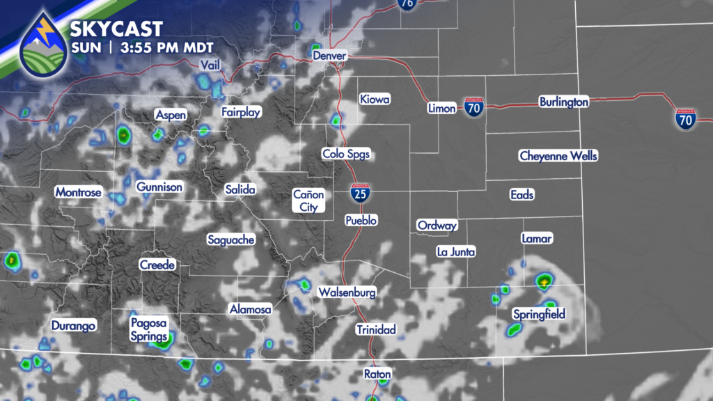
As an area of high pressure east of Colorado moves slightly farther southeastward, the monsoonal moisture plume will be allowed to move eastward also. This will position it over western Colorado, allowing for an uptick in thunderstorm activity on Sunday. The best chance for storms will be over the mountains, with the potential for a few of these storms to slide off the hills and impact areas along and east of I-25. However, storms for the lower elevations will be more isolated in nature. So, not everyone gets in on the rain on Sunday.
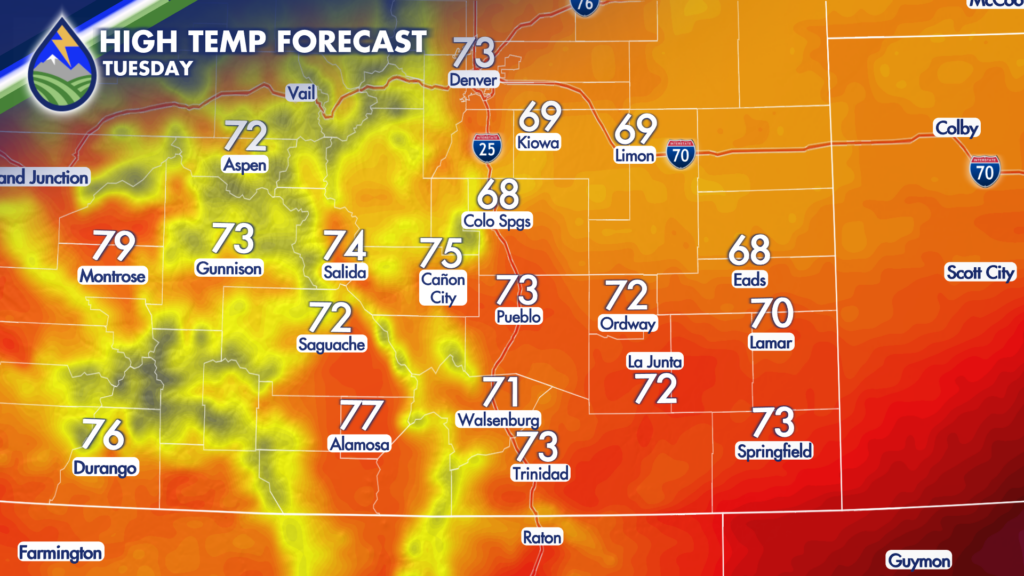
Monday brings another cold front, but it arrives late in the day. Therefore, many areas will still warm into the 80s and 90s before the cooler air arrives! Once the cold front passes, air behind will keep Tuesday’s high temperatures in the 60s and 70s.
This cold front will interact with monsoonal moisture in place to increase the chance for thunderstorms Monday and Tuesday. Flash Flooding over and near area burn scars and fires will need to be monitored as any storm that develops beginning Monday will be capable of producing moderate to heavy rain.
Another wave of energy increase storm coverage and intensity further Wednesday and Thursday – which, at this point, look to be the most active weather days this week!