







How often do we get this amount of widespread heavy rain? It’s a good question…and one worth looking into for the next few days.
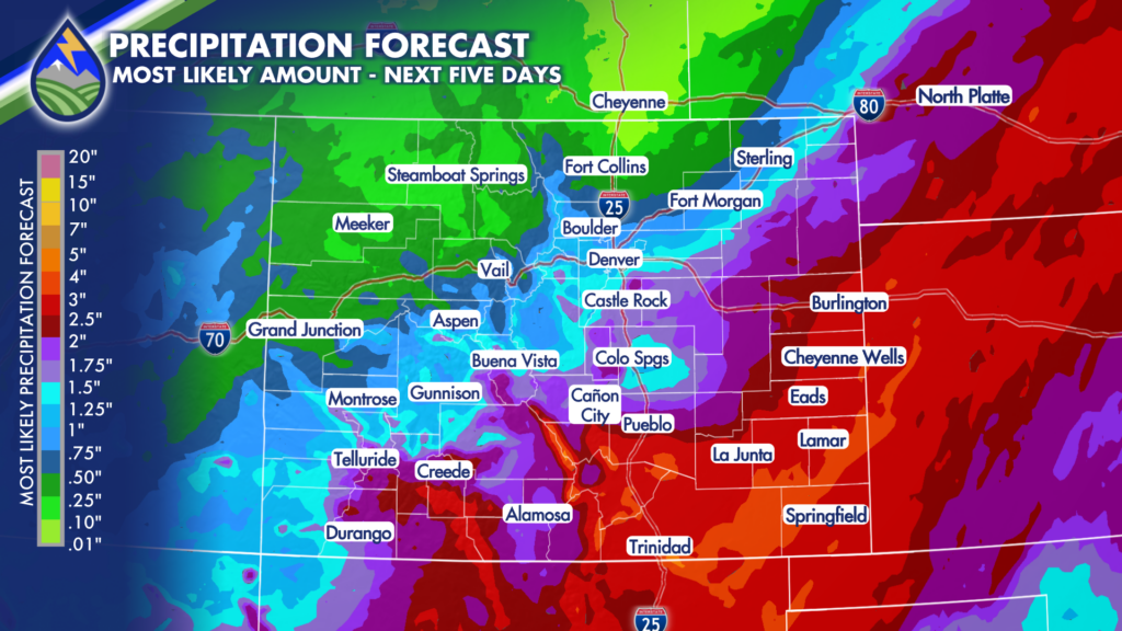
The above image is the current “quantitative precipitation forecast” from NOAA’s Weather Prediction Center as of 6am Monday morning. Notice where the WPC has the 2″+ amounts…I’ll come back to this. The image below is the WPC’s published Average Recurrence Interval given the data in the first map. The ARI expresses the expected amount of time between periods of this much rain at each location.
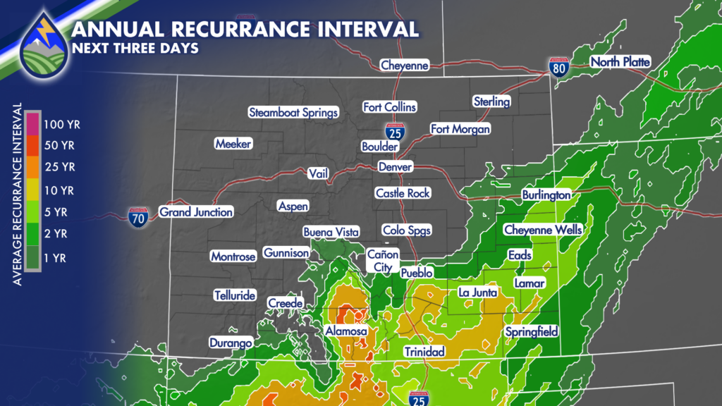
Personally, I’m forecasting the system to take a more north track, with potential for the 2-4″ of rain with locally higher amounts that you see on this map also possible for Colorado Springs and the Palmer Divide. The Average Recurrence Interval values are similar to what you see being forecast for the areas along and south of highway 50. Here’s a convenient table given the WPC forecast/ARI for some areas in southern Colorado for convenience – I don’t want you to have to work hard if you don’t want too!
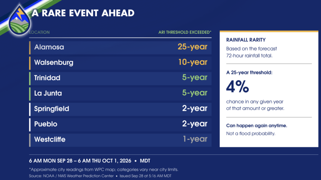
I’ll update this when the WPC QPF values start shifting north to match my forecast. 🙂






