







See the Bluish colors on Water Vapor that are trucking northeast into Texas…well, shoot.
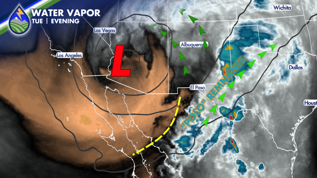
We need more of that pulling into the storm if we want inch-plus amounts on the Palmer Divide. The Weather Service office in Boulder already dropped the Flood Watch for Douglas and Elbert Counties.
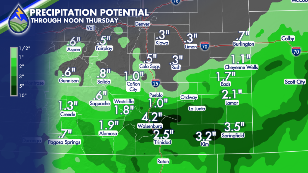
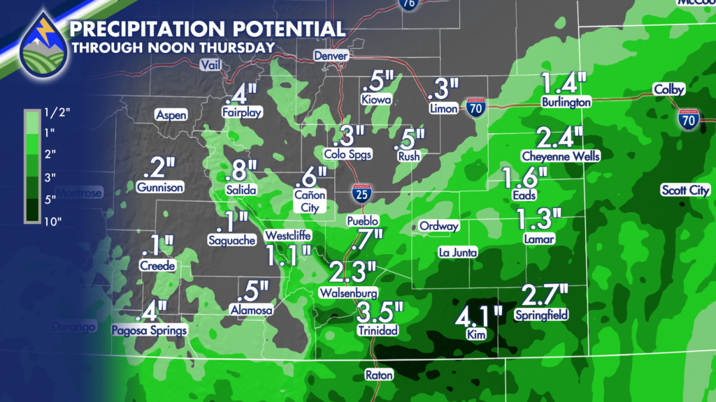
Heaviest amounts will still be south of highway 50 as we’ve telling you the whole time, but I’m dropping amounts farther north. A few models still show Colorado Springs getting near an inch…which is still possible, especially if we get a thunderstorm or two…but even those are looking most likely farther south on Wednesday.
I’ve got two new models from this evening painting a pretty clear picture at this point in terms of potential rain amounts. Impacts south of highway 50 include the risk of flooding – especially the Aspen Acres Burn…other areas may end up at risk, too.
I’ve been saying this my entire career…and when I die, I want you all to make sure it gets on my headstone: “The track matters”
It always matters. Every time.






