







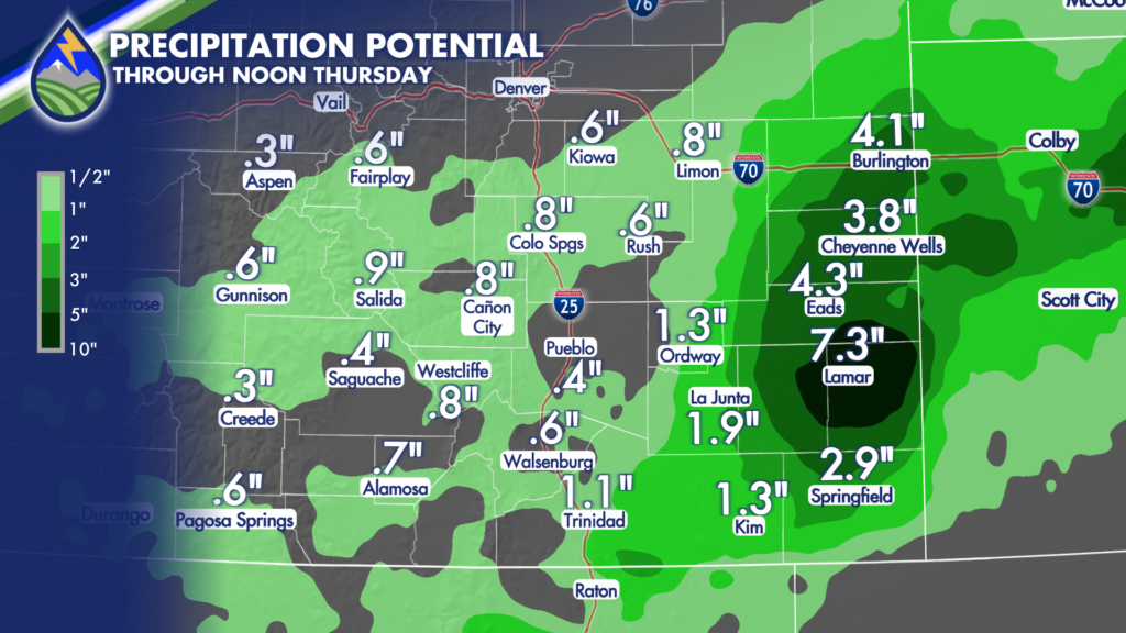
DO I THINK LAMAR IS GETTING 7″? No….
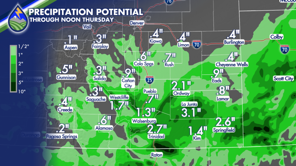
This is a fun look at a few different precip. outputs from different models for the rest of today through Thursday morning. The first one is the European, second is the HRRR (High Resolution Rapid Refresh), and the third is the GRAF. Differences…totally! Things to take from them when building the forecast? Totally!
European
HRRR – (High Resolution Rapid Refresh)
GRAF
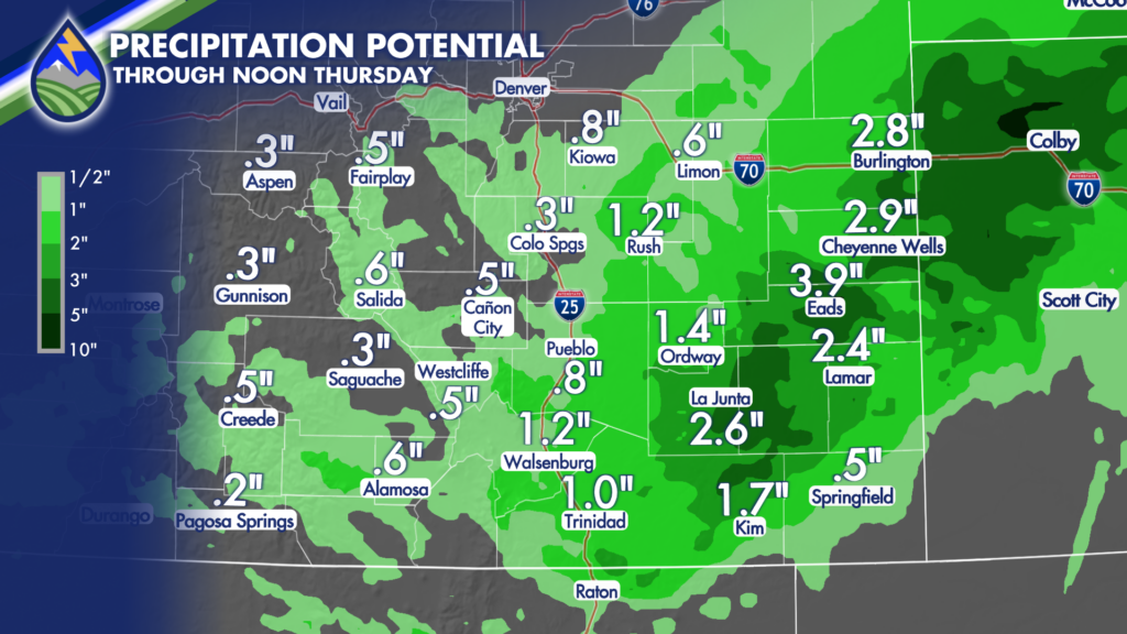
All three of these show a couple of bullseyes in southern Colorado, primarily focused in two areas…I’d describe them as south of the Arkansas River and then near Kansas…These are the areas most likely to get more than 2″ of rain through the first half of Thursday.
Some of it is the flow coming up from the south ahead of the low…and then some of it is as we transition to the back side of the system overnight. The back part of the system should feature one or two bands oriented southwest to northeast that may be pretty intense…as some thunderstorms.
We’ve still got Flood Watches up through today and into tomorrow as we’re going to get a few spots that may see flood issues occur. It’s most likely – south of highway 50 and then in the bands on the backside of the system overnight.
We’ll let you know about any issues!






