







HEADING TOWARD TRANSITION TIME
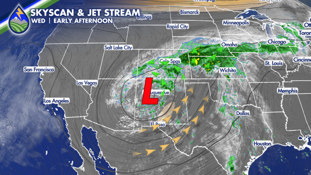
As the low continues moving east across New Mexico we’re seeing drier air wrap into the southern part of the state. That will move eastward into tonight as we get onto the backside of the low.
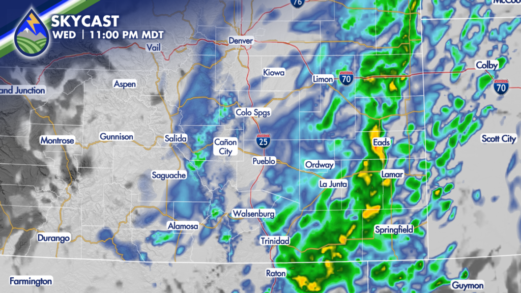
As this happens, precipitation will start to focus on a southwest to northeast orientation over far eastern Colorado, where the heaviest rain will be likely after the sun sets. Some of this will be moderate to heavy, and there could be a thunderstorm or three in there as well. We’ll keep an eye out for localized flooding issues.
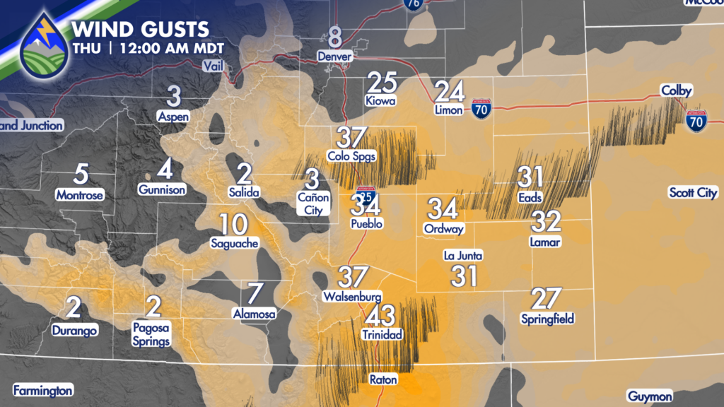
The other thing that happens is a strengthening north wind develops thanks to the deepening area of low pressure at the surface. We expect wind gusts east of the mountains between 25-45mph developing overnight.






