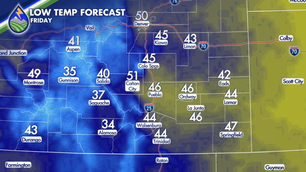
GRAY START EARLY FRIDAY/FOG FOR SOME
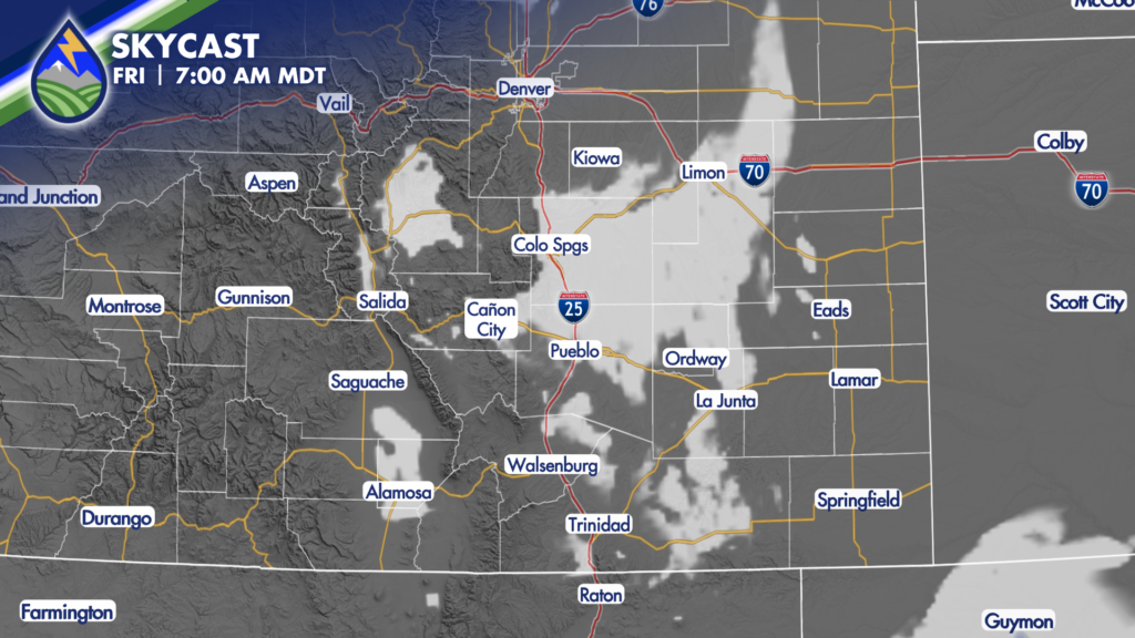
With upslope continuing into early Friday morning, and are moving westward over some saturated ground, expect overcast and some foggy spots early Friday morning.
We’re more likely to have clouds north of the Arkansas River where the southeast wind pushes up the slopes of Pikes Peak and the Palmer Divide, verses on the Raton Mesa where the SE wind slopes to the lower elevations along the river. That said, I can’t rule the clouds out completely as some of these areas had the heaviest rain – 4-6″+ over the last 42 hours!
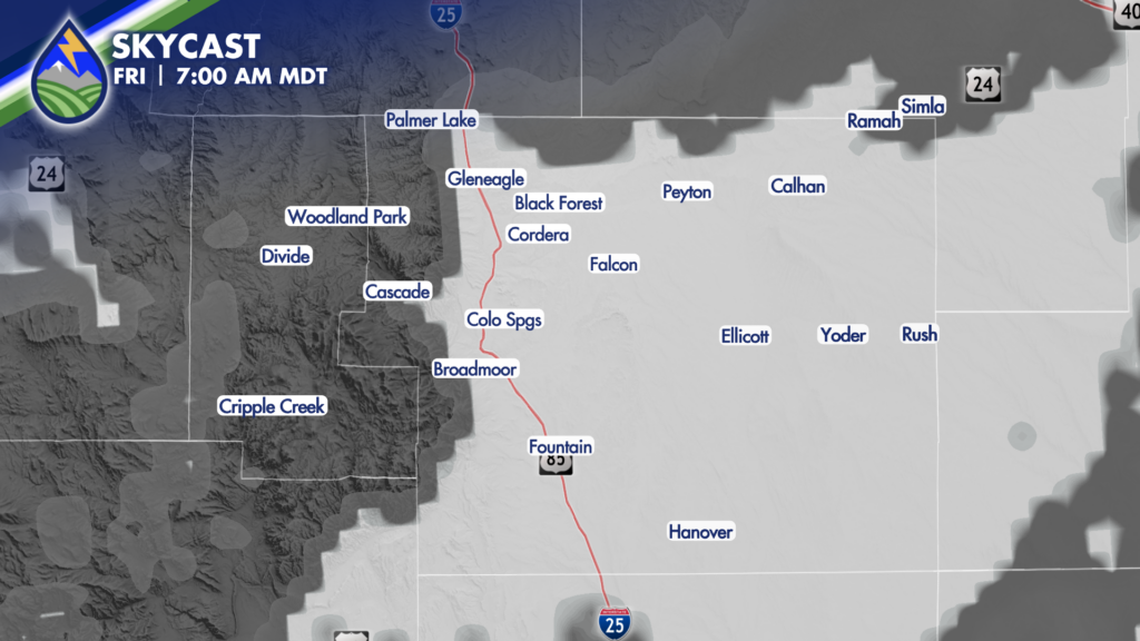
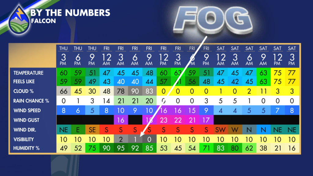
Fog is more likely against the higher terrain of the Pikes Peak Region and the southern slopes of the of the Palmer Divide – so I pulled the grids out for Falcon…Be careful Friday morning, and get ready to use the low beams early on.
DRIER AIR AND CLEAR SKIES SETS THE STAGE FOR FROST
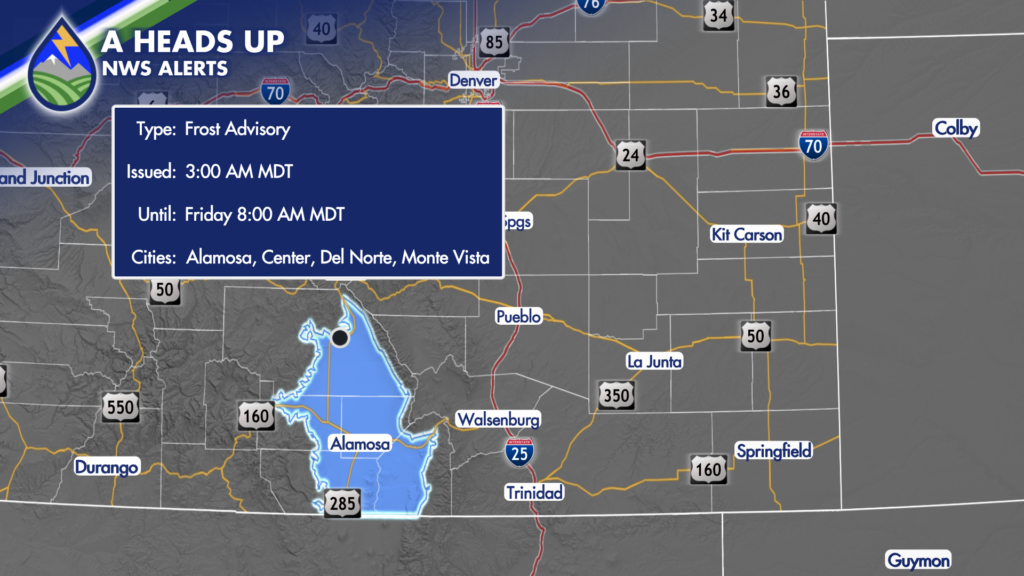
Where drier air moves in over the mountains and keeps a clear sky early Friday, we’re going to get chilly in some of the valleys. Cold enough that some frost is possible in the San Luis Valley. It’s that time of year!