





TWO Tropical Systems’ Remnants Over the West Next Week?

WILD IN THE WEST

Next week’s pattern is pretty active with the remnants of two tropical systems and a storm from Alaska all set to be in, and interact over the western United States.
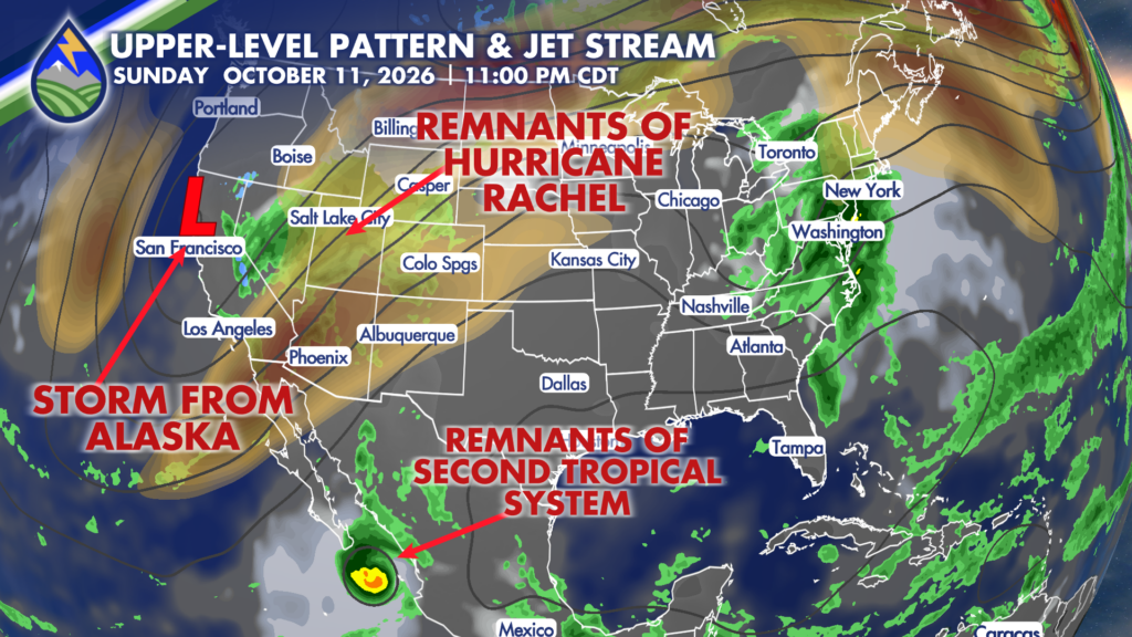
It’s looking like most of the remnants from Hurricane Rachel will fire northward – probably west of Colorado’s main cities – late in the weekend. The middle of the week is more interesting for Colorado as the circulation over the west coast inches east and draws the moisture from the second system northward.
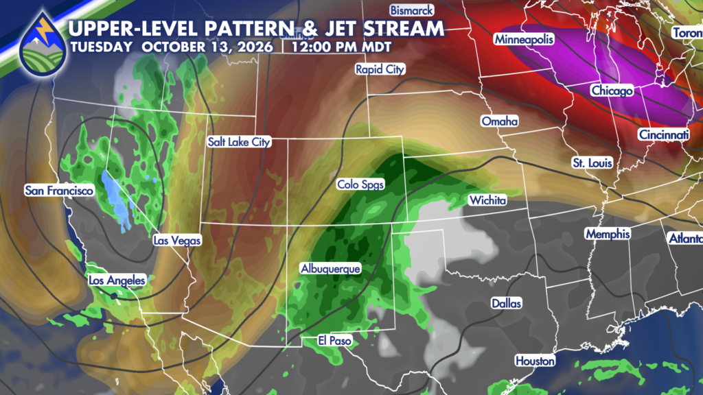
Models are getting some better agreement about the pattern through the middle of the week and an increasing chance in this second system from the tropics in the eastern Pacific Ocean as playing a role around here.
LATE WEEK QUESTIONS

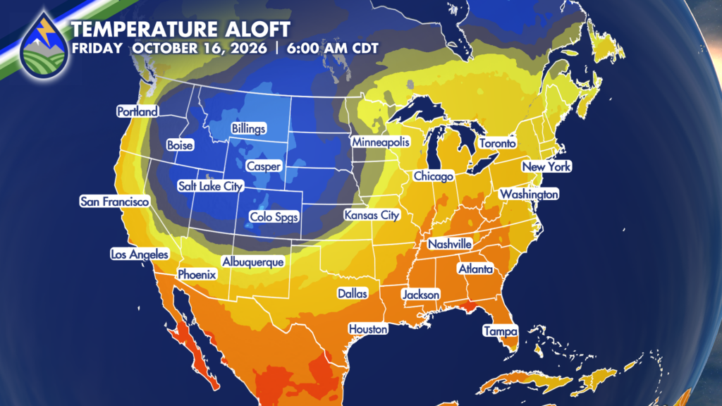
Then late in the week as the circulation finally moves through at some point, we’ve got to watch what happens behind it – as there is uncertainty. The American GFS model has been really consistent with dumping cold air into the back of this system thanks to a wave from the Canadian plains diving south into it. It’s got a lot more snow for more areas early Thursday morning. In contrast, the European model has been really consistent with building a ridge of high pressure up over Canada, and is warmer for the late week and weekend time frame. It keeps snow confined to the highest elevations of the central and northern Rockies.

That’s a long ways off, but the point for next week is that there’s a lot to watch!

The American GFS brings Canadian air south late next week.


