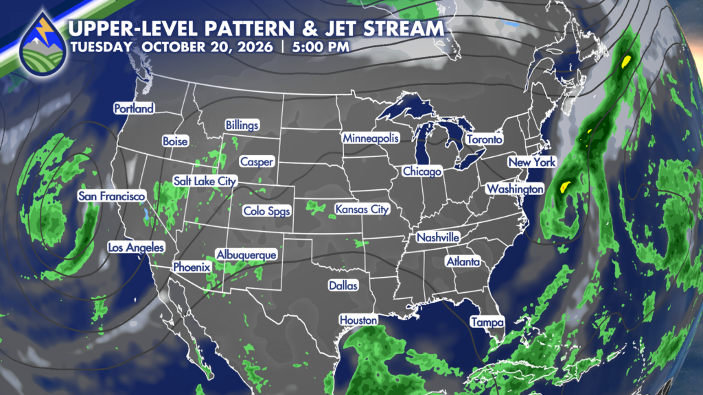
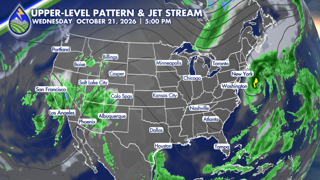
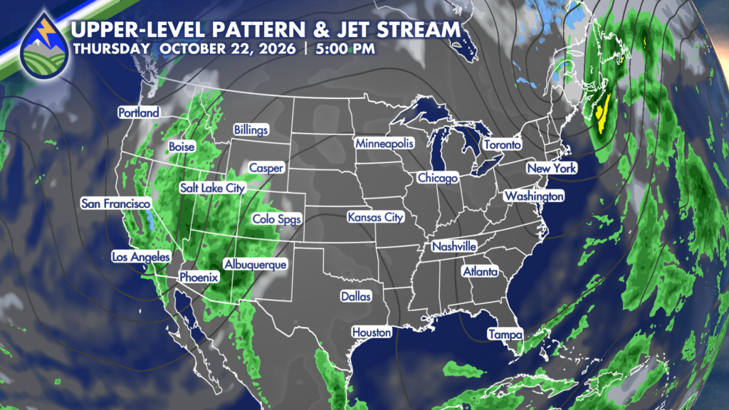
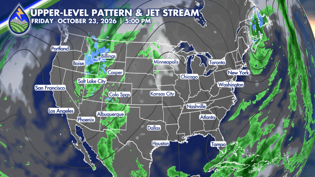
A pretty active stretch is heading toward Southern Colorado, especially for the high country. A slow-moving upper-level system now off the California coast will gradually move inland through the middle and end of the work week, pulling a deep plume of moisture into Colorado.

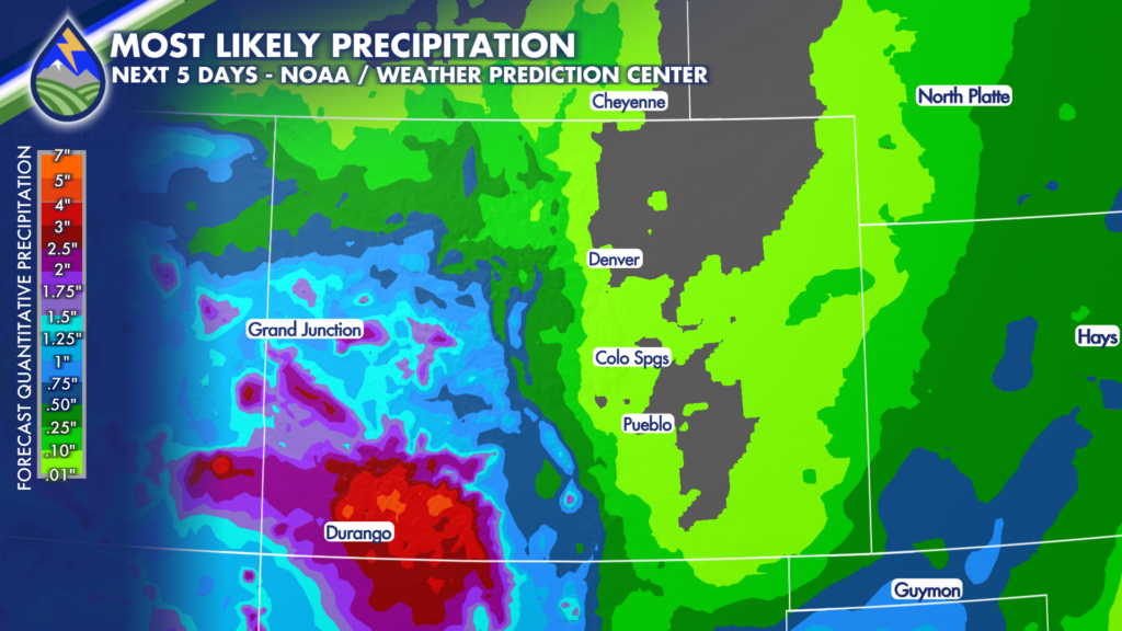
The biggest concern will be across the southwestern mountains, with the San Juan Mountains expected to see the heaviest and most persistent rain from Wednesday through Friday. Two to four inches of rain may fall in parts of the San Juans during that time. That kind of rainfall can lead to flooding, rising creeks and streams, and mudslides or landslides in vulnerable terrain. If you have travel, hiking, camping, or outdoor work planned in the San Juans later this week, keep a close eye on changing weather and local alerts.

Flood watches are already in place farther southwest in parts of Arizona, and flood or flash flood watches may eventually be issued for southwestern Colorado as this setup gets closer. We will be watching for any changes closely and will keep you updated.

For Tuesday, most of Southern Colorado stays relatively quiet. Moisture will begin increasing over the mountains, where a few sprinkles or isolated showers are possible. A weak disturbance moving out of the Desert Southwest could also spark an afternoon thunderstorm in far southeastern Colorado, mainly around Baca County, Springfield, and Campo. Those storms should move quickly east toward Kansas, with quieter conditions returning through the evening.

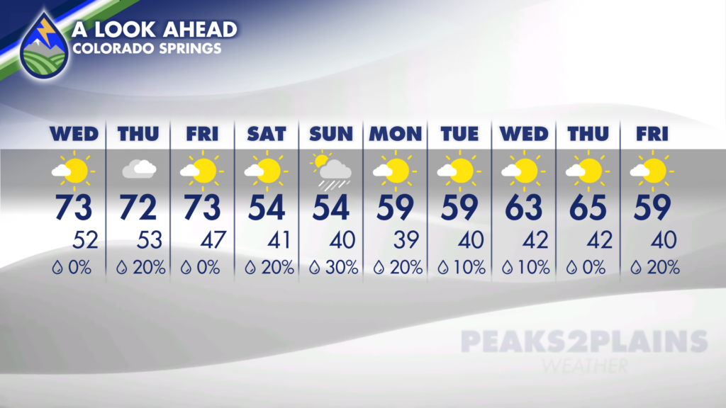
Tuesday temperatures stay mild across the region. Colorado Springs reaches the low 70s, Pueblo tops out near 78 degrees, and much of the Plains will be in the 70s. Southeastern Colorado may be among the warmer spots, despite the small chance for an afternoon storm. Mountain communities will be cooler, while the San Luis Valley stays seasonable for October.

Tuesday night into early Wednesday will be cool, with many lower-elevation communities dropping into the 40s. Cañon City and Springfield may stay closer to the 50s, while high-country temperatures fall into the 30s in spots. Expect increasing clouds overnight as the larger weather system approaches.

Wednesday is the transition day. Temperatures will be similar to Tuesday for many communities, but southwesterly flow will begin directing more moisture into the mountains. Showers become more widespread over the high country, particularly west of I-25 and across the southwestern mountains. The Plains should remain mostly dry through much of the work week, though breezy conditions will become more noticeable later in the week.

Thursday looks like the most concerning day for persistent heavy rain in the mountains. Rounds of showers are expected through the day, with the San Juan Range remaining the primary focus for the heaviest totals. Moderate rainfall may also spread into portions of the central mountains, the San Luis Valley, and the eastern mountain slopes. Snow levels are expected to remain high for much of this event, so rain—not snow—will be the main issue at most elevations.

By Friday, showers are still expected, especially during the first half of the day, but coverage and intensity may begin to decrease as the system gradually shifts east. That does not mean the flooding concern disappears right away. After multiple days of rain, saturated ground and higher water levels can make runoff issues more likely, especially in steep terrain and near small streams, low-lying roads, and drainage areas.

For communities along and east of I-25, the main weather story through Friday looks to be wind rather than widespread rain. Thursday and Friday may turn breezy to windy across the Plains, particularly farther east toward the Kansas border. If you have lightweight outdoor items, trash cans, or fall decorations outside, it may be a good time to secure them before the stronger winds arrive.

Looking ahead to the weekend, cooler air spreads across much of Colorado as the upper-level system moves overhead. The heavy-rain focus in the high country may shift somewhat east, and there is a possibility that the lower elevations and Plains could get in on some rain as well. The exact timing, placement, and intensity of weekend precipitation are still uncertain, so this is a forecast detail that will need refining over the next few days.

Expect a noticeably cooler feel for the weekend, with lower-elevation temperatures trending down from the 70s and toward the 50s and 60s. That will be a change after the mild weather early in the week. Mountain travel plans should include extra time, rain gear, and awareness of changing road and trail conditions, especially from Wednesday through Friday.

The key takeaway: Tuesday is mostly quiet, with only isolated mountain showers and a possible storm in far southeastern Colorado.

Our Weather. Together.