
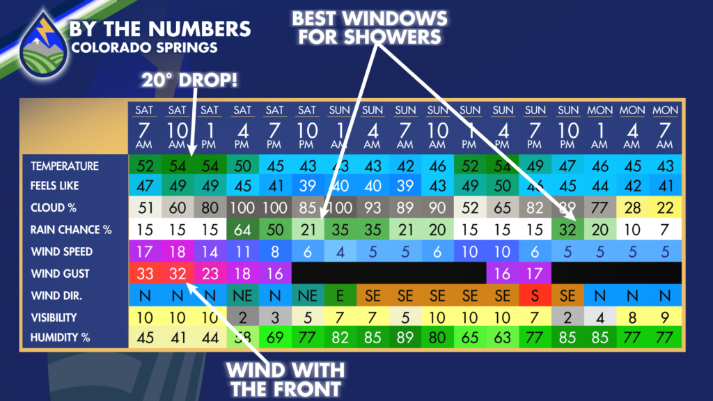
COLORADO SPRINGS/PUEBLO: Saturday brings a big change behind the cold front. Check out the grids for Colorado Springs, showing the temperature drop behind the front and the wind through the morning as we swap out airmasses. Two windows for showers are expected in the cities through the weekend….Saturday afternoon and evening and then again on Sunday afternoon.
TELLER COUNTY/PALMER DIVIDE: A heads up that we’ll see a switch over to snow under heavier showers Saturday afternoon….and some will stick to the grass and trees in Teller County on Highway 24. Some snowflakes could mix in late in the day or the evening over Monument Hill if the showers are heavy enough, too!
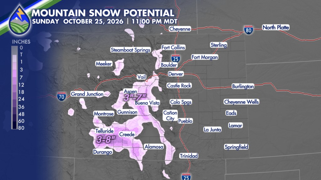
MOUNTAINS: Snow levels drop Saturday afternoon and evening, with accumulating snow most likely above 9,000 feet. The highest peaks above 10,000 feet could get 3–8 inches through Sunday morning, with 1–4 inches at somewhat lower elevations. Expect worsening visibility and pass conditions after sunset, with travel impacts lingering into Sunday morning.
Closer to home, rain could mix with or change to snow around Woodland Park, Divide and Florissant Saturday evening, with a little accumulation on grass. A few flakes could mix in over the Palmer Divide if showers get heavy enough.
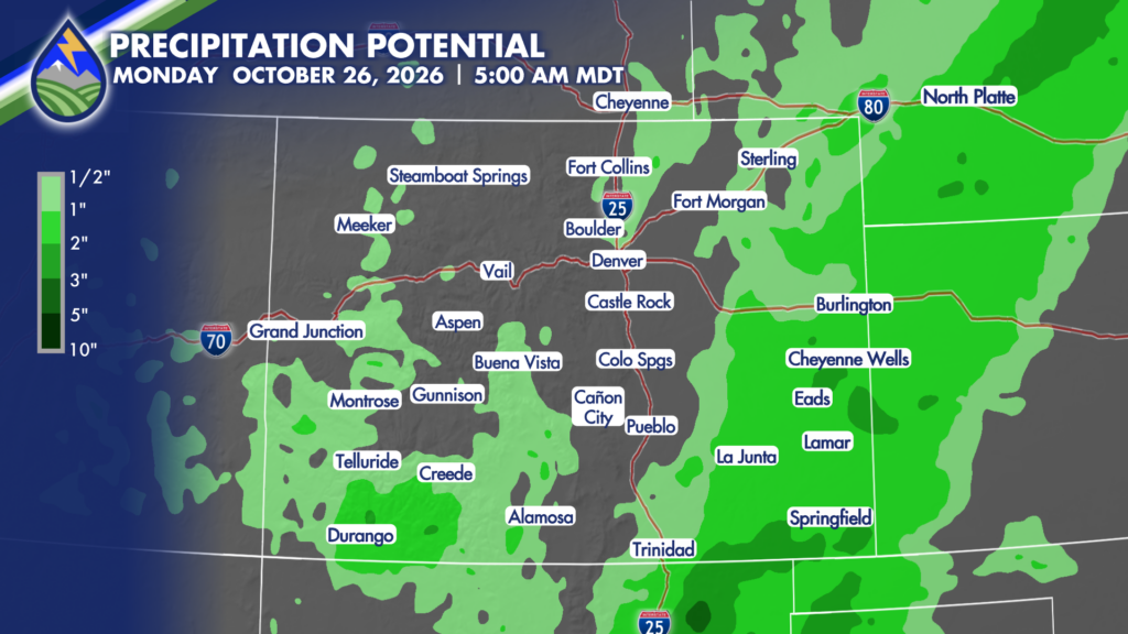
EASTERN PLAINS: Rain becomes more widespread late Saturday, with the heavier, steadier showers favoring areas east and southeast of I-25. Over the plains 1–2″ is possible in a southwest-northeast band over the eastern plains away from the cities. A few thunderstorms are likely in this area too, and a couple could be strong south of the river.