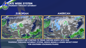
While just a few days ago there was looking to be the potential for a high impact storm for portions of southern Colorado, as models begin to agree on its timing and track, it’s looking less and less like that scenario will become reality.
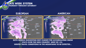
The storm should begin spreading moisture into the high country beginning on Thursday, and it is in the mountains where we could get some decent accumulations! Friday looks to bring the highest impacts to the high country, as wind combined with falling snow could create hazardous driving conditions.
Before this system exits to the east by late Saturday, this storm has the potential to produce upwards of a foot of snow for some of the highest peaks, especially those in the San Juan Mountain Range!
There is certainly a chance for showers, especially on Friday, for areas along the I25 corridor and across the Palmer Divide, but it just doesn’t appear we’ll have the ingredients for significant precipitation amounts.
Of course, this system’s arrival is still several days away so there is time for trends to change and IF we were to see the track start trending farther south that would change this projection completely!
So, be sure to check back in with your Peaks2Plains crew for frequently updated forecasts as this system evolved and heads our way.
However, just know that as of Sunday morning, this system is not looking to be as impressive (as far as the lower elevations are concerned) as it was last week.