
Two systems are lined up for Colorado this week, and while the bigger snow totals stay focused on the high country, Southern Colorado will have some wind to contend with between them. The first system arrives Tuesday into early Wednesday. The leading edge of this trough is moving across the Great Basin and Intermountain West, carrying plenty of mid- and high-level moisture. That moisture is already showing up as increasing clouds across southwestern Colorado, with lower-level moisture arriving Tuesday afternoon. Before that system gets here, watch for fog again late tonight and early Tuesday along Interstate 25 and across the eastern plains. Temperatures will hover near freezing through early Tuesday morning, and visibility may be reduced in spots.
We had accidents in Pueblo County early Monday morning, likely related to reduced visibility, so give yourself some extra time, use your low beams, and take it slow on the morning commute. The fog should lift fairly early Tuesday, especially around El Paso County. Around Pueblo County, sunshine should return no later than about 2 p.m. If clouds and fog clear out efficiently enough, highs along I-25 and across the eastern plains can reach the 60s. If they hang on longer, temperatures may be held in the 40s and 50s. Snow with the first system develops across the San Juans Tuesday afternoon, generally between 3 and 6 p.m. Valley locations west of the Continental Divide may see heavier rain and even a few thunderstorms. Snow will be lighter farther north around the I-70 ski resorts, with roughly 1 to 3 inches possible in areas around Vail Pass. High-country temperatures Tuesday stay in the 40s.
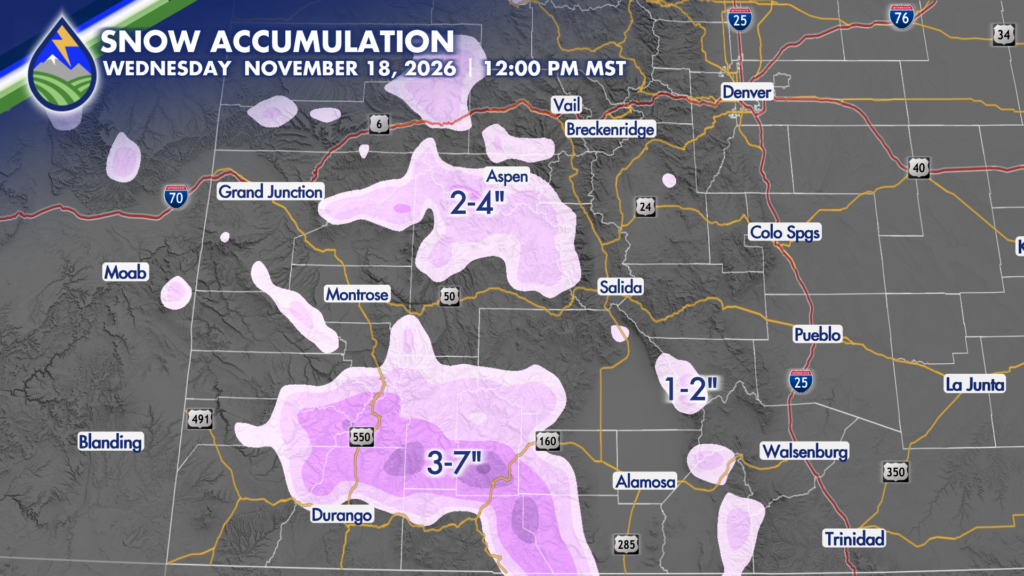
Wednesday is the day to secure the outdoor decorations. The system passes north and west of us, but it will bring stronger winds to the Front Range mountains, the Sangre de Cristos, and the I-25 corridor. Higher terrain west of Denver and west of Colorado Springs, especially above 9,000 feet, could see gusts in the 60 to 70 mph range by mid- to late morning. Along I-25, including the Colorado Springs and Pueblo areas, gusts around 30 to 35 mph are possible through early Wednesday afternoon. The Sangre de Cristos could see gusts around 50 to 55 mph, while areas near La Veta and La Veta Pass may see gusts in the 40 to 50 mph range. Winds should begin to taper off Wednesday evening, generally after 6 or 7 p.m.
Thursday brings a break before system number two starts moving in Thursday night. This one has the potential to be the heavier hitter for Colorado’s mountains, with snow continuing through Friday and lingering into early Saturday. The slow movement of this system is important because it allows snow to keep adding up across the central and northern mountains. The Elk Mountains and nearby higher terrain on the western side of the state are favored for the biggest totals. Elevations above roughly 10,000 to 11,000 feet could pick up close to 1 to 2 feet of snow in the most favored locations. That is where this late-week system has the best chance to really deliver. Around Steamboat Resort and the higher peaks of northern Colorado, snowfall could reach roughly 10 to 20 inches at the highest elevations. The town of Steamboat is closer to a 4 to 8 inch range. Aspen and Snowmass may see around 3 to 7 inches, with similar 3 to 7 inch amounts possible in parts of the San Juans above about 9,000 to 10,000 feet. Telluride is also in that 3 to 7 inch range.
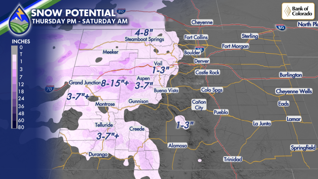
Timing for the second system looks fairly quiet through Thursday daytime. Snow begins to push into northwestern Colorado after sunset Thursday, continues overnight into Friday morning, and becomes more widespread and heavier through Friday. It then takes its time moving out, keeping snow going across parts of the central and northern mountains Friday night into early Saturday. For Southern Colorado, the most noticeable impacts from these systems are likely to be wind rather than widespread measurable snow along the I-25 corridor. Another round of stronger winds is possible Friday as the late-week trough moves through. Woodland Park and nearby higher terrain may be especially breezy on both Wednesday and Friday. The late-week system also sends a cold front through the region. Temperatures fall back into the 40s and 50s for highs Saturday and Sunday, with 30s and 40s possible around Woodland Park. That will be a noticeable change after the milder temperatures expected Tuesday and Thursday. It has been a late start for measurable snow around Colorado Springs and Pueblo, and I know that is disappointing for many of us who are ready for a more wintry pattern. For now, the better snow stays in the mountains while Southern Colorado gets the wind and a cooler push heading into the weekend before Thanksgiving. Keep an eye on the forecast if you have mountain travel planned late Thursday through Saturday, especially across the central and northern mountains. Our Weather. Together.