Overnight, winds will shift to be out of the east which will increase low-level moisture.
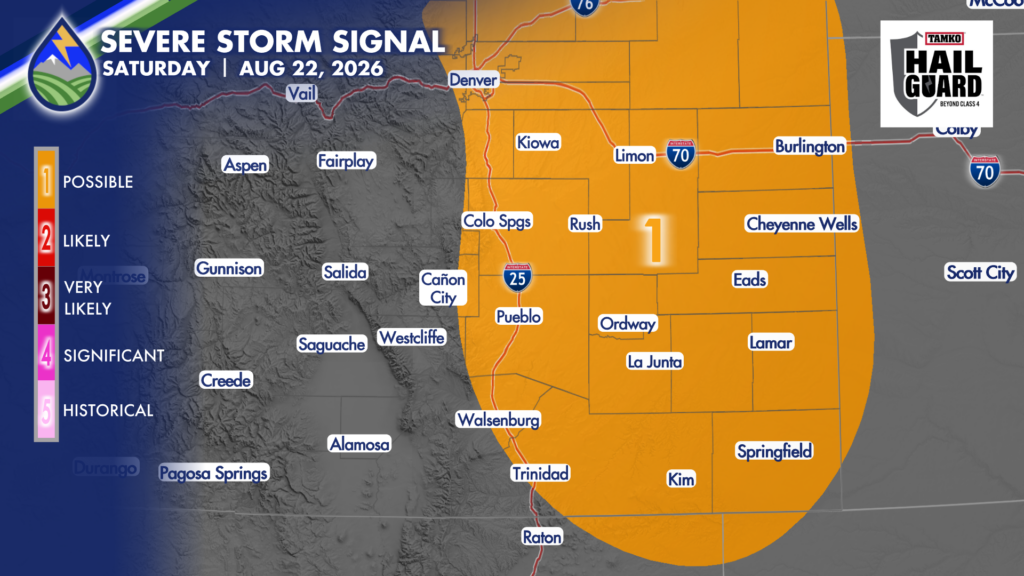
With more moisture to work with, an uptick in storm coverage and intensity is expected on Saturday (with a similar scenario expected to play out on Sunday, as well!).
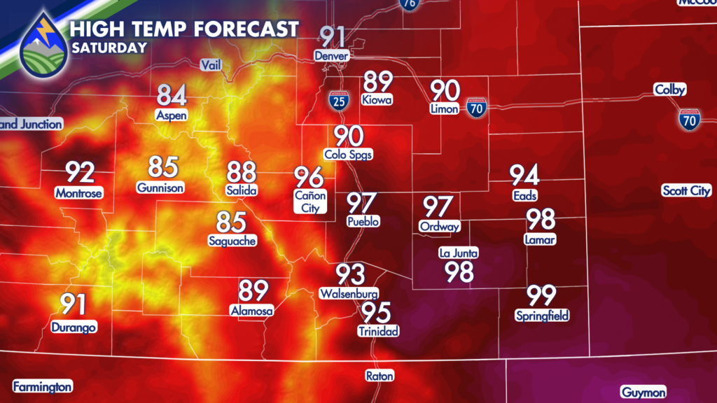
Saturday morning is expected to begin dry and mild, so plan to take advantage of it! If you have outdoor, afternoon or evening plans, you’ll want to be sure you have your Peaks2Plains Weather app handy as storms could either chase you back indoors, cause delays or even cancellations.
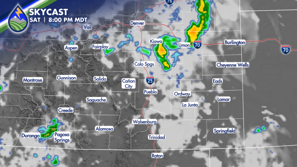
Storms should develop in the mountains during the early afternoon before beginning to impact the I25 corridor during the mid-afternoon. Storms will slowly expand across the plains by the evening, and are expected to continue to impact the region through Saturday night! It’s likely the plains will not clear completely until after midnight.
Any cell that develops will be capable of producing moderate to heavy rain, so flash flooding over and near area burn scars is possible. The stronger cells could produce abundant lightning, damaging winds and even large hail.
Patchy fog is possible across the plains early Sunday, with another round of potentially strong storms expected Sunday.
Sunday’s setup looks a bit more favorable for heavy rain to impact the Aspen Acres Fire zone, so it’s possible Flash Flood Watches could be issued for the second half of the weekend.