


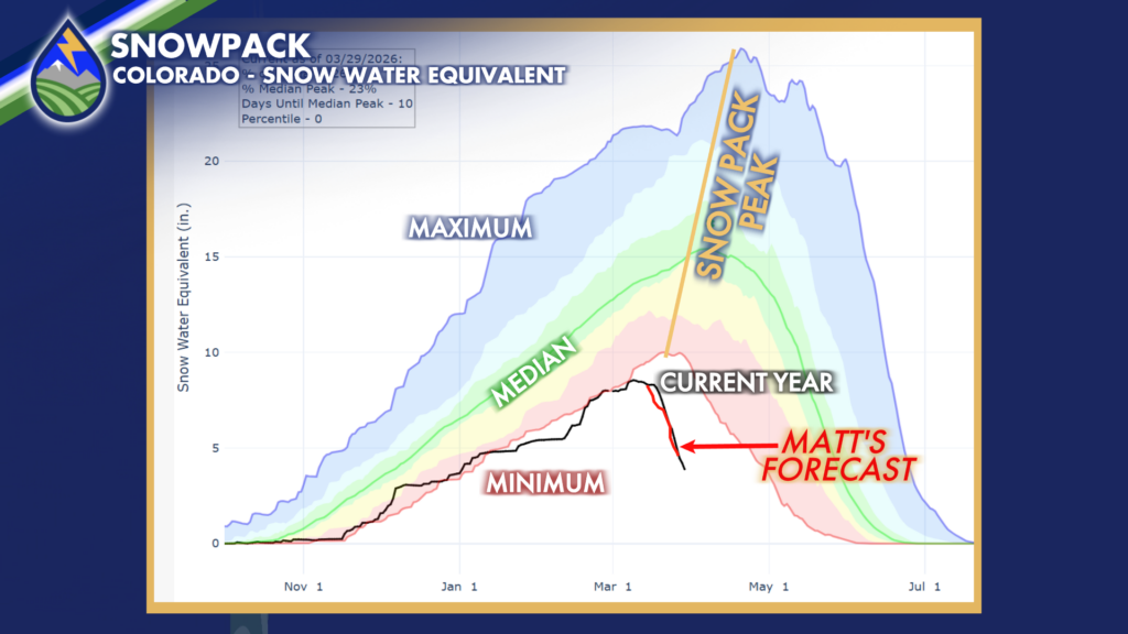
A couple things about our snow pack that has lost about 3.5-4.5 feet’s worth in the last two and half weeks…Here’s a forecast I made before we went into the first of the two record heat waves.. Unfortunately it work out about perfect.
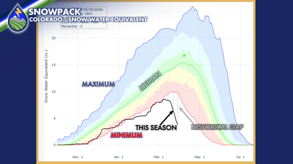
In the second graph I’ve changed the perspective to show the historical gap that has developed over that same time period. Where we are today (3/29) at 3.9″ of snow water equivalent in the state is the level we were at on May 1st in 2002, the year that had the 3.9″ of snow water equivalent we are at today. The previous minimum on March 29th was 9.8″! Our historical gap is month earlier than the PREVIOUS HISTORICAL LOW for this value. That’s mind boggling!
So some of you don’t get upset, this data set I’m showing here goes back into the 1980s. So, yes, it’s possible we’ve had a year worse than this. Likelihood, not many.
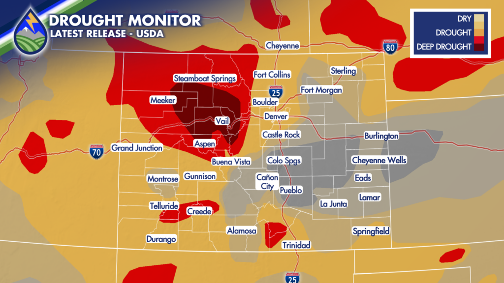
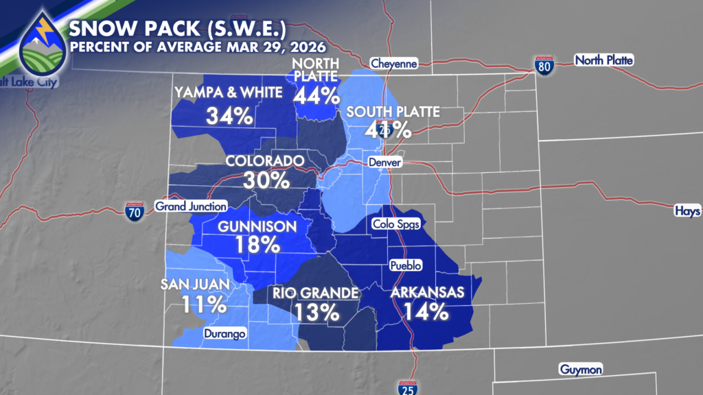
We’ve got deep drought in the central and northern mountains and well-established drought conditions elsewhere in the high country. If you find yourself thinking, why isn’t the drought the same in the southern mountains? Remember in the fall when there was 5-10″ of mainly rain from the remnants of a tropical storm? Remember Poncha Springs flooding? That’s why the deepest drought isn’t as widespread in the southern mountains.