


“Super El Niño” headlines – a lot of hype and not a lot of context. Long-range seasonal forecasting isn’t really my lane — but I do care about people understanding the science behind the stories you might be seeing.
“Super El Niño” isn’t an official category. The term was popularized by a NASA scientist to describe the 1997–98 event and *shocking*… it stuck. The scale goes Weak, Moderate, Strong, and Very Strong — “Very Strong” meaning sea surface temperatures 2°C or more above average. That’s the closest thing to a real definition of “super.” Everything else is media excitement, IMHO.
Here’s where things actually stand. We’re coming out of a fading La Niña, and the ocean heat below the surface in the equatorial Pacific is actually impressive. NOAA puts about a 62% chance of El Niño emerging by June–August, climbing to 72–80% by fall. BUT there’s only about a 1 in 3 chance it reaches “strong” status by October–December. A moderate El Niño is equally — maybe more — likely.
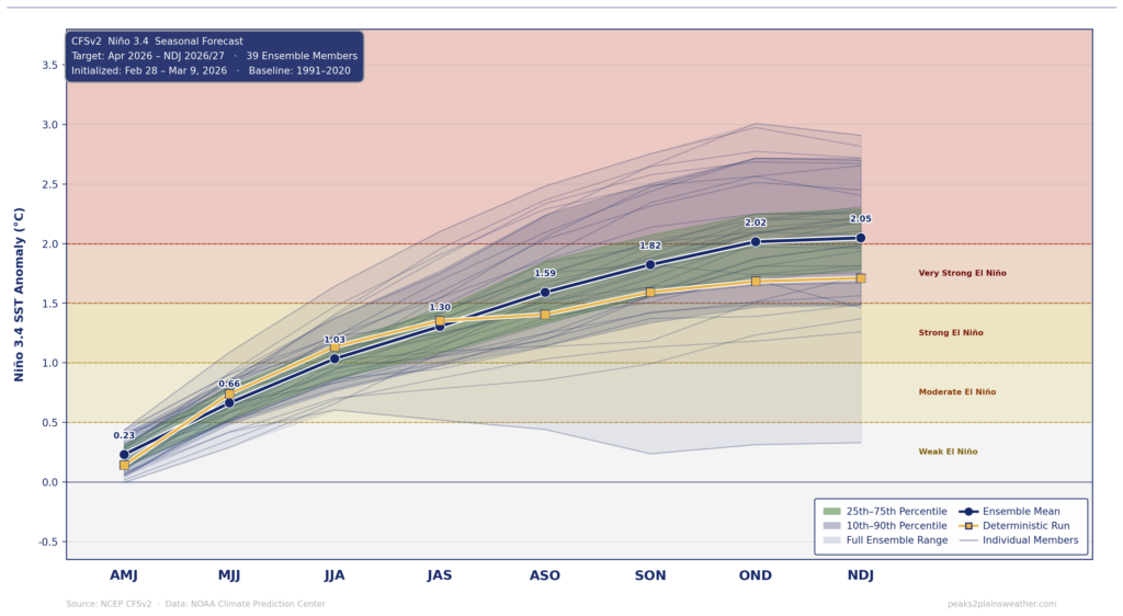
There’s also something called the Spring Predictability Barrier that almost nobody in these headlines mentions. Spring is when ENSO forecast skill falls off a cliff. Models right now can only explain about a third of what actually happens with ENSO by summer. The most embarrassing forecast busts in recent memory — 2012–13, 2014–15 — were strong El Niño predictions in spring that turned into nothing. We’re sitting right in that window. Check back in July and we’ll re-evaluate.
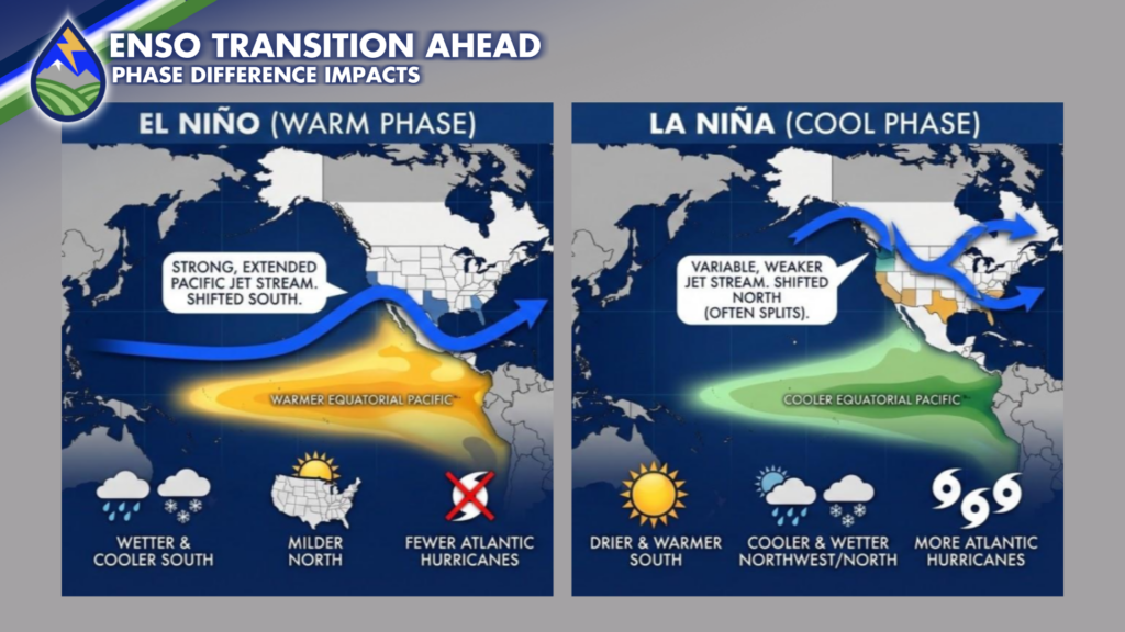
In Colorado, here’s the nuance that rarely gets coverage – Stronger is not always better for our snow! The data shows the sweet spot for Colorado mountain snow is actually a moderate El Niño, around +1.2–1.5°C. If it’s stronger the jet dips too far south, sending moisture into New Mexico and Arizona instead.
That big 1997–98 El Niño? Mountain snowpack was only 50–90% of average across much of the state. Southern Colorado tends to be the exception — the Pikes Peak region and Arkansas River Valley sit right in the bullseye when that storm track drops south. The October 1997 blizzard is a perfect example. Kyle Mozley, long-term guru at our Pueblo NWS office has shown that southern Colorado’s strongest El Niño signal comes in fall and spring — exactly what that storm illustrated.
There’s genuine reason for cautious optimism after this winter’s record low and now sad snowpack. But I just want you to know that “Super El Niño = epic ski season” is a far more complicated story than the headlines suggest. That said, there’s no question it’ll be better than the one that’s ending! It has too, right?!?