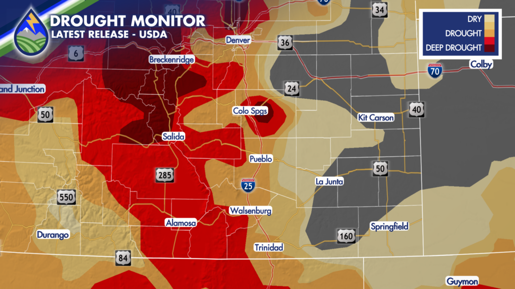
Thanks to recent heavy rain, drought conditions are slowly improving for portions of Colorado!
In comparison to last week when about 91% of the state was considered to be in at least some category of drought, this week that statistic has dropped to 84%.
This is thanks to beneficial rain that fell thanks to an upper-level system drawing tropical moisture into the state. The bulk of this rain fell over the southeastern plains where the most dramatic drought improvements were measured.
The mountains are still in need of additional moisture to help alleviate the extreme to exceptional drought many areas are still experiencing, and it looks like the forecast for the weekend could help!
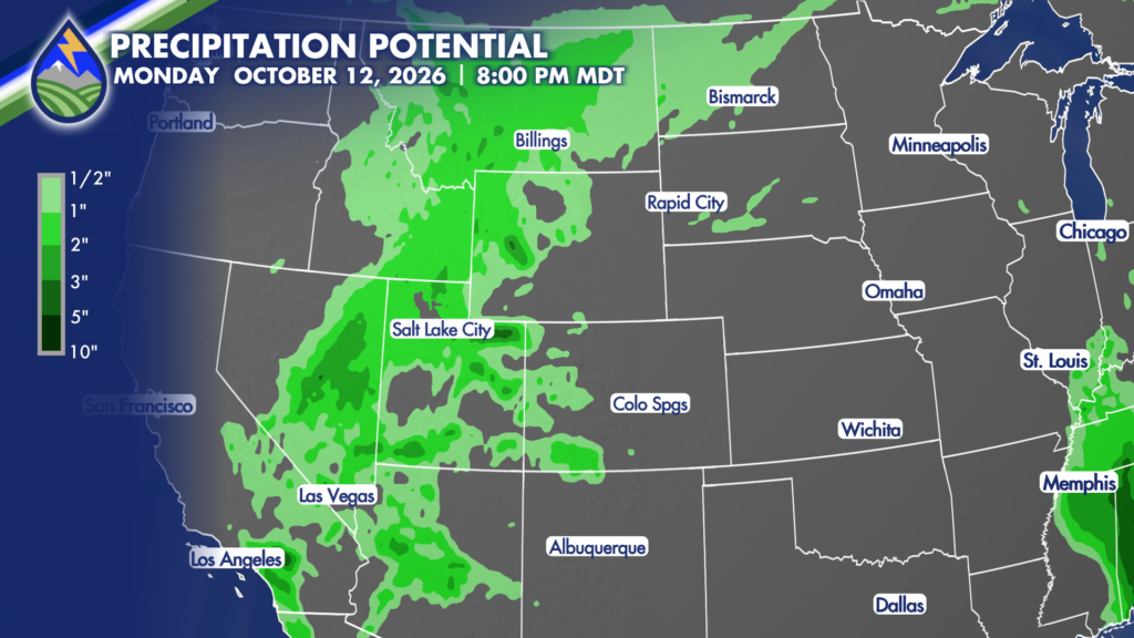
Flow over the state will become more southwesterly thanks to an approaching upper level system digging across the western coastline. This will help to draw moisture from the remnants of Tropical Storm Rachel and Hurricane Simon this weekend and into early next week!
Heavy rain producing storms will be possible over the higher terrain this weekend and Monday, before this upper level system begins to move overhead. The track of this storm will determine how far east the rain moves Tuesday and Wednesday, but it does appear that during this Tuesday and Wednesday timeframe will be the best chance for lower elevation rain.
While Colorado is expecting rain, especially in the mountains, you’ll notice that the current track of the storm suggests that the bulk of the moisture will actually stay just to our north and west over the Great Basin and Northern Rockies.
As this system evolves and moves our way, your Peaks2Plains Weather crew will be closely monitoring the track as any slight deviation from the current expected track could dramatically increase or decrease where the most rain falls.