







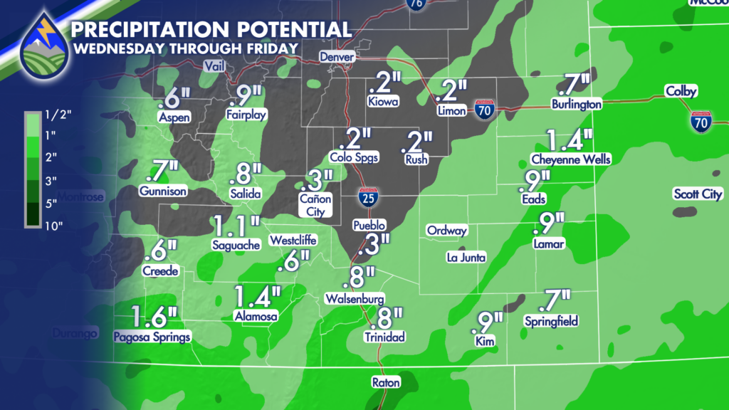
The grids are back! They tell the storm pretty well for the next few days…
Plenty of cloud cover today as deep moisture streams north from New Mexico. That cloud cover will be noticeable through the next couple of days, holding temperatures down compared with recent afternoons. Highs will generally reach the 60s and 70s, with some mountain valleys staying in the 50s. It will also be breezy at times, especially farther east across the plains.
Showers and thunderstorms becoming more numerous from the south overnight through Thursday. Heaviest totals are most likely over the southern tier. Farther north, be ready for locally heavier downpours under stronger thunderstorms.
Thunderstorms will be efficient rain producers, meaning a storm that moves over your neighborhood could quickly drop around two-tenths to one-half inch of rain.
Clouds will help keep temperatures from dropping as much as they would under clear skies. Many lower elevations will stay in the 50s overnight, while mountain valleys generally settle into the 40s rather than the colder 30s that have shown up on some of our recent clear mornings.
Thursday remains cool and unsettled. Morning showers are possible near the New Mexico line and south of Highway 160, then shower and thunderstorm coverage increases and expands north through the afternoon. The mountains look favored for the better coverage of storms and locally heavier rain Thursday, though the plains will still have opportunities for showers and thunderstorms.
The rain coming in is welcome, but as always when you’re talking thunderstorms, keep in mind amounts will vary from one neighborhood to the next.






