







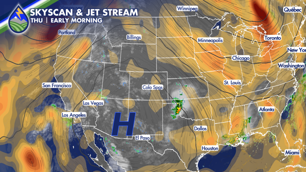
Thursday starts off beautifully across Southern Colorado, but we’ll be watching the sky again this afternoon and evening as thunderstorms develop around the mountains and work southeast. Storms should develop first over the higher terrain during the middle and late afternoon, then drift generally southeast into the evening. There may be a few storms that reach Colorado Springs, Pueblo, Trinidad, and nearby communities along I-25, but storms will have a tougher time sustaining themselves farther east across the plains today.
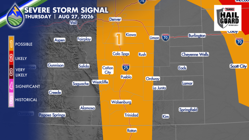
The best opportunity for the stronger storms, heavier rain, and any brief severe weather will be near the eastern slopes of the mountains, the southern Palmer Divide, Pikes Peak, the Sangre de Cristo Mountains, and parts of the I-25 corridor. That is where terrain, afternoon heating, monsoon moisture, and a little upslope flow can work together most effectively. The severe-weather setup is not as significant as it was Wednesday, and that is welcome news. We did not use all of that potential yesterday, with only a couple of one-inch hail reports around the Palmer Divide. Still, today is not a zero-risk day. A stronger storm or two could briefly produce wind gusts near 60 mph, with one-inch hail also possible.
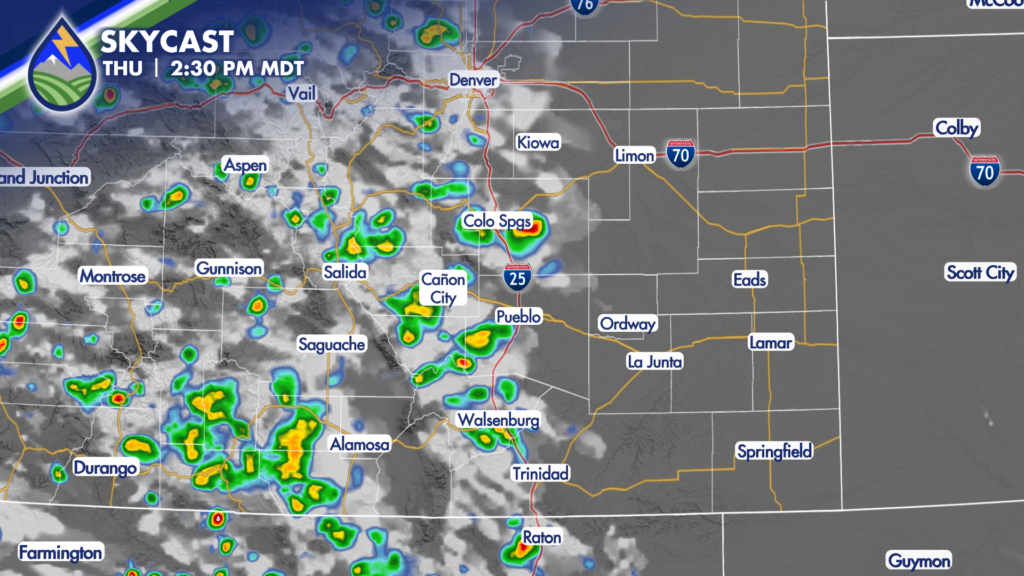
Heavy rain is most likely where storms can sit over the terrain or repeatedly move across the same location. The Aspen Acres burn scar remains a place to watch closely for runoff concerns if a storm develops nearby. If you are near a burn scar, creek, arroyo, or low-water crossing, do not wait for rain to be falling directly on you before taking rising water seriously.
Temperatures Thursday will be very similar to Wednesday. Most locations across the peaks and plains should finish within a degree or two of yesterday’s readings. It will still feel warm before storms fire, with cooler and gustier conditions underneath any shower or thunderstorm.
There is also a partial lunar eclipse tonight, running roughly from 10 PM to 1 AM. Clouds should decrease through the evening in many spots, so there may be a window to catch it. Your viewing odds improve away from city lights, especially if you can find a clear view of the sky.
Friday is a drier day. Temperatures climb a few degrees, with the biggest warming felt across the plains. Afternoon storms will not disappear entirely, but they should be fewer, weaker, and more focused over the mountains and perhaps the Palmer Divide With less moisture available Friday, some of the activity may be more about virga and gusty wind than widespread soaking rain. A mountain storm or two could still put down a decent shower, but the chance of the heavier rain-producing storms comes down compared with much of this week.
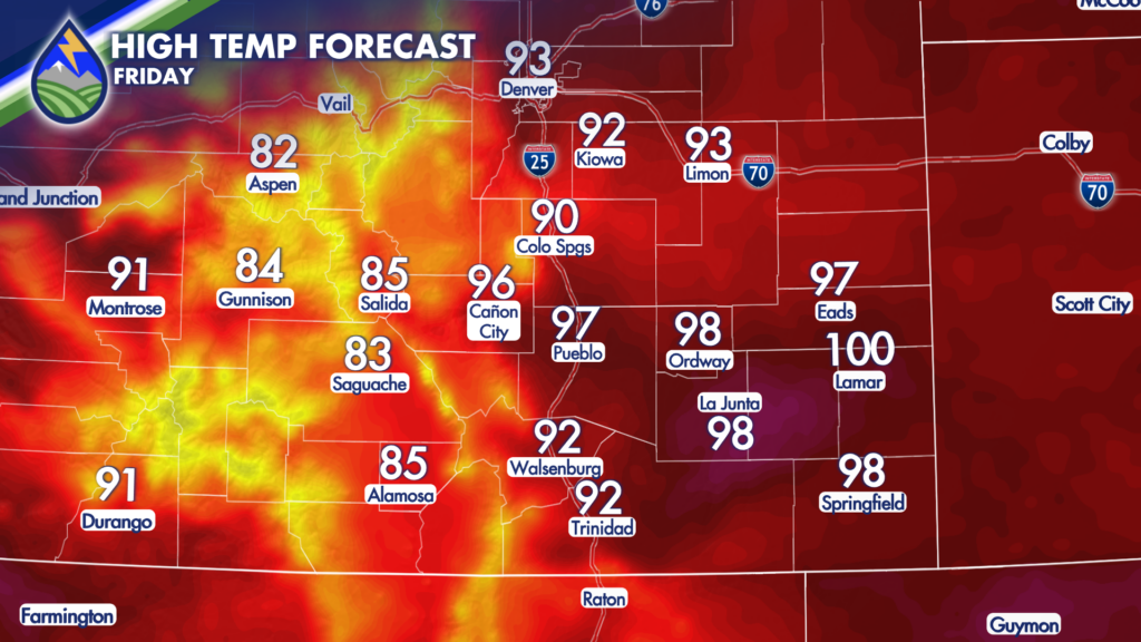
Friday will be a better day for many outdoor plans, but it is still worth having a lightning plan if you are hiking, camping, golfing, working outside, or heading into the high country. Storms do not need to be widespread to produce dangerous lightning or a sudden wind gust.
Saturday turns hotter, especially over the plains. Some communities will head back toward triple digits, with the lower Arkansas Valley having the best shot at the hottest readings. Mountain valleys and higher terrain warm as well, though they will remain noticeably cooler than the plains The best storm chance Saturday looks to be along and west of the Continental Divide as monsoon moisture begins to thicken back up. A few storms may eventually work toward the I-25 corridor, but the farther-eastern plains appear more likely to stay mainly dry through much of the day.
Looking farther ahead, moisture is expected to return more noticeably late in the weekend and into early next week, especially over the mountains and western half of Colorado. That should bring a renewed chance for afternoon and evening showers and thunderstorms, while the plains will have lower but still occasional storm chances.
Our Weather. Together.






