So, about next week…
An upper low will begin moving across the west coast and into the Great Basin late Sunday and into Monday. This will begin to increase moisture in Colorado, so expect increasing rain chances for the mountains late Sunday and across the rest of the state Monday.
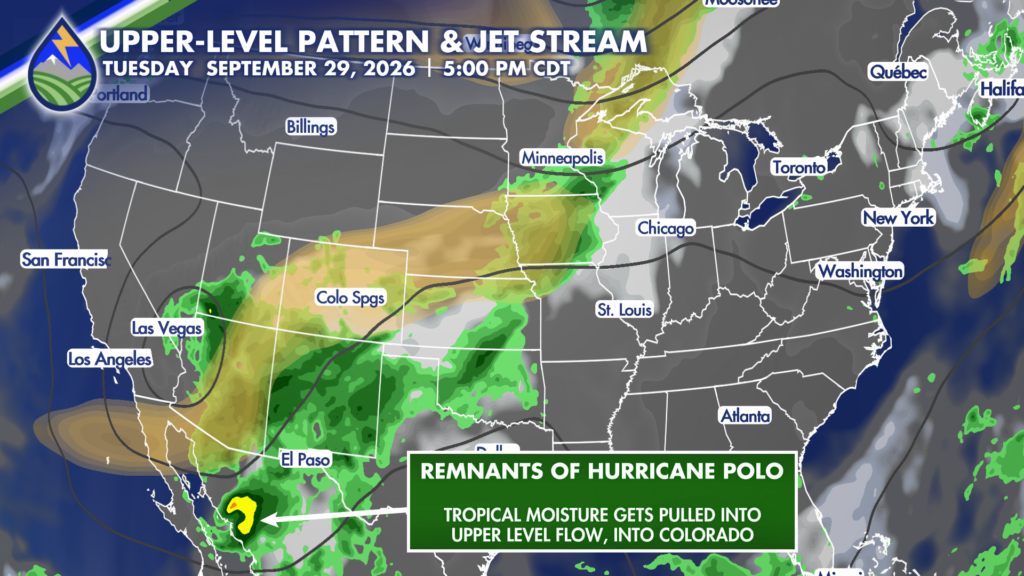
Then things get really interesting. As moisture increases, so will storm chances Tuesday afternoon… but, what’s really cool is late in the day Tuesday, the remnants of Hurricane Polo (which is basically just a bunch of tropical moisture) get wrapped up in the counterclockwise flow around our approaching low.
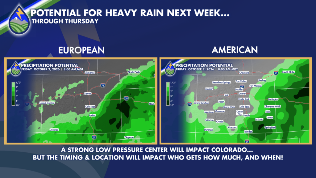
This sets the stage for a WET day Wednesday, with wrap-around heavy rain potentially lasting into Thursday before this system moves east.
There’s still some disagreement with the timing and track of this storm, which isn’t unusual this far out. While models *are* agreeing on the fact that the highest impacts from this system will be felt over southern/eastern Colorado – you can see from the model comparison, that one model suggests more widespread heavy rain from Southern I25 across the plains toward Eastern I70, while another keeps the bullseye focused over SE Colorado with much of the heavy rain residing just east of Colorado.
Needless to say, this forecast will be continuously tweaked as we get more information that will help narrow down the track and timing. So, check back often – this is the kind of dynamic system your Peaks2Plains crew LOVES to forecast, so you better believe there will be frequent updates.
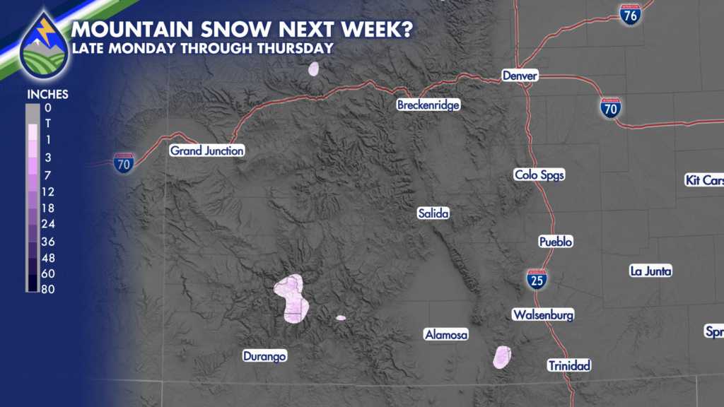
As for snow, earlier this week it was looking more likely for some decent snow – and while at least some to collect on the highest peaks (especially for the southern ranges), the big story with this system really doesn’t look like it’ll be snow totals… rather, heavy rain and MUCH cooler temps will be what most remember from this system more so than the amount of snow (or, lack thereof) some mountains may accumulate.
In summary, expect storm chances to begin increasing Monday. Expect a very active timeframe Tuesday through Thursday. There is the potential for high impact rain, with high temps forecast to fall into the 50s and 60s.