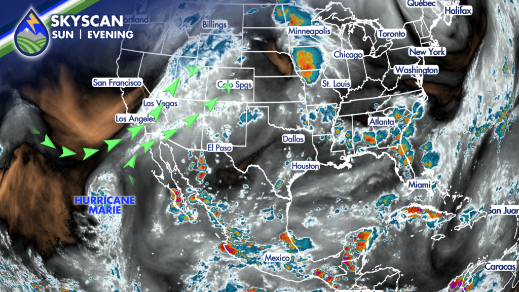
High-pressure is expected to shift southeastward, which will allow the plume of monsoonal moisture to center itself over Colorado beginning on Labor Day.
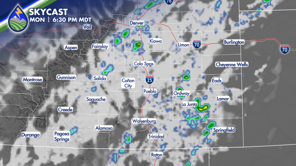
The increase in moisture will increase the potential for thunderstorms across the area, particularly during the afternoon and evening timeframe. Storms will be capable of producing gusty winds, lightning and heavy rain. Showers and thunderstorms will develop over the high country first, before sliding across the I-25 corridor and eventually pushing across the plains. Storms should end overnight, with partly cloudy skies expected by early Tuesday morning.
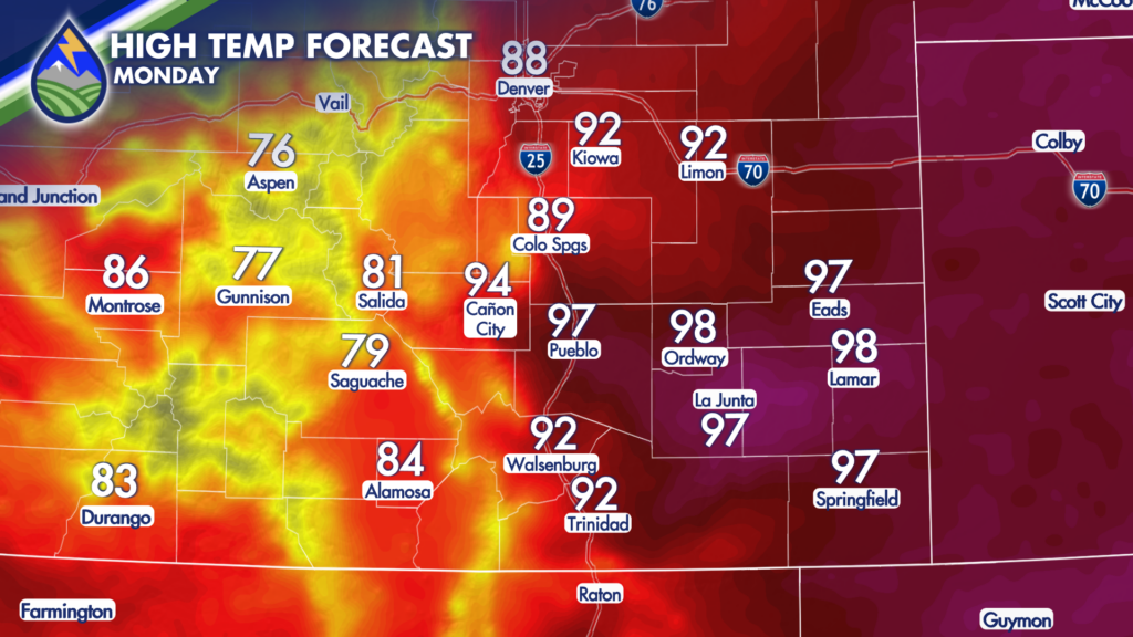
Heat will be another big storm on Monday, with highs well into the 90s for many of the lower elevations. It will be breezy at times throughout the day, with up to 35MPH gusts possible.
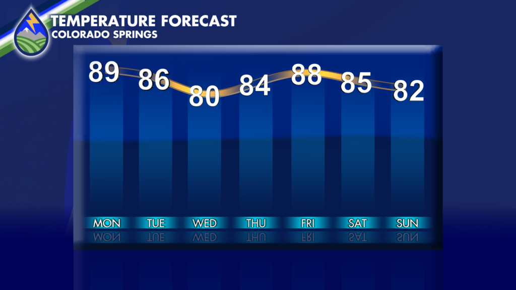
By Tuesday, slightly cooler air is expected with another slight cooldown expected on Wednesday. The most active timeframe for storms will be from Monday through Wednesday, with decreasing storm coverage and intensity Thursday and Friday.
Another system looks to impact the area by next weekend, although there is some disagreement amongst forecasting models related to the timing and intensity of this system.
Stay tuned to Peaks2Plains Weather, as we’ll be monitoring these next waves closely as they evolve and head our way.