


USING “PAINTBALLS”
Behind the scenes we’re always using multiple computer models to look at a range of possible solutions for expected weather, and combining that with our knowledge of the atmosphere, and what has happened in the past in similar situations to make the eventual forecast we give you on Peaks2Plains Weather.
Because we’ve got more time to dive into the detail, one of the things I like to show you during thunderstorm season is what I call the “paintballs” to try and show where there is or isn’t consensus in the numerical guidance suite of models about where thunderstorms are more likely to be at certain times.
In this example, I’m showing where three different computer models think strong thunderstorm cores will be at 2:15 on Monday afternoon. Each model’s 40dbz+ radar forecast (40dbz radar reflectivity return is a good approximation of when thunderstorms are considered “strong”) is depicted with one color. One model is white, one is pink, and one is cyan (bright light blue).
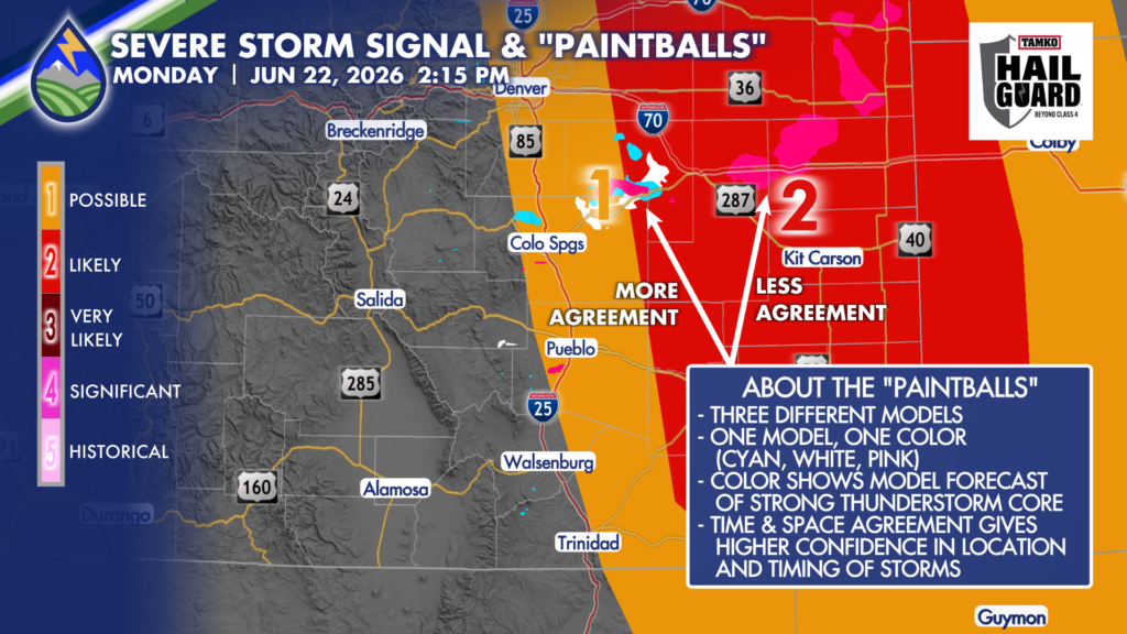
Today’s example shows that at 2:15, all three models have a storm(s) over Elbert and northeast El Paso County. The GRAF model (pink) shows storms over I-70 into northeast Colorado, where as, at 2:15, the other models don’t show strong storms. So, in the early afternoon, there is greater confidence that by 2:15 storms will have already formed and be strong near highway 24 northeast of the Springs. There is less confidence that storms will be strong at that point farther east.
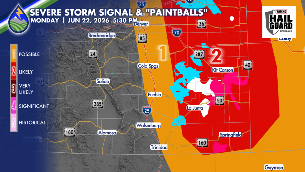
By 5:30, all three models have a cluster of strong (likely severe at that point) storms southeast of the Palmer Divide and approaching the Arkansas River. They all have the same idea, although the timing is a little bit different (+/- 30-45 minutes of each other)….so we’ve got high confidence that strong storms will be moving southeast across the plains in the late afternoon. We’ll watch for any individual cell that moves more south than southeast today. Any storm that takes this “right-turn” may have very large hail greater than 2″ and the potential for a tornado. Most storms will have the potential for hail between 1″-2″ in diameter.
This is the kind of detail we’re trying to provide at Peaks2Plains, lift the curtain up on the forecasting process, and educating you along the way.


