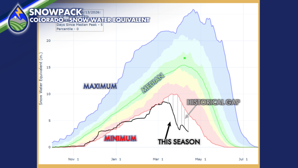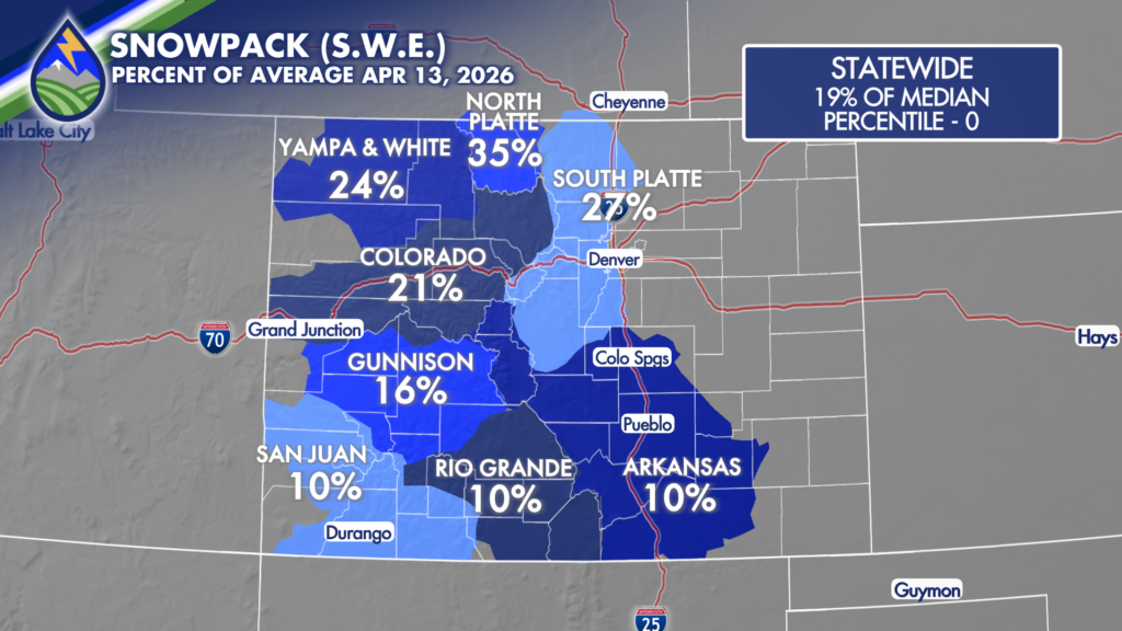
Ahead of the two storms this week…snowpack numbers have continued to drop and continue to set new historical lows in the SNOTEL data set. We’re at 10% of AVERAGE in the southern basins….statewide at 19%…On April 13th we sit at where the previous historical low was on May 2nd. Winter ’25-’26 was ROUGH. Drought has been increasing in coverage and deepening over the state and fire danger has been frequent on the warm and breezy/windy days.