







ASPEN ACRES FIRE UPDATE (SUNDAY MORNING)
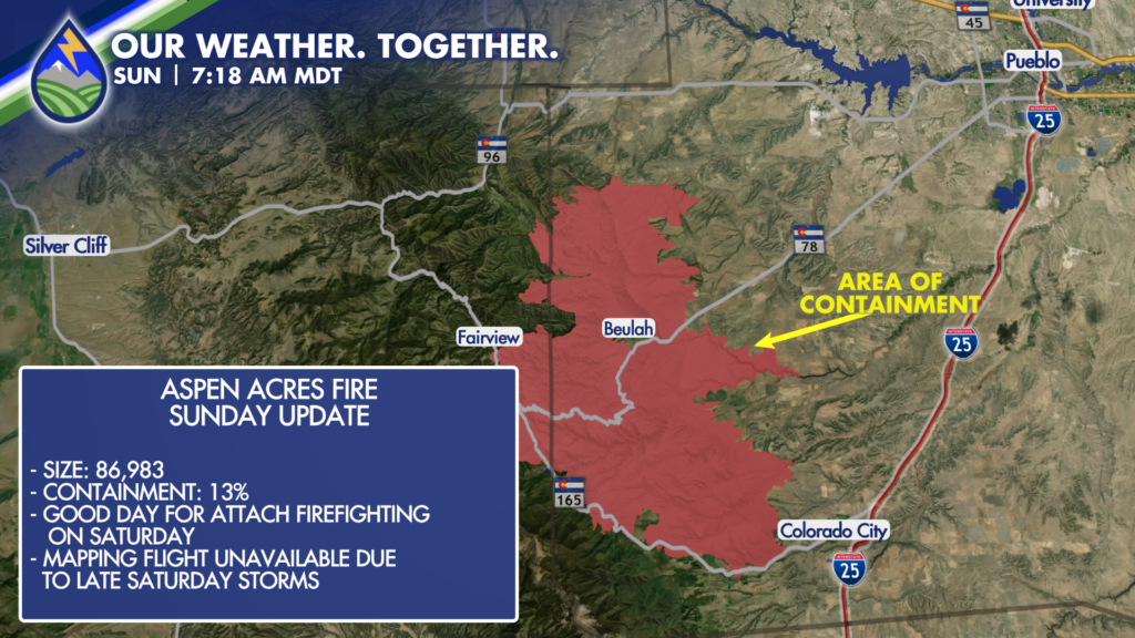
Crews reported a good day on the fire Saturday behind the cold front and were able to aggressively attack the fire compared to previous days.
Some containment has been officially called to the south of highway 78 on the eastern end of the fire. You’ve got to start somewhere and we are at 13%! More may come today given the fires eastern position and other work that was done on Saturday in establishing lines.
CHALLENGES AHEAD
Biggest weather challenges ahead are scattered afternoon thunderstorms. Strong outflow winds are expected with storms due to increasing moisture through the early week in the mid and upper-levels of the atmosphere with a relatively dry sub-cloud layer. Evaporation cools the column below the cloud and brings strong, erratic wind down to the surface creating increases in speed and wind-direction that vary from the larger scale wind flow. This makes for highly dangerous conditions for crews out on the lines.
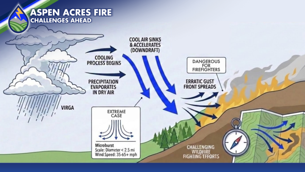
Incident meteorologists on the fire will use radar and available weather stations to monitor the development of these downdrafts and outflow boundaries the next several afternoons as storms become more likely through mid-week.
By Tuesday, some of the stronger cells will be able to overcome the drier air at the surface as moisture continues to increase in the mid-levels and storms that manage to hit the burn may help to slow or extinguish flames in spots, but will bring an increased flash flood risk on and near the burn as water will not as easily absorb into the ground compared to pre-fire conditions.






